
The Baltimore and Ohio Railroad was the first common carrier railroad and the oldest railroad in the United States with its first section opening in 1830. Merchants from Baltimore, which had benefited to some extent from the construction of the National Road early in the century, wanted to do business with settlers crossing the Appalachian Mountains. The railroad faced competition from several existing and proposed enterprises, including the Albany-Schenectady Turnpike, built in 1797, the Erie Canal, which opened in 1825, and the Chesapeake and Ohio Canal. At first, the B&O was located entirely in the state of Maryland; its original line extending from the port of Baltimore west to Sandy Hook, Maryland, opened in 1834. There it connected with Harper's Ferry, first by boat, then by the Wager Bridge, across the Potomac River into Virginia, and also with the navigable Shenandoah River.

The Western Maryland Railway was an American Class I railroad (1852–1983) which operated in Maryland, West Virginia, and Pennsylvania. It was primarily a coal hauling and freight railroad, with a small passenger train operation.
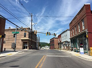
Georges Creek Valley is located in Allegany County, Maryland along the Georges Creek. The valley is rich in wide veins of coal, known historically as "The Big Vein." Coal was once extracted by deep mines but is only mined today through surface mining. The Georges Creek Valley was once a major center for the US coal industry.

Maryland Route 36 is a 29.43-mile (47.36 km) state highway located in Allegany County, Maryland, United States. MD 36's southern terminus is at the West Virginia Route 46 (WV 46) bridge in Westernport and its northern terminus at U.S. Route 40 Alternate near Cumberland. Between Westernport and Frostburg, it is known as Georges Creek Road, and from Frostburg to Cumberland it is known as Mount Savage Road. Like the majority of Maryland state highways, MD 36 is maintained by the Maryland State Highway Administration (MDSHA).
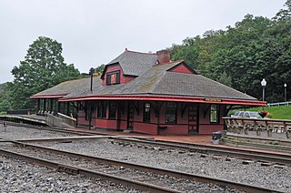
The Cumberland and Pennsylvania Railroad (C&P) was an American railroad which operated in Western Maryland. Primarily a coal hauler, it was owned by the Consolidation Coal Company, and was purchased by the Western Maryland Railway (WM) in 1944.

Mount Savage is an unincorporated community and census-designated place (CDP) in Allegany County, Maryland, United States. As of the 2010 census it had a population of 873.
Eckhart Mines is an unincorporated community and census-designated place (CDP) in Allegany County, Maryland, United States. As of the 2010 census it had a population of 932.
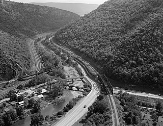
The Eckhart Branch Railroad was a railroad that operated in the Cumberland, Maryland area in the 19th century.
The Mount Savage Railroad was a railroad operated by the Maryland and New York Coal and Iron Company of Mount Savage, Maryland between 1845 and 1854. The 14.9 miles (24 km) rail line ran from Frostburg to Cumberland, Maryland.
The Georges Creek Railroad was a railroad operated by the Georges Creek Coal and Iron Company in Western Maryland. The railroad operated from 1853 to 1863, when it was acquired by the Cumberland and Pennsylvania Railroad (C&P).
The Georges Creek Coal and Iron Company is a defunct coal mining, iron producer and railroad company that operated in Maryland from 1835 to 1863.
The Georges Creek and Cumberland Railroad (GC&C) was a railroad that operated in Maryland from 1876 until 1917, when it was merged with the Western Maryland Railway (WM). The main line ran from Cumberland to Lonaconing.
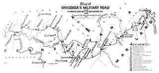
Cumberland, Maryland is named after the son of King George II, Prince William, the Duke of Cumberland. It is built on the site of the old Fort Cumberland, a launch pad for British General Edward Braddock's ill-fated attack on the stronghold of Fort Duquesne during the French and Indian War.
The Mount Savage Locomotive Works was a railroad workshop established at Mount Savage, Maryland, US. The Cumberland and Pennsylvania Railroad locomotive shops were established in Mt. Savage in 1866, under the direction of James Millholland. The original locomotive shop was constructed of stone and was 90 feet x 250 feet in size with a 33-foot-high roof. An adjoining car shop, built at about the same time, was also of stone and was later extended with a wooden structure. These buildings still stand in Mt. Savage.
The Potomac Wharf Branch was a historic railroad located in Maryland. It was built by the Maryland Mining Company between 1846 and 1850, as an extension to the Eckhart Branch Railroad. The Potomac Wharf Branch crossed Wills Creek on a bridge just east of the present Route 40 road bridge near Cumberland. Rail tracks from this line may still be seen near some billboards, and a gas station in that area.
The West Virginia Central and Pittsburg Railway (WVC&P) was a railroad in West Virginia and Maryland operating in the late 19th and early 20th centuries. It had main lines radiating from Elkins, West Virginia in four principal directions: north to Cumberland, Maryland; west to Belington, WV; south to Huttonsville, WV; and east to Durbin, WV. Some of the routes were constructed through subsidiary companies, the Piedmont and Cumberland Railway and the Coal and Iron Railway.
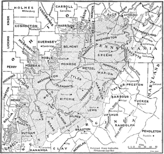
The Pittsburgh Coal Seam is the thickest and most extensive coal bed in the Appalachian Basin; hence, it is the most economically important coal bed in the eastern United States. The Upper Pennsylvanian Pittsburgh coal bed of the Monongahela Group is extensive and continuous, extending over 11,000 mi2 through 53 counties. It extends from Allegany County, Maryland to Belmont County, Ohio and from Allegheny County, Pennsylvania southwest to Putnam County, West Virginia.
The Mount Savage Iron Works operated from 1837 to 1868 in Mount Savage, Maryland. The ironworks were the largest in the United States in the late 1840s, and the first in the nation to produce heavy rails for construction of railroads. The works were established in an area adjacent to mines for coal, iron ore and fire clay. Facilities included blast furnaces, puddling furnaces, a rolling mill, iron refineries, coke production and brick production.
Georges Creek may refer to:

The North Branch Potomac River flows from Fairfax Stone in West Virginia to its confluence with the South Branch Potomac River near Green Spring, West Virginia, where it turns into the Potomac River proper.


