
Maryland Route 7 (MD 7) is a collection of state highways in the U.S. state of Maryland. Known for much of their length as Philadelphia Road, there are five disjoint mainline sections of the highway totaling 40.23 miles (64.74 km) that parallel U.S. Route 40 (US 40) in Baltimore, Harford, and Cecil counties in northeastern Maryland. The longest section of MD 7 begins at US 40 just east of the city of Baltimore in Rosedale and extends through eastern Baltimore County and southern Harford County to US 40 in Aberdeen. The next segment of the state highway is a C-shaped route through Havre de Grace on the west bank of the Susquehanna River. The third mainline section of MD 7 begins in Perryville on the east bank of the Susquehanna River and ends at US 40 a short distance west of the start of the fourth section, which passes through Charlestown and North East before ending at US 40, just west of Elkton. The fifth segment of the highway begins at South Street and passes through the eastern part of Elkton before reconnecting with US 40 east of Elkton and west of the Delaware state line.

Maryland Route 147 is a state highway in the U.S. state of Maryland. Known as Harford Road, the state highway runs 18.82 miles (30.29 km) from U.S. Route 1 and US 40 Truck in Baltimore north to US 1 and US 1 Business in Benson. MD 147 is an alternate route to US 1 between Baltimore and Bel Air, the county seat of Harford County. The state highway is the main street of several neighborhoods in Northeast Baltimore and the Baltimore County suburbs of Parkville and Carney. MD 147 is maintained by the Maryland State Highway Administration in Baltimore and Harford counties and by the Baltimore City Department of Transportation within the city. Harford Road was a pair of turnpikes before the Baltimore–Carney portion of the highway was designated one of the original state roads. The Baltimore County section of MD 147 was constructed in the early 1910s and widened multiple times in the late 1920s and 1930s. The section of the state highway in Harford County was built in the late 1920s.

Maryland Route 150 (MD 150) is a state highway in the U.S. state of Maryland. Known for most of its length as either Eastern Avenue or Eastern Boulevard, the highway runs 13.01 miles (20.94 km) from U.S. Route 40 (US 40) in Baltimore east to Graces Quarters Road in Chase in eastern Baltimore County. MD 150 connects Baltimore with its southeastern suburbs of Dundalk, Essex, and Middle River. The state highway also links those communities with Interstate 95 (I-95), I-695, I-895, and Martin State Airport. MD 150 was constructed from Baltimore to Middle River and in Chase in the mid-1920s. The road was completed through Middle River in the early 1930s. Between 1942 and 1944, MD 150 was reconstructed as a four-lane divided highway with interchanges to improve access between Baltimore and the Glenn L. Martin Company aircraft manufacturing plant in Middle River. The highway has followed several routes since it was extended west into the city of Baltimore in the mid-1940s; the present route in East Baltimore was established shortly after 2000.
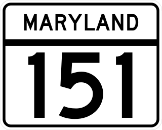
Maryland Route 151 (MD 151) is a state highway in the U.S. state of Maryland. Known for most of its length as North Point Boulevard, the state highway runs 10.80 miles (17.38 km) from 7th Street in Sparrows Point north to U.S. Route 1 (US 1) in Baltimore. MD 151 is a four- to six-lane divided highway that connects the communities of Edgemere and Dundalk on the Patapsco River Neck peninsula of southeastern Baltimore County with industrial areas in Sparrows Point and East Baltimore. MD 151 was originally constructed in the early 1920s from Sparrows Point to Edgemere. The highway was connected to Baltimore by the Baltimore County portion of MD 20, a number also assigned to the highway from Rock Hall to Chestertown in Kent County. During World War II, MD 151 was extended north through Dundalk on a new divided highway parallel to MD 20 and through East Baltimore on an expanded Erdman Avenue to connect the Bethlehem Steel complex at Sparrows Point with MD 150 and US 40. In the late 1960s and early 1970s, Interstate 695 (I-695) was constructed parallel to MD 151 between Edgemere and MD 157 in Dundalk.

Maryland Route 23 is a state highway in the U.S. state of Maryland. The state highway runs 20.58 miles (33.12 km) from U.S. Route 1 in Hickory north and west to the Pennsylvania state line near Norrisville, where the highway continues as Pennsylvania Route 24. MD 23 is an L-shaped highway in northwestern Harford County that consists of two major sections. Between US 1 and MD 165 in Jarrettsville, MD 23 is marked east–west along a two-lane road with partial control of access named East–West Highway. From MD 165 to the state line, the state highway is marked north–south along Norrisville Road, a rural two-lane highway that passes through the villages of Madonna and Shawsville. The two sections of MD 23 are connected by a short concurrency with MD 165.

Maryland Route 564 is a state highway in the U.S. state of Maryland. Known for most of its length as Lanham Severn Road, the state highway runs 6.73 miles (10.83 km) from MD 450 in Lanham east to a dead end near a connection to MD 197 in Bowie. MD 564 was constructed from Lanham to Old Town Bowie in the mid-1930s. In the early 1990s, the highway was extended east over part of MD 197 when that highway was relocated through Bowie.
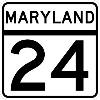
Maryland Route 24 (MD 24) is a state highway in the U.S. state of Maryland. The state highway runs 25.17 miles (40.51 km) from an entrance to Aberdeen Proving Ground in Edgewood north to the Pennsylvania state line near Fawn Grove, Pennsylvania, where the road becomes State Route 2055 (SR 2055). MD 24 is the main north–south highway of Harford County. The southern half of the state highway connects U.S. Route 1 (US 1) and the county seat of Bel Air with Aberdeen Proving Ground, US 40, and Interstate 95 (I-95) through a suburban corridor. The northern half of MD 24 is a rural highway that passes through Rocks State Park.

Maryland Route 22 is a state highway in the U.S. state of Maryland. The state highway runs 12.91 miles (20.78 km) from U.S. Route 1 Business and MD 924 in Bel Air east to an entrance to Aberdeen Proving Ground in Aberdeen. MD 22 is the main connection between the county seat of Bel Air and Aberdeen, which is the largest city in Harford County. The state highway also provides the primary route between Interstate 95 (I-95) and Aberdeen Proving Ground.
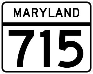
Maryland Route 715 is a state highway in Harford County in the U.S. state of Maryland. Known as Short Lane, the state highway runs 1.06 miles (1.71 km) from U.S. Route 40 in Aberdeen east to an entrance to Aberdeen Proving Ground. MD 715 was constructed during World War II as a military access project. Between 2010 and 2013, the state highway was reconstructed to better handle the increased traffic brought by the Base Realignment and Closure (BRAC) process.
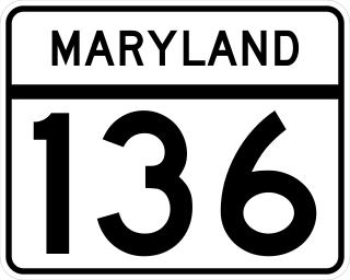
Maryland Route 136 is a state highway in the U.S. state of Maryland. The state highway runs 30.04 miles (48.34 km) from MD 7 near Abingdon north to MD 23 in Norrisville. MD 136 is an L-shaped route that connects the communities of Creswell, Churchville, Dublin, and Whiteford in eastern Harford County with each other and with Norrisville in the county's northwestern corner. The state highway is connected to the cities of Aberdeen and Havre de Grace via its connection with MD 22. MD 136 is also linked to the county seat of Bel Air from the east through MD 22, from the northeast by U.S. Route 1, from the north via MD 24, and from the northwest by MD 23. The state highway starts on the coastal plain near the Chesapeake Bay and crosses Harford County's two main tributaries of the Susquehanna River, Deer Creek and Broad Creek, while traversing a wide swath of the Piedmont. MD 136 is the second longest Maryland state highway entirely within one county after MD 235.

U.S. Route 1 Business is a business route of U.S. Route 1 in the U.S. state of Maryland. The highway runs 6.90 miles (11.10 km) from US 1 and Maryland Route 147 in Benson north to US 1 near Hickory. US 1 Business is the old alignment of US 1 through Bel Air, the county seat of Harford County. US 1 was originally constructed on both sides of Bel Air in the early 1910s. The U.S. highway was widened in the 1920s, 1930s, and 1950s. US 1 Business was assigned to the highway from Benson through Bel Air to south of Hickory after the Bel Air Bypass was built in the mid-1960s. US 1 Business was extended north through Hickory when US 1 bypassed Hickory in 2000.
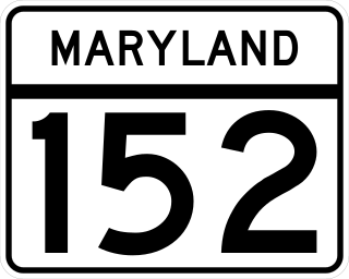
Maryland Route 152 is a state highway in the US state of Maryland. The state highway runs 17.34 miles (27.91 km) from an entrance to Aberdeen Proving Ground in Edgewood north to MD 146 near Taylor. MD 152 parallels the western edge of Harford County, connecting the communities of Joppatowne and Fallston with Interstate 95 (I-95), U.S. Route 40, and US 1. The state highway north of Joppa was mostly built in the late 1920s and early 1930s. MD 152 south of Joppa was built around 1940; shortly thereafter, the highway was reconstructed as a wartime access project. The state highway originally had only a partial interchange with I-95; it was expanded to full interchange in the mid 1990s concurrent with the expansion of the highway to a four-lane divided highway through Joppa.

Maryland Route 155 is a state highway in the U.S. state of Maryland. Known for most of its length as Level Road, the state highway runs 9.06 miles (14.58 km) from MD 22 in Churchville east to U.S. Route 40 and MD 7 in Havre de Grace. In conjunction with MD 22, MD 155 serves as the main highway linking Bel Air and Havre de Grace in eastern Harford County. The state highway also connects Havre de Grace with Interstate 95 (I-95) and Susquehanna State Park. The first portion of MD 155 near Havre de Grace was built by 1910; the remainder of the highway east of Hopewell Village was completed in the mid-1920s. The Churchville–Hopewell Village portion of the state highway, originally designated MD 156, was built in the mid-1930s. MD 155 received its present designation over its western half in 1952 when MD 155 and MD 156 swapped paths.

Maryland Route 156 is a state highway located in Harford County in the U.S. state of Maryland. Known as Aldino Road, the state highway runs 3.92 miles (6.31 km) from MD 22 near Churchville east to MD 155 near Hopewell Village. MD 156 provides access to the Harford County Airport in the unincorporated community of Aldino. The state highway, which was originally designated part of MD 155, was built as a modern highway by 1910 and rebuilt in the 1920s. MD 156 received its present designation in 1952 when MD 155 and MD 156 swapped paths.

Maryland Route 159 is a state highway located in Harford County in the U.S. state of Maryland. Known for most of its length as Perryman Road, the state highway runs 4.73 miles (7.61 km) from a dead end at the Bush River near Perryman north to U.S. Route 40 and MD 7 in Aberdeen. The northernmost part of MD 159 was constructed in the early 1920s and became the original alignment of US 40. The Perryman Road portion of MD 159 was constructed in the late 1920s and early 1930s. MD 159 was extended west along what was MD 7 to US 40 in 1950.

Maryland Route 462 is a state highway in the U.S. state of Maryland. Known as Paradise Road, the route runs 4.15 miles (6.68 km) from MD 132 in Aberdeen north to MD 155 near Hopewell Village. MD 462 was built in the early 1930s.
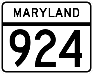
Maryland Route 924 is a state highway in the U.S. state of Maryland. The state highway runs 7.39 miles (11.89 km) from MD 24 near Emmorton to U.S. Route 1 and MD 24 in Bel Air. MD 924 is the old alignment of MD 24 through the Bel Air area in central Harford County. The state highway was originally constructed in the late 1920s and early 1930s. MD 924 was assigned when MD 24 was moved to a new divided highway to the west in 1987.
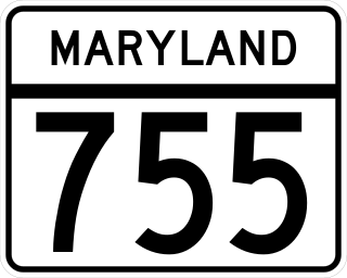
Maryland Route 755 is a state highway in Harford County in the U.S. state of Maryland. Known as Edgewood Road, the state highway runs 1.79 mi (2.88 km) from an entrance to Aberdeen Proving Ground north to U.S. Route 40 in Edgewood. Originally constructed as MD 408 in 1930, the state highway became a southern extension of MD 24 in the early 1950s. MD 755 was designated in the early 1970s after MD 24 moved to its present course.


