
Wierzchowina is a village in the administrative district of Gmina Żółkiewka, within Krasnystaw County, Lublin Voivodeship, in eastern Poland. It lies approximately 7 kilometres (4 mi) south of Żółkiewka, 28 km (17 mi) south-west of Krasnystaw, and 49 km (30 mi) south-east of the regional capital Lublin.
Aleksandrów is a village in the administrative district of Gmina Gościeradów, within Kraśnik County, Lublin Voivodeship, in eastern Poland. It lies approximately 8 kilometres (5 mi) north of Gościeradów, 18 km (11 mi) west of Kraśnik, and 55 km (34 mi) south-west of the regional capital Lublin.
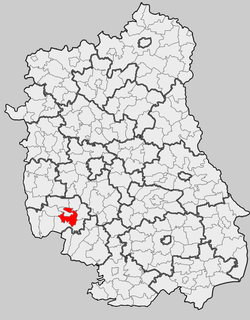
Gościeradów is a village in Kraśnik County, Lublin Voivodeship, in eastern Poland. It is the seat of the gmina called Gmina Gościeradów. It lies approximately 17 kilometres (11 mi) west of Kraśnik and 59 km (37 mi) south-west of the regional capital Lublin.
Gościeradów Plebański is a village in the administrative district of Gmina Gościeradów, within Kraśnik County, Lublin Voivodeship, in eastern Poland. It lies approximately 2 kilometres (1 mi) west of Gościeradów, 18 km (11 mi) west of Kraśnik, and 59 km (37 mi) south-west of the regional capital Lublin.
Gościeradów-Kolonia is a village in the administrative district of Gmina Gościeradów, within Kraśnik County, Lublin Voivodeship, in eastern Poland.
Księżomierz is a village in the administrative district of Gmina Gościeradów, within Kraśnik County, Lublin Voivodeship, in eastern Poland. It lies approximately 17 kilometres (11 mi) west of Kraśnik and 57 km (35 mi) south-west of the regional capital Lublin.
Łany is a village in the administrative district of Gmina Gościeradów, within Kraśnik County, Lublin Voivodeship, in eastern Poland. It lies approximately 4 kilometres (2 mi) south-west of Gościeradów, 20 km (12 mi) south-west of Kraśnik, and 62 km (39 mi) south-west of the regional capital Lublin.
Liśnik Duży is a village in the administrative district of Gmina Gościeradów, within Kraśnik County, Lublin Voivodeship, in eastern Poland. It lies approximately 6 kilometres (4 mi) east of Gościeradów, 11 km (7 mi) west of Kraśnik, and 53 km (33 mi) south-west of the regional capital Lublin.
Mniszek is a village in the administrative district of Gmina Gościeradów, within Kraśnik County, Lublin Voivodeship, in eastern Poland. It lies approximately 6 kilometres (4 mi) south-west of Gościeradów, 21 km (13 mi) south-west of Kraśnik, and 64 km (40 mi) south-west of the regional capital Lublin.
Suchodoły is a village in the administrative district of Gmina Gościeradów, within Kraśnik County, Lublin Voivodeship, in eastern Poland. It lies approximately 10 kilometres (6 mi) west of Kraśnik and 52 km (32 mi) south-west of the regional capital Lublin.
Szczecyn is a village in the administrative district of Gmina Gościeradów, within Kraśnik County, Lublin Voivodeship, in eastern Poland. It lies approximately 20 kilometres (12 mi) south-west of Kraśnik and 64 km (40 mi) south-west of the regional capital Lublin.
Wólka Gościeradowska is a village in the administrative district of Gmina Gościeradów, within Kraśnik County, Lublin Voivodeship, in eastern Poland. It lies approximately 15 kilometres (9 mi) south-west of Kraśnik and 57 km (35 mi) south-west of the regional capital Lublin.
Wólka Szczecka is a village in the administrative district of Gmina Gościeradów, within Kraśnik County, Lublin Voivodeship, in eastern Poland. It lies approximately 25 kilometres (16 mi) south-west of Kraśnik and 68 km (42 mi) south-west of the regional capital Lublin.
Mikulin is a village in the administrative district of Gmina Kraśnik, within Kraśnik County, Lublin Voivodeship, in eastern Poland. It lies approximately 6 kilometres (4 mi) south-west of Kraśnik and 50 km (31 mi) south-west of the regional capital Lublin.
Dębowiec is a village in the administrative district of Gmina Trzydnik Duży, within Kraśnik County, Lublin Voivodeship, in eastern Poland. It lies approximately 4 kilometres (2 mi) north of Trzydnik Duży, 7 km (4 mi) west of Kraśnik, and 50 km (31 mi) south-west of the regional capital Lublin.
Zielonka is a village in the administrative district of Gmina Trzydnik Duży, within Kraśnik County, Lublin Voivodeship, in eastern Poland. It lies approximately 5 kilometres (3 mi) south-east of Trzydnik Duży, 10 km (6 mi) south of Kraśnik, and 54 km (34 mi) south-west of the regional capital Lublin.
Bęczyn is a village in the administrative district of Gmina Urzędów, within Kraśnik County, Lublin Voivodeship, in eastern Poland. It lies approximately 2 kilometres (1 mi) west of Urzędów, 10 km (6 mi) north-west of Kraśnik, and 43 km (27 mi) south-west of the regional capital Lublin.
Popkowice is a village in the administrative district of Gmina Urzędów, within Kraśnik County, Lublin Voivodeship, in eastern Poland. It lies approximately 6 kilometres (4 mi) east of Urzędów, 8 km (5 mi) north of Kraśnik, and 38 km (24 mi) south-west of the regional capital Lublin.
Zdrapy is a village in the administrative district of Gmina Wilkołaz, within Kraśnik County, Lublin Voivodeship, in eastern Poland. It lies approximately 3 kilometres (2 mi) south of Wilkołaz, 12 km (7 mi) north-east of Kraśnik, and 34 km (21 mi) south-west of the regional capital Lublin.


