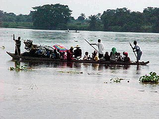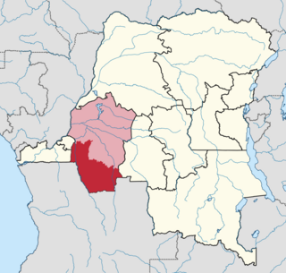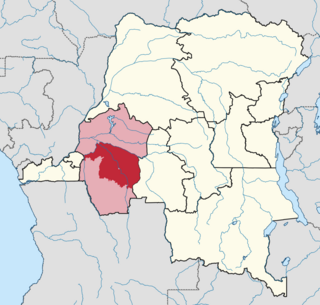
Bandundu is one of eleven former provinces of the Democratic Republic of the Congo. It bordered the provinces of Kinshasa and Bas-Congo to the west, Équateur to the north, and Kasai-Occidental to the east. The provincial capital is also called Bandundu.

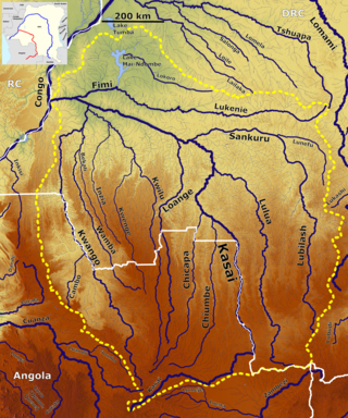
The Kwilu River is a major river in both Lunda Norte Province and Lunda Sul Province in Angola as well as Kwilu Province, formerly known as Bandundu province, in the Democratic Republic of the Congo (DRC) to the city of Bandundu, where it joins the Kwango River just before this stream enters the Kasai River. In the DRC the river flows past the towns of Gungu, Kikwit, Bulungu, Bagata, Rutherfordia and Bandundu. Lusanga, formerly Leverville, lies at the location where the Kwenge River joins the Kwilu, between Kikwit and Bulungu.

Bandundu, formerly known as Banningville or Banningstad, is the capital city of Kwilu Province of the Democratic Republic of the Congo.
Idiofa is a town in Kwilu Province of the Democratic Republic of the Congo.
Bagata is a town in the Kwilu Province of the Democratic Republic of the Congo. It is the administrative headquarters of Bagata Territory, and is situated on the Kwilu River between Kikwit and Bandundu.
Kasongo Lunda is a town and seat of Kasongo Lunda Territory, in the Kwango Province of the Democratic Republic of the Congo. The town lies near the border with Angola to the east, here defined by the Kwango River. As of 2012 the town was estimated to have a population of 23,820.

Kwango is a province of the Democratic Republic of the Congo. It's one of the 21 provinces created in the 2015 repartitioning. Kwango, Kwilu, and Mai-Ndombe provinces are the result of the dismemberment of the former Bandundu province. Kwango was formed from the Kwango district whose town of Kenge was made the provincial capital and thus gained city status.

Kwilu is a province of the Democratic Republic of the Congo. It's one of the 21 provinces created in the 2015 repartitioning. Kwilu, Kwango, and Mai-Ndombe provinces are the result of the dismemberment of the former Bandundu province. Kwilu was formed from the Kwilu district and the independently administered cities of Bandundu and Kikwit. Bandundu is the provincial capital. The 2020 population was estimated to be 6,682,300.
Idiofa Territory is an administrative area in the Kwilu Province of the Democratic Republic of the Congo (DRC). The capital is the town of Idiofa.
Bagata Territory is an administrative region in the Kwilu Province of the Democratic Republic of the Congo. The headquarters are in the town of Bagata. The territory is divided into five sectors: Kidzweme, Kwango-Kasai, Kwilu-Ntobere, Manzasay and Wamba-Fatunda.

The Kwenge River is a stream in the Bandundu Province of the Democratic Republic of the Congo.
Gungu is a town in Kwilu Province, Democratic Republic of the Congo (DRC). It is the capital of Gungu Territory as well as Gungu Sector. The town lies west of the Kwilu River and is situated between the streams Lukunia in the south-east and Kitembo in the north-west. The estimated population as of 2012 was 23,893. Gungu is connected to the Congolese Road Network via the RP230 and RP231. Both roads are in a bad condition and the town is only reachable by 4x4 vehicles. As of July 2018, none of the roads in Gungu are paved and the large alleys are overgrown with grass. Only small paths remain that are regularly used by motorcycles. Water supply is provided by pumping water into the town from a nearby stream. There is an electricity network, but as of July 2018, it is not in operation, leaving the town with nearly no power.
Oshwe is a community in Mai-Ndombe province, Democratic Republic of the Congo (DRC). It is the headquarters of Oshwe territory. The town lies on the Lukenie River. The estimated population as of 2012 was 22,576. The town is served by Oshwe Airport at an elevation of 1,150 feet (350 m).
Bulungu is a community in the Kwilu Province of the Democratic Republic of the Congo. The town lies on the southwestern bank of the Kwilu River, downstream from Kikwit. Bulungu is the headquarters of the Bulungu Territory. As of 2012 the population was estimated to be 57,168.
Kiri is a town in Mai-Ndombe Province, Democratic Republic of the Congo. It is the headquarters of Kiri Territory. As of 2012 the estimated population was 14,612. The town is served by a small airport, Basango Mboliasa Airport, at an elevation of 309 metres (1,013 ft).
Masi-Manimba Territory is an administrative area of Kwilu province, Democratic Republic of the Congo. Its headquarters are in the town of Masi-Manimba, on the Lukula River, a tributary of the Kwilu River. The Luie and Kafi rivers also run from south to north through the territory, tributaries of the Lukula. The territory is divided into ten sectors: Bindungi, Kibolo, Kinzenga, Kinzenzengo, Kitoy, Masi-Manimba, Mokamo, Mosango, Pay-Kongila and Sungu.

The Loange River is a tributary of the Kasai River. Originating in Angola, the river flows north into the Democratic Republic of the Congo, through the eastern part of Kwango. The river then continues north along the boundary between Kwilu and Kasai provinces to its mouth on the Kasai.
Masi-Manimba Airport is an airport serving the town of Masi-Manimba in Kwilu Province, Democratic Republic of the Congo. The airport is 4 kilometres (2.5 mi) west of Masi-Manimba.

Kwango District was a district of the Congo Free State, Belgian Congo and the Democratic Republic of the Congo. It went through various changes in extent. It roughly corresponded to the present provinces of Kwilu and Kwango.

Kwilu District was a district of the Belgian Congo and the Democratic Republic of the Congo. It roughly corresponded to the present province of Kwilu.


