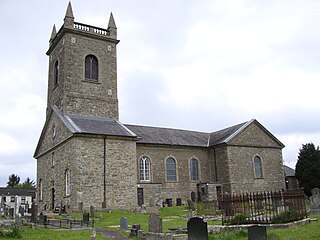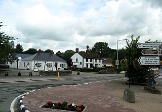
Clogher is a village and civil parish in the border area of south County Tyrone, Northern Ireland. It lies on the River Blackwater, 5.8 miles from the border crossing to County Monaghan. It stands on the townlands of Clogher Demesne and Clogher Tenements. The 2011 Census recorded a population of 717. The civil parish of Clogher covers areas of County Fermanagh as well as County Tyrone.

Clontibret is a village and parish in County Monaghan, Ireland. The village population in the 2016 census was 172. Clontibret is also a parish in both Roman Catholic and Church of Ireland traditions. The territory of the parish also includes Annyalla and Doohamlet as well as smaller settlements such as Cremartin, Scotch Corner and Lisnagrieve.

Camlough is a village west of Newry in County Armagh, Northern Ireland. The village is named after a lake, known as the Cam Lough. South of the village is Camlough Mountain, part of the Ring of Gullion and is designated an Area of Outstanding Natural Beauty. Camlough had a population of 1,074 at the 2011 Census.

The Battle of Clontibret was fought in County Monaghan in May 1595, during the Nine Years' War in Ireland. A column of 1,750 English troops led by Henry Bagenal was ambushed near Clontibret by a larger Gaelic Irish army led by Hugh O'Neill, Earl of Tyrone. The English column had been sent to relieve the besieged English garrison at Monaghan Castle. The English suffered very heavy losses, but a suicidal cavalry charge apparently saved it from destruction. The Irish victory shocked the English and was their first severe setback during the war.

Tydavnet, officially Tedavnet , is a village in northern County Monaghan, Ireland, and also the name of the townland and civil parish in which the village sits. Both the Church of Ireland and Catholic church have Tydavnet named as a parish and in both cases, the geographical area is almost identical. The village is located on the R186 regional road.

Caledon is a small village and townland in County Tyrone, Northern Ireland. It is in the Clogher Valley on the banks of the River Blackwater, 10 km from Armagh. It lies in the southeast of Tyrone and near the borders of County Armagh and County Monaghan. It is situated in the historic barony of Dungannon Lower and the civil parish of Aghaloo. In the 2001 Census it had a population of 387 people. It is a designated conservation area. It was historically known as Kinnaird.

Scotstown is a village in the townland of Bough in north County Monaghan, Ireland. Scotstown is located in the parish of Tydavnet, along the Monaghan Blackwater, Scotstown being the village closest to the river's source. Scotstown is centred in the townland of Bough, but extends into Carrowhatta, Teraverty, Drumdesco and Stracrunnion townlands.
Charles McNally was the Roman Catholic Bishop of Clogher in Ireland.
Hugh MacMahon (1660–1737) was Bishop of Clogher 1707–1715 and Archbishop of Armagh 1715–1737.

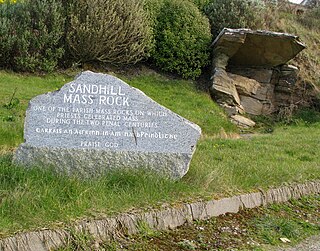
A Mass rock was a rock used as an altar by the Catholic Church in Ireland, during the 17th and 18th centuries, as a location for secret and illegal gatherings of faithful attending the Mass offered by outlawed priests. Similar altars, known as Mass stones, were used by the similarly illegal and underground Catholic Church in Scotland, membership in which was similarly criminalised following the Scottish Reformation in the mid-16th century.

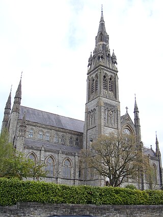
The Diocese of Clogher is a Latin Church diocese of the Catholic Church in Ireland. It was formed in 1111 at the Synod of Rathbreasail as the see for the Kingdom of Uí Chremthainn. It is part of the Province of Armagh.

Inniskeen, officially Inishkeen, is a small village, townland and parish in County Monaghan, Ireland, close to the County Louth and County Armagh borders. The village is located about 17 kilometres (11 mi) from Dundalk, 11 km (7 mi) from Carrickmacross, and 5 km (3 mi) from Crossmaglen. Seven townlands of this Roman Catholic Diocese of Clogher parish lie within County Louth.
Magheracloone is a parish in south County Monaghan. Its name comes from the Irish Machaire Cluana which means 'plain of meadow'. A generally hilly parish; its name is derived from its most important place in ancient times; a flat area of land in the townland of Camaghy, on which the sports ground and ancient church of St. Molua were located. The parish covers 12,952 statute acres in area, making it the largest parish in South Monaghan. The parish borders three neighbouring counties; Cavan, Louth and Meath. Magheracloone is the only parish in Monaghan to border Meath; it is located approximately 90 km from both Belfast and Dublin.
The parish of Killanny lies in both County Louth and Monaghan and is part of the Diocese of Clogher. It is named after Saint Enda of Aran, known by the diminutive Éanna. The civil parish consists of 31 townlands in County Monaghan and 11 in County Louth. The townland of Killany, which can also be spelled Killanny or Killaney, lies within County Louth, and contains the old St. Ultan's Killanny Parish church and graveyard. The main Dublin-Derry road passes through Killanny. Several small lakes are to be found throughout the parish and the soil quality is superior to that of the north of Carrickmacross, reflecting the underlying limestone rock.
Pilib mac Séamus Mac Mathghamhna was a canon chorister of Clogher, parson of Dartry and coarb of Clones Abbey.

Doohamlet, is a village and townland on the Castleblayney–Ballybay road in County Monaghan, Ireland. It is part of a wider parish of Clontibret in the diocese of Clogher. Doohamlet village is located approximately three miles from the N2 Dublin-Derry route on the R183 road. The wider district comprises around thirty townlands.
Tassan is a townland in the parish of Clontibret in County Monaghan, Ireland.

Tassan Rovers GAA was a Gaelic football team in Tassan, County Monaghan, Ireland. The Tassan team came together in early 1937 and participated in the Junior League Mid Monaghan section. The team was managed by Francis Brennan, John Mulligan, Peter Flanagan and Frank Murphy. Paddy Morgan, Lisdrumgormely was also associated with the team. The Tassan team wore red jerseys and trained and played football in a local meadow field known as the "Boggan".
Lawrence "Larry" Duffy is an Irish Roman Catholic prelate who has served as Bishop of Clogher since 2019.
Killykeskeame is a townland in the Civil Parish of Killeevan, in the Barony of Dartree, County Monaghan. It consists of 126.49 acres. The name Killykeskeame is an anglicisation of the Gaelic "Cill Choiscéim" which means the 'Church of the Footstep', referencing a medieval chapel that once was located in the townland.


