
Sir Douglas Mawson OBE FRS FAA was an Australian geologist, Antarctic explorer, and academic. Along with Roald Amundsen, Robert Falcon Scott, and Sir Ernest Shackleton, he was a key expedition leader during the Heroic Age of Antarctic Exploration. The Mawson Station in the Australian Antarctic Territory is named in his honour.

Drygalski Island is an ice-capped island that is 20.4 kilometres (11 nmi) long and rises to 325 m (1,066 ft) in the Davis Sea of the Southern Ocean, about 85 km (53 mi) north of the coast of Queen Mary Land and 45 km (28 mi) north-northeast of Cape Filchner. The island has an area of 220 km2 (85 sq mi).

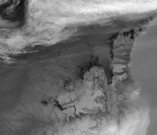
Davis Sea is an area of the sea along the coast of East Antarctica between West Ice Shelf in the west and the Shackleton Ice Shelf in the east, or between 82° and 96°E. The name "Davis Sea" appears in most leading geographically authoritative publications such as the 2014 10th edition World Atlas from the National Geographic Society and the 2014 12th edition of the Times Atlas of the World, unlike neighboring proposed water body names such as a Russian proposed "Cooperation Sea" name to the west.

Shackleton Ice Shelf is an extensive ice shelf fronting the coast of East Antarctica for about 384 km, projecting seaward about 145 km in the western portion and 64 km in the east. It occupies an area of 33,820 km². It is part of Mawson Sea and separates the Queen Mary Coast to the west from the Knox Coast of Wilkes Land to the east. The existence of this ice shelf was first made known by the USEE under Charles Wilkes who mapped a portion of it from the Vincennes in February 1840. It was explored by the Australian Antarctic Expedition under Douglas Mawson (1911–14) who named it for Sir Ernest Shackleton. The extent of the ice shelf was mapped in greater detail in 1955, using aerial photography obtained by US Navy Operation Highjump, 1946-47. Further mapping by the Soviet Expedition of 1956 showed the portion eastward of Scott Glacier to be a part of this ice shelf.

Mawson Peak is an active volcanic mountain on Heard Island, an external Australian territory in the Southern Ocean.
Charcot Island or Charcot Land is an island administered under the Antarctic Treaty System, 56 kilometres (30 nmi) long and 46 kilometres (25 nmi) wide, which is ice covered except for prominent mountains overlooking the north coast. Charcot Island lies within the Bellingshausen Sea, 102 kilometres (55 nmi) west of Alexander Island, and about 57 kilometres (31 nmi) north of Latady Island. A notable landmark of the island is its northernmost point, Cape Byrd.
Fletcher Island is a rocky island, 0.5 km (0.25 nmi) in diameter, which is the largest of the Fletcher Islands. Fletcher Island is located at 66°53′S143°05′E. Fletcher Island lies in the eastern part of Commonwealth Bay, 11 km (6 nmi) west-southwest (WSW) of Cape Gray. Fletcher Island was discovered by the Australian Antarctic Expedition (AAE) (1911–1914) under Douglas Mawson, who named it for Frank D. Fletcher, First Officer on the expedition ship Aurora.
Welch Island is an island, 1.9 km (1 nmi) long with a prominent pinnacle rock of 130 m (427 ft), lying north of Rouse Islands and 1.9 km (1 nmi) off the shore in the eastern side of Holme Bay. is 0.93 km (0.5 nmi) south of Welch Rocks.
Denman Glacier is a glacier 7 to 10 nautical miles wide, descending north some 70 nautical miles, which debouches into the Shackleton Ice Shelf east of David Island, Queen Mary Land. It was discovered in November 1912 by the Western Base party of the Australasian Antarctic Expedition under Sir Douglas Mawson. Mawson named the glacier for Lord Denman, Governor-General of Australia in 1911, a patron of the expedition.
Mawson Peninsula is a high, narrow, ice-covered peninsula on the George V Coast, on the west side of the Slava Ice Shelf, Antarctica, terminating in Cape Hudson. It extends for over 30 nautical miles (56 km) in a northwesterly direction. The peninsula was photographed from the air by U.S. Navy Operation Highjump, 1946–47, and was sketched and photographed by Phillip Law of the Australian National Antarctic Research Expeditions who flew along it to its northern end in February 1959. It was named by the Antarctic Names Committee of Australia for Sir Douglas Mawson.

The Framnes Mountains are an Antarctic mountain range consisting of Casey Range, Masson Range, David Range, and Brown Range, and adjacent peaks and mountains. The three major ranges and other lesser features were sighted and named in February 1931 by the British Australian New Zealand Antarctic Research Expedition under Douglas Mawson. This coast was also sighted by Norwegian whalers in the same season. The whole area was mapped in detail by Norwegian cartographers from aerial photographs taken by the Lars Christensen Expedition in January 1937. This overall name for the several ranges was given by Lars Christensen after Framnesfjellet, a hill near Sandefjord, Norway.

The Australasian Antarctic Expedition (AAE) was an Australasian scientific team that explored part of Antarctica between 1911 and 1914. It was led by the Australian geologist Douglas Mawson, who was knighted for his achievements in leading the expedition. In 1910 he began to plan an expedition to chart the 3,200-kilometre-long (2,000 mi) coastline of Antarctica to the south of Australia. The Australasian Association for the Advancement of Science approved of his plans and contributed substantial funds for the expedition.
Mawson's Huts are the collection of buildings located at Cape Denison, Commonwealth Bay, in the far eastern sector of the Australian Antarctic Territory, some 3000 km south of Hobart. The buildings were erected and occupied by the Australasian Antarctic Expedition (AAE) of 1911-1914, led by geologist and explorer Sir Douglas Mawson.
Mount Kirkby is a very large, prominent, linear, flat-topped mountain on the northern face of the Porthos Range in the Prince Charles Mountains of Antarctica. Situated about 3 nautical miles (6 km) east of Crohn Massif, it is approximately 9 kilometres (5 nmi) long east-west and 4 kilometres (2 nmi) wide at the western end, tapering to the east. It rises to 2,438 metres (8,000 ft). The mountain was first visited by the Australian National Antarctic Research Expeditions southern party led by William G. Bewsher in December 1956, and was named by the Antarctic Names Committee of Australia for Sydney L. Kirkby, a surveyor at Mawson Station in 1956 and 1960.
The Masson Range is a high broken chain of mountains, consisting primarily of the North Masson, Central Masson and South Masson Ranges and the Trilling Peaks, forming a part of the Framnes Mountains. Having several peaks over 1,000 metres (3,300 ft), the range extends in a north–south direction for 15 nautical miles (28 km). It was discovered and charted by the British Australian and New Zealand Antarctic Research Expedition, 1929–31, under Douglas Mawson, and named for Professor Sir David Orme Masson, a member of the Advisory Committee for this expedition as well as the Australasian Antarctic Expedition, 1911–14, also under Mawson. The mountains were first visited by an Australian National Antarctic Research Expeditions party led by John Béchervaise in 1956.
Borradaile Island is one of the Balleny Islands. It was the site of the first landing south of the Antarctic Circle, and features the "remarkable pinnacle" called Beale Pinnacle, near Cape Beale on its south-eastern coast, and Cape Scoresby on its north-western coast.

Butler Island is a circular, ice-covered island 11 kilometres (6 nmi) wide which rises to 185 metres (610 ft), lying 13 kilometres (7 nmi) east of Merz Peninsula, off the eastern coast of Palmer Land. It was discovered and photographed from the air in December 1940 by the United States Antarctic Service. During 1947 it was photographed from the air by the Ronne Antarctic Research Expedition, who in conjunction with the Falkland Islands Dependencies Survey (FIDS) charted it from the ground. It was named by FIDS for K.S.P. Butler, FIDS commander in 1947–48.
Jennings Bluff is a dark, flat-topped outcrop in the Nicholas Range of Antarctica, 10 nautical miles (19 km) north of Mount Storegutt. It rises about 100 metres (330 ft) above the general ice level and has a steep eastern side, backing to an ice scarp in the west. The bluff was discovered by the British Australian New Zealand Antarctic Research Expedition, 1929–31, under Mawson. It was mapped by Norwegian cartographers from aerial photos taken by the Lars Christensen Expedition, 1936–37, and called Brattstabben. It was photographed from Australian National Antarctic Research Expeditions aircraft in 1956 and remapped, and was renamed by the Antarctic Names Committee of Australia in 1961 for Noel Durrent Jennings, an assistant diesel mechanic at Mawson Station in 1960.
The Douglas Islands are two small islands 22 kilometres (12 nmi) northwest of Cape Daly, and 6 kilometres (3 nmi) north of Andersen Island, as well as 7 kilometres (4 nmi) north-east of Child Rocks, which are both part of the Robinson Group.. They were discovered by the British Australian New Zealand Antarctic Research Expedition under Mawson, 1929–31, and named for Vice-Admiral Percy Douglas, then Hydrographer of the Royal Navy. The islands were first sighted during an aircraft flight from the Discovery on Dec. 3 1, 1929, and reported to lie in about 66°40′S64°30′E, but after the 1931 voyage they were placed at 67°20′S63°32′E. In 1956, an Australian National Antarctic Research Expeditions sledge party led by P.W. Crohn was unable to find them in this position, but found two uncharted islands farther south to which the name has now been applied.


