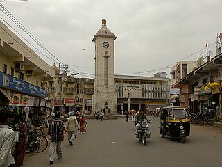
Nadiad is a city in the state of Gujarat, India and the administrative centre of the Kheda district. It is known for the Santram Mandir, the Mai Mandir, It is the birthplace of Sardar Vallabhbhai Patel, the first Deputy Prime Minister of India.
Kheda is a city and a municipality in the Indian state of Gujarat. Kheda was known as Kaira during the British Raj. It was ths former administrative capital of Kheda district. The city is known for tobacco farming. The nearest railway station is Mahemadavad Kheda Road and the nearest airport is Ahmedabad Airport.

Navsari is an administrative district in the state of Gujarat in India, with its headquarters at the city of Navsari. The district covers an area of 2,211 square kilometres and was formed in 1997 after Valsad district was split into Valsad and Navsari districts. It is the largest producer of chikoos in India.

Khambhat, also known as Cambay, is a city and the surrounding urban agglomeration in Anand district in the Indian state of Gujarat. It was once an important trading center, but its harbour gradually silted up, and the maritime trade moved to Surat. Khambat lies on an alluvial plain at the north end of the Gulf of Khambhat, noted for the extreme rise and fall of its tides, which can vary as much as thirty feet in the vicinity of Khambat. Khambat is known for its halvasan sweet, sutarfeni, akik stone and kites (patang), and for sources of oil and gas.

Vadtal is located in the Kheda district of Gujarat, India. It is the pilgrim centre of Swaminarayan Sampraday and the headquarter of Swaminarayan's temple. Gomati is a holy lake in Vadtal.

Abu Road is a city and sub-district in Sirohi district of Rajasthan state in western India, lies on the bank of West Banas River. It is the tehsil and sub-district headquarters and the largest city in Sirohi District in terms of area and population. Its railway station is an important stop on the main Indian Railways line between New Delhi and Ahmedabad and registers an impressive growth in passenger traffic and revenue generation for North Western Railway zone. The popular hill station, Mount Abu is 27 km up the hill from Abu Road.
Umreth is a taluka and the administrative center of Anand District in the state of Gujarat, India. It is administered by Umreth Nagarpalika. It is part of the region known as Charotar, located in Anand and Kheda districts.

Anand District is an administrative district of Gujarat state in western India and whose popular nickname is Charotar. It was carved out of the Kheda district in 1997. Anand is the administrative headquarters of the district. It is bounded by Kheda District to the north, Vadodara District to the east, Ahmedabad District to the west, and the Gulf of Khambhat to the south. Major towns are Umreth, Khambhat, Karamsad, Tarapur, Petlad, Borsad and Sojitra.

Kheda District was also known as Kaira District in British Raj. Kheda District one of the thirty-three districts of Gujarat state in western India. It is part of the region known as Charotar, consisting of Kheda and Anand districts. Kheda was Former Administrative Capital In British Raj. Now Nadiad is the administrative headquarters of the district.

Valsad district is one of the 33 districts in the Western Indian state of Gujarat. It is bound by Navsari district to the north, Nashik district of Maharashtra state to the east, and Dadra and Nagar Haveli district of the Dadra and Nagar Haveli and Daman and Diu (DNHDD) union territory and the Palghar district of Maharashtra to the south. The Arabian Sea lies west of the district. The coastal Damaon enclave of DNHDD is bounded by Valsad district on the north, east, and south. The district's administrative capital is Valsad. The district's largest city is Vapi.
Mahemdavad is a town with municipality in the Kheda district in the Indian state of Gujarat. Mahemdavad is situated on the Vatrak River bank. The nearest city is Kheda. It is 30 km from largest city of Gujarat, Ahmedabad.
Mahudha is a Village and municipality in Kheda district in the Indian state of Gujarat.Mahudha is about 25 kilometres away (SE) from the pilgrim town of Dakor. The nearest city, Nadiad, is 16 kilometres south west.

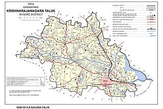
Saligrama is a new sub-district of Mysore district, situated on the northern bank of the river Cauvery [Kaveri]. This place is esteemed as sacred by the Shri Vaishnavas on account of its having been the residence of Sri Ramanujacharya. It is the headquarters of Saligrama Taluk. It was established as a new taluk carving out of K.R.Nagar taluk with effect from 31.12.2020 and become ninth taluk of Mysore district of Karnataka, India.
Rampur ( ) is a village in Kheda district, Gujarat, India. It is located at 22°39'27"N / 72°46'26"E and 3 km far east of Vaso.
Bhadarva (Bhadarwa) is a village in Savli Taluka in Vadodara District of Gujarat, India.
Matar is one of the 182 Legislative Assembly constituencies of Gujarat state in India. It is part of Kheda district. Matar Assembly Constituency represent Kheda.
Kanij is a village in Mehmedabad Taluka in Kheda District of Gujarat State, India. It is about 37m above sea level. Kanij is located 15 km towards the north from district headquarters Kheda. The primary language spoken is Gujarati. 15 km from Ahmedabad. 47 km from the state capital Gandhinagar.
Kanjari Boriyavi Junction railway station is a railway station on the Western Railway network in the state of Gujarat, India. It is located in Kanjari, Kheda district of Gujarat, India. Kanjari Boriyavi Junction railway station is 8 km far away from Anand railway station and 11 km far away from Nadiad railway station. Passenger, MEMU and few Express trains halt at Kanjari Boriyavi Junction railway station. Kanjari Boriyavi Junction railway station is also connected to Vadtal by rail.
Mahemadavad Kheda Road railway station is a railway station on the Western Railway network in the state of Gujarat, India. This Station Connects to Kheda City and Mahemdavad Town. Mhemadavad Kheda Road railway station is 18km from Nadiad railway station. Passenger, MEMU, and a few Express/Superfast trains halt at Mahemadavad Kheda Road railway station. This railway station's nearest city is Kheda.
Davda is a panchayat village in the Indian state of Gujarat. It is part of Nadiad (rural) Taluka of Kheda district. It is nine kilometers west of the town of Nadiad. Davda has a branch Post Office with a sub-office in nearby Palana.


