Matela, Nepal मटेला | |
|---|---|
City | |
| Country | |
| Zone | Seti Zone |
| District | Bajhang District |
| Population | |
| • Religions | Hindu |
| Time zone | UTC+5:45 (Nepal Time) |
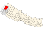
Matela is a village in Bajhang District in the Seti Zone of north-western Nepal. [1]
Matela, Nepal मटेला | |
|---|---|
City | |
| Country | |
| Zone | Seti Zone |
| District | Bajhang District |
| Population | |
| • Religions | Hindu |
| Time zone | UTC+5:45 (Nepal Time) |
Matela is a village in Bajhang District in the Seti Zone of north-western Nepal. [1]
Bheri Zone was one of the fourteen zones located in the Mid-Western Development Region of Nepal. Nepalgunj were the administrative headquarters.

Mahakali was one of the fourteen zones located in the Far-Western Development Region of Nepal, covering an area of 6,205 km2 in the most western part of the country. It stretches along Nepal's far western border with India, marked by the Kali River or Mahakali River, which originates from Limpiyadhura, a tripoint between China India and Nepal which is at present occupied by Indian army since 1962 Sino India war.
Basantapur is a Village Development Committee in Baitadi District in Sudurpashchim Pradesh of western Nepal. At the time of the 1991 Nepal census it had a population of 2,141 and had 366 houses in the village.
Basant pur is a place which is almost 50 kilometres (31 mi) away from the Daimadu. This village is very nice, and people there are very helpful. Many of the people from this village are settled in metro cities of India and in the large cities of the Nepal. Many of the people are settled in Delhi; some of them are businessmen, and a number of youngsters have joined the army in Nepal and are serving their nation. Those who are away from their village they come once in a year and see their native village. Many NGO's are working for the village. The village has its own high school and is having water supply to almost every house. Many festivals like "Gaura", "Dasai" (etc.) are celebrated round the year. The main earning of the people comes from agriculture. The village has many mills for the grinding of wheat. The public transport system is not connected to it, but maybe in the coming years, there will be a transport system of the village.
Kadel is a village in Bajhang District in the Seti Zone of north-western Nepal. At the time of the 1991 Nepal census it had a population of 3,816 and had 693 houses in the village.
Kot Bhairab is a village in Bajhang District in the Seti Zone of north-western Nepal. At the time of the 1991 Nepal census it had a population of 2,734 and had 506 houses in the village.
Lekhgaun is a village in Bajhang District in the Seti Zone of north-western Nepal. At the time of the 1991 Nepal census it had a population of 3,346 and had 626 houses in the village.
Majhigaun is a village in Bajhang District in the Seti Zone of north-western Nepal. At the time of the 1991 Nepal census it had a population of 3,309 and had 622 houses in the village.
Bichhiya is a village in Bajura District in the Seti Zone of north-western Nepal. At the time of the 1991 Nepal census it had a population of 1,904 and had 352 houses in the village.
Jagannath, Nepal is a village in Bajura District in the Seti Zone of north-western Nepal. At the time of the 1991 Nepal census it had a population of 2,612 and had 538 houses in the village.
Sappata is a village in Bajura District in the Seti Zone of north-western Nepal. At the time of the 1991 Nepal census it had a population of 3,788 and had 662 houses in the village.

Kanda, Bajura is a village in Bajura District in the Seti Zone of north-western Nepal. At the time of the 1991 Nepal census it had a population of 2,741 and had 484 houses in the village.
Indrapur is a town in Banke District in Province No. 5 of south-western Nepal. At the time of the 1991 Nepal census it had a population of 5,403 and had 1056 houses in the town. It had been a part of Nepalgunj sub-metropolitan city while expansion of municipality in to sub metropolitan city. However, this part of Sub-metropolitan city was structured under Janaki Rural Municipality.
Khajura Khurda is a town in Banke District in the Bheri Zone of south-western Nepal. At the time of the 1991 Nepal census it had a population of 4,508 and had 831 houses in the town.
Parsapur is a village development committee in Banke District in Province No. 5 of south-western Nepal. At the time of the 1991 Nepal census it had a population of 3,201 and had 604 houses in the town. Now, it is a part of Nepalgunj sub-metropolitan city.
Tara Nagar is a village development committee in Gorkha District in the Gandaki Zone of northern-central Nepal. At the time of the 1991 Nepal census it had a population of 5,698 and had 1066 houses.
Saya is a village and municipality in Humla District in the Karnali Zone of north-western Nepal. At the time of the 1991 Nepal census it had a population of 1422 persons living in 268 individual households.
Kadamandau is a village development committee in Doti District in the Seti Zone of western Nepal. At the time of the 1991 Nepal census it had a population of 3084 living in 609 individual households.
Pokhari is a Village Development Committee in Doti District in the Seti Zone of western Nepal. At the time of the 1991 Nepal census it had a population of 2968 residing in 632 individual households.

The Sharda River flows along Nepal's western border with India in the Himalayas. It is formed by the joining of two streams of headwaters, the Kalapani River descending from the western border of the Lipulekh Pass and the Kuthi Yankti river descending from the Limpiyadhura range. It takes the name Kali River from the union of the two streams at Gunji as it flows through the hills. After Brahmadev Mandi it enters the terai plains where it is called the Sharda river. Flowing southeast into Uttar Pradesh, the river joins Ghaghra, a tributary of the Ganges.
Mashtanamdali is a former Village development committee in Achham District in the Seti Zone of western Nepal. At the time of the 1991 Nepal census, the village had a population of 1995 living in 350 houses. At the time of the 2001 Nepal census, the population was 2004, of which 31% was literate. Mashtanamdali now is part of Kamalbazar Municipality which was established in 2014.
Coordinates: 29°30′N81°6′E / 29.500°N 81.100°E
| This article about a location in the Bajhang District of Nepal is a stub. You can help Wikipedia by expanding it. |