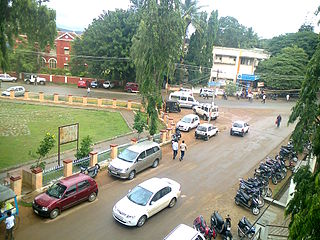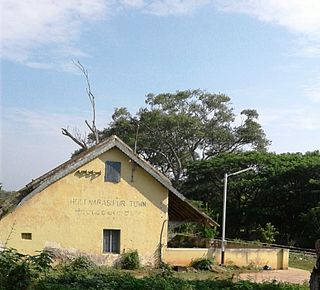
Halebidu is a town located in Hassan District, Karnataka, India. Historically known as Dwarasamudra, Halebidu became the regal capital of the Hoysala Empire in the 11th century CE. In the modern era literature it is sometimes referred to as Halebeedu or Halebid as the phonetic equivalent, a local name after it was damaged and deserted after being ransacked and looted twice by the forces of the Delhi Sultanate in the 14th century.

Belur is a town and taluk in Hassan district in the state of Karnataka, India. The town is renowned for its Chennakeshava Temple dedicated to Vishnu, one of the finest examples of Hoysala architecture and the largest Hindu temple complex that has survived from pre-14th-century Karnata-Dravida tradition. A historic site inspired by the teachings of Ramanujacharya, it has been a Vaishnava Hindu pilgrimage center since at least the 12th century. It was also the first capital of the Hoysala dynasty, before they built Dwarasamudra.

Hassan is a city in the southern part of the Indian state of Karnataka. It is the headquarters of Hassan district. The city is situated midway between Bangalore and Mangalore on National Highway 75.

Chikmagalur, known officially as Chikkamagaluru, is a city and the headquarters of Chikmagalur district in the Indian state of Karnataka. Located on the foothills of the Mullayanagiri peak of the Western Ghats, the city attracts tourists from around the world for its pleasant and favourable hill station climate, tropical rainforest and coffee estates.
Baghpat is a city in the Indian state of Uttar Pradesh. It is the administrative headquarters of Bagpat district, which was established in 1997. It is part of the National Capital Region, surrounding New Delhi.

Hassan is one of the 31 districts of Karnataka, India. The district headquarter is Hassan. It was carved out from Mysore district in the year 1866, during the Commissioner's Rule of Mysore (1831-81).

Holenarasipura is a town and taluk in Hassan district of Karnataka. The town is situated on the banks of the Hemavati, one of the tributaries of the Kaveri.

Sakleshpur, Sakleshpura or Sakleshapura is a hill station town and headquarters of Sakleshpur taluk in Hassan district in the Indian state of Karnataka.

Wandoor is a town in Nilambur Taluk, Malappuram District, Kerala, India. It is located on the southeast of Chaliyar River, about 24 kilometres northeast of the district seat Malappuram, and 8 km south of the taluk seat Nilambur. In the year 2011, the town has a population of 50,973.
Erikuthi is a village in Gudiyatham Taluk, Vellore District, Tamil Nadu, India. It lies near the state boundary with Andhra Pradesh, about 16 kilometres west of the subdistrict capital Gudiyatham, and 45 kilometres west of the district capital Vellore. As of 2011, it had a population of 8,057.

Thevalakkara is a village in the Karunagappally Taluk, Kollam District of the state of Kerala, India. It is located near the coast of the Indian Ocean, about 13 kilometres north of the district capital Kollam, and 7 kilometres southeast of the subdistrict capital Karunagappally. It contains a Devi temple along with a church and a mosque. The kadappa at Thevalakara is where ship masts (kadappa) were made for centuries. In 2011, it has a total population of 42,977.
Chinchali is a village in Raybag Taluk, Belagavi District, Karnataka, India. It is located near the state boundary with Maharashtra, approximately 84 kilometres north of the district seat Belgaum, and 10 kilometres northeast of the taluk seat Raibag. In the year 2011, the village has a population of 18,986.
Arehalli is a village in the state of Karnataka in southern India.As per census 2011, the location code number of Arehalli is 615144. It is located in the Belur taluk of Hassan district in Karnataka, and is about 230 kilometres from the state capital Bangalore, and 146 kilometres from the chief port city of Mangalore. It is well connected by road through the city of Hassan. The nearest airport is Mangalore International Airport at 160 km, and the nearest major railway station is Hassan Junction railway station located at a distance of 46 km; Sakleshpura railway station is 17 km away.
Belur is a first-grade town panchayat in the Vazhapadi taluk of Salem district, in Tamil Nadu, India.
Kurichi is a village in the Vazhapadi taluk of Salem district, in Tamil Nadu, India.
Tukkiyampalayam is a village in the Vazhapadi taluk of Salem district, in Tamil Nadu, India.
Rajaudha, also spelled as Rajodha, is a village in Porsa Tehsil, Morena District, Madhya Pradesh, India. It is located near the state border with Uttar Pradesh, about 49 kilometres northeast of the district capital Morena, and 6 kilometres northeast of the tehsil capital Porsa. As of the year 2011, it has a population of 16,524.
Maura, or Moura Jharkaha, is a village in Shankarpur Block, Madhepura District, Bihar, India. It is located in the north of the district, approximately 19 kilometres northeast of the district capital Madhepura, and 5 kilometres north of the block capital Shankarpur. As of 2011, it has a population of 42,528.
Mathighatta is a village in Chikkanayakahalli Taluk, Tumkur District, Karnataka, India. It is situated along the Karnataka State Highway 73, about 24 kilometres west of the district seat Tumkur, and 33 kilometres southeast of the taluk seat Chikkanayakana Halli. As of 2011, the village had a population of 1,843.
Partapnagar is a village in Naugachhia Block, Bhagalpur District, Bihar, India. It is located on the north of Bhagalpur District, about 20 kilometres northeast of the district capital Bhagalpur, and 2 kilometres northwest of the block capital Naugachhia. In the year 2011, it had a population of 35,878.


