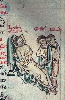
Llywelyn the Great was a King of Gwynedd in north Wales and eventually "Prince of the Welsh" and "Prince of Wales". By a combination of war and diplomacy he dominated Wales for 45 years.
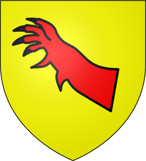
Gwenwynwyn ab Owain Cyfeiliog was the last major ruler of mid Wales before the completion of the Norman English invasion. He was one of few native rulers to represent a real threat to the rule of Llywelyn the Great.

Montgomeryshire, also known as Maldwyn, is one of thirteen historic counties and a former administrative county of Wales. It is named after its county town, Montgomery, which in turn is named after one of William the Conqueror's main counsellors, Roger de Montgomerie, who was the 1st Earl of Shrewsbury.

Welshpool is a market town and community in Powys, Wales, historically in the county of Montgomeryshire. The town is four miles from the Wales–England border and low-lying on the River Severn; its Welsh language name Y Trallwng means "the marshy or sinking land". The community includes Cloddiau and Pool Quay.

The Kingdom of Powys was a Welsh successor state, petty kingdom and principality that emerged during the Middle Ages following the end of Roman rule in Britain. It very roughly covered the northern two-thirds of the modern county of Powys and part of today's English West Midlands. More precisely, and based on the Romano-British tribal lands of the Ordovices in the west and the Cornovii in the east, its boundaries originally extended from the Cambrian Mountains in the west to include the modern West Midlands region of England in the east. The fertile river valleys of the Severn and Tern are found here, and this region is referred to in later Welsh literature as "the Paradise of Powys".

Powys Wenwynwyn or Powys Cyfeiliog was a Welsh kingdom which existed during the high Middle Ages. The realm was the southern portion of the former princely state of Powys which split following the death of Madog ap Maredudd of Powys in 1160: the northern portion (Maelor) went to Gruffydd Maelor and eventually became known as Powys Fadog; while the southern portion (Cyfeiliog) going to Owain Cyfeiliog and becoming known, eventually, as Powys Wenwynwyn after Prince Gwenwynwyn ab Owain, its second ruler.
Gruffydd ap Gwenwynwyn was a Welsh king who was lord of the part of Powys known as Powys Wenwynwyn and sided with Edward I in his conquest of Wales of 1277 to 1283.

The Abbey of Strata Marcella was a medieval Cistercian monastery situated at Ystrad Marchell on the west bank of the River Severn near Welshpool, Powys, Wales.
Owen de la Pole, also known as Owain ap Gruffydd ap Gwenwynwyn, was the heir presumptive to the Welsh principality of Powys Wenwynwyn until 1283 when it was abolished by the Parliament of Shrewsbury. He became the 1st Lord of Powis after the death of his father Gruffydd ap Gwenwynwyn c. 1287. He is not related to the English de la Pole family descended from William de la Pole, Chief Baron of the Exchequer in the following century, later Earls and Dukes of Suffolk.
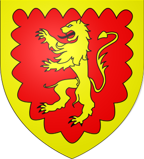
The Royal House of Dinefwr was a cadet branch of the Royal House of Gwynedd, founded by King Cadell ap Rhodri, son of Rhodri the Great. Their ancestor, Cunedda Wledig, born in late Roman Britain, was a Sub-Roman warlord who founded the Kingdom of Gwynedd during the 5th century, following the Anglo-Saxon settlement of Britain. The House achieved the important titles of King of the Britons and Prince of Wales.

Ial or Yale was a commote of medieval Wales within the cantref of Maelor in the Kingdom of Powys. When the Kingdom was divided in 1160, Maelor became part of the Princely realm of Powys Fadog, and belonged to the Royal House of Mathrafal.

The history of Gwynedd in the High Middle Ages is a period in the History of Wales spanning the 11th through the 13th centuries. Gwynedd, located in the north of Wales, eventually became the most dominant of Welsh polities during this period. Contact with continental courts allowed for Gwynedd to transition from a petty kingdom into an increasingly sophisticated principality of seasoned courtiers capable of high level deplomacy and representation; not only with the Angevine kings, but also the king of France and the Papal See. Distinctive achievements in Gwynedd include further development of Medieval Welsh literature, particularly poets known as the Beirdd y Tywysogion associated with the court of Gwynedd; the reformation of bardic schools; and the continued development of Cyfraith Hywel. All three of these further contributed to the development of a Welsh national identity in the face of Anglo-Norman encroachment of Wales.

The Royal House of Mathrafal began as a cadet branch of the Welsh Royal House of Dinefwr, taking their name from Mathrafal Castle, their principal seat and effective capital. They effectively replaced the House of Gwertherion, who had been ruling the Kingdom of Powys since late Roman Britain, through the politically advantageous marriage of an ancestor, Merfyn the Oppressor. His son, King Bleddyn ap Cynfyn, would join the resistance of the Anglo-Saxon King Harold Godwinson, against the invasion of William the Conqueror, following the Norman conquest of England. Thereafter, they would struggle with the Plantagenets and the remaining Welsh Royal houses for the control of Wales. Although their fortunes rose and fell over the generations, they are primarily remembered as Kings of Powys and last native Prince of Wales.

Castle Caereinion is a small village and community in Montgomeryshire, Powys, Wales upon the River Banwy, around 8 miles west of Welshpool, and 4 miles east of Llanfair Caereinion.

Ystrad Marchell sometimes Strad Marchell was a medieval commote (cwmwd) in the cantref of Ystlyg in the Kingdom of Powys. It roughly coincides with the parish of Welshpool.

Llanerchydol is a settlement on the A458 about 2 km west of the centre of Welshpool in the county of Powys in Wales. It is part of the community of Welshpool and also lends its name to an electoral ward.
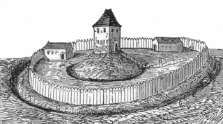
Tomen yr Allt was a Medieval motte and bailey defensive castle near Llanfyllin in Powys, Wales. "Tomen ar hallt" is modern Welsh for "mound on the wooded hillside."
Hawise Lestrange was the daughter of the Marcher lord John Lestrange (d.1269) of Great Ness, Cheswardine and Knockin (Shropshire). Married at a young age to the ruler of southern Powys, Gruffudd ap Gwenwynwyn, she became a key figure in border affairs and in the management of her family and estates until her death at a great age. She was deeply implicated in a plot to overthrow the prince of Wales, Llywelyn ap Gruffudd, in 1274, and with her husband sided with Edward I in the English king's conquest of Wales.

Rhayader Castle is the remains of a motte-and-bailey castle in the town of Rhayader, Powys, Wales. The available documentary sources are not clear enough to distinguish between this site and the castle mound across the river and one or the other was probably built by Rhys ap Gruffydd, Prince of Deheubarth, in 1177. At that time the river formed the border between Gwrtheyrnion and the independent state of Buellt; the town of Rhayader is on the Gwrtheyrnion side of the river.
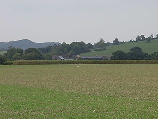
Carreghofa Castle was a Norman timber and masonry castle located in the Welsh village of Carreghofa, Powys. Between its construction in 1101 and destruction in 1236, it was the site of many battles between rival Welsh and English forces. Archaeological remains of the castle's perimeter were uncovered in the late 19th century and this is all that remains of the structure.
