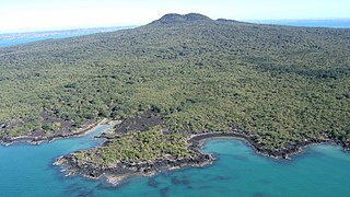
Rangitoto Island is a volcanic island in the Hauraki Gulf near Auckland, New Zealand. The 5.5 km (3.4 mi) wide island is a symmetrical shield volcano cone capped by central scoria cones, reaching a height of 260 m (850 ft). Rangitoto is the youngest and largest of the approximately 50 volcanoes of the Auckland volcanic field, having erupted in two phases about 620 and 600 years ago and covering an area of 2,311 ha. It is separated from the mainland of Auckland's North Shore by the Rangitoto Channel. Since World War II, it has been linked by a causeway to the much older, non-volcanic Motutapu Island.

Waiheke Island is the second-largest island in the Hauraki Gulf of New Zealand. Its ferry terminal in Matiatia Bay at the western end is 21.5 km (13.4 mi) from the central-city terminal in Auckland.

The Hauraki Gulf / Tīkapa Moana is a coastal feature of the North Island of New Zealand. It has an area of 4000 km2, and lies between, in anticlockwise order, the Auckland Region, the Hauraki Plains, the Coromandel Peninsula, and Great Barrier Island. Most of the gulf is part of the Hauraki Gulf Marine Park.

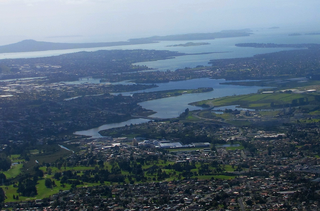
Waitematā Harbour is the main access by sea to Auckland, New Zealand. For this reason it is often referred to as Auckland Harbour, despite the fact that it is one of two harbours adjoining the city. The harbour forms the northern and eastern coasts of the Auckland isthmus and is crossed by the Auckland Harbour Bridge. It is matched on the southern side of the city by the shallower waters of the Manukau Harbour.

Moturoa / Rabbit Island is a small island that lies across the southernmost part of Tasman Bay / Te Tai-o-Aorere, on the northern coast of New Zealand's South Island. The long narrow island runs east–west for 8 kilometres (5 mi), and covers 15 km2 (5.8 sq mi).

Ponui Island is a privately owned island located in the Hauraki Gulf, to the east of the city of Auckland, New Zealand. It is located to the southeast of Waiheke Island, at the eastern end of the Tamaki Strait, which separates the island from the Hunua Ranges on the mainland to the south.
The Tamaki River or Tamaki Estuary is mostly an estuarial arm and harbour of the Hauraki Gulf, within the city of Auckland in New Zealand. It extends south for 15 kilometres (9 mi) from its mouth between the suburb of Saint Heliers and the long thin peninsula of Bucklands Beach, which reaches its end at Musick Point. The inlet extends past the suburbs of Glendowie, Wai o Taiki Bay, Point England, Glen Innes, Tāmaki, Panmure, and Ōtāhuhu to the west, and Bucklands Beach, Half Moon Bay, Farm Cove, Sunnyhills and Pakuranga to the east.

Auckland City was a territorial authority with city status covering the central isthmus of the urban area of Auckland, New Zealand. It was governed by the Auckland City Council from 1989 to 2010, and as a territory within the wider Auckland Region, was also governed by Auckland Regional Council. Auckland City was disestablished as a local authority on 1 November 2010, when Auckland City Council was amalgamated with other councils of the Auckland Region into the new Auckland Council. At the time of its disestablishment, the city had a resident population of around 450,000.

Mechanics Bay is a reclaimed bay on the Waitematā Harbour in Auckland, New Zealand. It is also the name of the area of the former bay that is now mainly occupied by commercial and port facilities. Sometimes the bay formed between Tamaki Drive and the western reclamation edge of Fergusson Container Terminal is also referred to as Mechanics Bay.

Ostend is a settlement on Waiheke Island, in New Zealand's Hauraki Gulf within the Auckland Region. Ostend is located in the west of the island, on and around a small peninsula which juts into Putiki Bay, one of two large indentations in the island's southwest coast. The southwest of the island contains much of the island's population, with Ostend being located immediately to the east of the settlement of Surfdale, and to the southwest of Onetangi.

Motukorea or Browns Island is a small New Zealand island, in the Hauraki Gulf north of Musick Point, one of the best preserved volcanoes in the Auckland volcanic field. The age of eruption is about 25,000 years ago, when the Tāmaki Estuary and the Waitemata Harbour were forested river valleys. Due to centuries of cultivation, little native bush remains except on the north-eastern cliffs, leaving the volcanic landforms easily visible. It exhibits the landforms from three styles of eruption. The island consists of one main scoria cone with a deep crater, a small remnant arc of the tuff ring forming the cliffs in the northeast, and the upper portions of lava flows. The area was dry land when the eruptions occurred, but much of the lava is now submerged beneath the sea.

Half Moon Bay, an affluent coastal suburb of Auckland, New Zealand, lies immediately south of Bucklands Beach. It formed part of Manukau City until the amalgamation of the entire Auckland Region in 2010 under one governing authority, Auckland Council.
Tāmaki Makaurau is a New Zealand parliamentary Māori electorate returning one Member of Parliament to the New Zealand House of Representatives. It was first formed for the 2002 election. The electorate covers the Auckland area and was first held by Labour's John Tamihere before going to Dr Pita Sharples of the Māori Party for three terms from 2005 to 2014. After Sharples' retirement, the electorate was won by Peeni Henare of the Labour Party in the 2014 election.
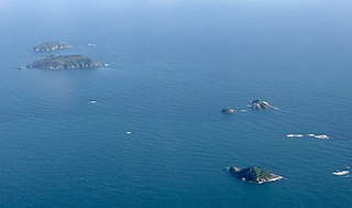
The Noises are a collection of islands lying northeast of Rakino Island in Auckland's Hauraki Gulf, off the coast of the North Island of New Zealand. The largest and most forested islands are Ōtata and Motuhoropapa; Orarapa and Maria/Ruapuke are also significant. After a rat eradication campaign in the 1960s, Maria was the first New Zealand island to become predator-free. The lack of invasive predators, intact native forest, and large numbers of breeding seabirds give the Noises significant conservation value. There has however been a marked decline in marine biodiversity surrounding the islands from over-fishing.
Chris Bailey is a Māori sculptor and carver. Bailey studied Māori language and Māori material culture at the University of Auckland under Dante Bonica. He lives and works on Waiheke Island.
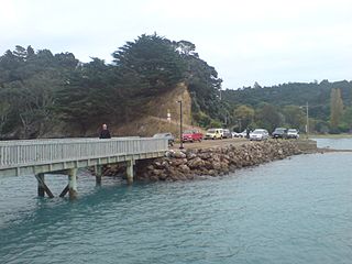
Rural Waiheke comprises the eastern and southern parts of Waiheke Island in the Hauraki Gulf near Auckland, in New Zealand. Apart from small settlements at Ōmiha and Orapiu, the area south and east of Onetangi is mostly private farmland. Waiheke Island Aerodrome is approximately in the centre of the island.

Sculpture on the Gulf is a temporary outdoor art exhibition on a coastal headland on Matiatia Bay, Waiheke Island, New Zealand. It is a biennial event founded in 2003 by the Waiheke Community Art Gallery.
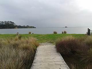
Whakanewha Regional Park is a regional park situated on Waiheke Island in New Zealand's Hauraki Gulf. It is owned and operated by Auckland Council.
Katherine Bay, alternatively spelt as Catherine Bay, is a bay located on the northwestern coast of Great Barrier Island, New Zealand. The bay was named in 1870 by Captain Nagle after his wife.
