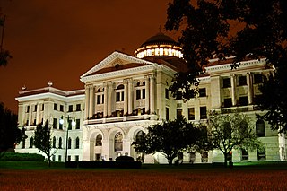
Lucas County is a county located in the U.S. state of Ohio and bordered on the east by Lake Erie, and on the southeast by the Maumee River, which runs to the lake. As of the 2010 census, the population was 441,815. Its county seat is Toledo, located at the mouth of the Maumee River on the lake. The county was named for Robert Lucas, 12th governor of Ohio, in 1835 during his second term. Its establishment provoked the Toledo War conflict with the Michigan Territory, which claimed some of its area.

New Haven is a city in Adams, Jefferson, and St. Joseph townships, Allen County, Indiana, United States. It the only suburb of the city of Fort Wayne, the second largest city in Indiana, and is situated mostly along the southern banks of the Maumee River. The population was 15,709 as of the 2015 estimate.

Maumee is a city in Lucas County, Ohio, United States. Located along the Maumee River, it is about 10 miles southwest of Toledo. The population was 14,286 at the 2010 census. Maumee was declared an All-America City by the National Civic League in June 2006.

The Maumee River is a river running from northeastern Indiana into northwestern Ohio and Lake Erie in the United States. It is formed at the confluence of the St. Joseph and St. Marys rivers, where Fort Wayne, Indiana, has developed, and meanders northeastwardly for 137 miles (220 km) through an agricultural region of glacial moraines before flowing into the Maumee Bay of Lake Erie. The city of Toledo is located at the mouth of the Maumee. The Maumee was designated an Ohio State Scenic River on July 18, 1974. The Maumee watershed is Ohio’s breadbasket; it is two-thirds farmland, mostly corn and soybeans. It is the largest watershed of any of the rivers feeding the Great Lakes, and supplies five percent of Lake Erie’s water.

The Great Black Swamp, was a glacially fed wetland in northwest Ohio and extreme northeast Indiana, United States, that existed from the end of the Wisconsin glaciation until the late 19th century. Comprising extensive swamps and marshes, with some higher, drier ground interspersed, it occupied what was formerly the southwestern part of proglacial Lake Maumee, a holocene precursor to Lake Erie. The area was about 25 miles (40 km) wide and 100 miles (160 km) long, covering an estimated 1,500 square miles (4,000 km2). Gradually drained and settled in the second half of the 19th century, it is now highly productive farm land.

The St. Marys River is a 99-mile-long (159 km) tributary of the Maumee River in northwestern Ohio and northeastern Indiana in the United States. Prior to development, it was part of the Great Black Swamp. Today, it drains a primarily rural farming region in the watershed of Lake Erie.

Lake Maumee was a proglacial lake and an ancestor of present-day Lake Erie. It formed about 14,000 Years Before Present (YBP) as the Huron-Erie Lobe of the Laurentide ice sheet retreated at the end of the Wisconsin glaciation. As water levels continued to rise the lake evolved into Lake Arkona and then Lake Whittlesey.

Maumee Bay State Park is a state park in Jerusalem Township, Lucas County, Ohio. The park was acquired by the state in 1974 and became a state park in 1975.

Farnsworth Metropark is a regional park located in Waterville, Ohio that is part of the Toledo Metroparks. The long narrow parks sits on the western shore of the Maumee River with a view of several islands, including Missionary, Butler and Indian islands, all of which are owned by the State of Ohio.

Maumee is an unincorporated community in Salt Creek Township, Jackson County, Indiana.

The Michigan Southern Railroad (Formerly Maumee & Western reporting - MAW) is a freight railroad in the United States operating between Woodburn, Indiana and Napoleon, Ohio and comprises 53 miles of track. The railroad originally extended to Toledo; portions have been converted to a rail trail.
Stautzenberger College is a private college located in Maumee, Ohio, United States, and Brecksville, Ohio. It is a part of American Higher Education Development Corporation.
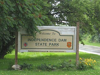
Independence Dam State Park is a 591-acre (239 ha) in Defiance County, Ohio in the United States. This Ohio state park lies on the banks of the Maumee River and features ruins of the Miami and Erie Canal. The park was established in 1949 and is open for year-round recreation including, boating, fishing, hiking and picnicking. It is off U.S. Route 24 just east of Defiance, Ohio.
Mary Jane Thurston State Park is a 591-acre (239 ha) Ohio state park in Wood and Henry Counties, Ohio in the United States. It is named for Mary Jane Thurston, a schoolteacher from Grand Rapids, Ohio who bequeathed 14 acres (57,000 m2) of land for the establishment of a park. The park is along the Maumee River near the remains of the historic Miami and Erie Canal. Mary Jane Thurston State Park is open for year-round recreation including, hunting, fishing and boating, picnicking, camping and hiking.

Maumee Valles is an ancient river valley in the Lunae Palus quadrangle of Mars, located at 19.7° N and 53.2° W. It is 350.0 km long and was named after a North American river in Indiana and Ohio.

Maumee Road Lands were a group of land tracts granted by the United States Congress to the state of Ohio in 1823 along the path of a proposed road in the northwest corner of the state.
Blanchard's Fork Reserve was an Ottawa Indian Reserve located in northwestern Ohio along the Blanchard River, also known as the Blanchard's Fork of the Auglaize River, a tributary of the Maumee River which ran to Lake Erie. The Reserve was established under the 1817 Treaty at the Foot of the Rapids of the Miami of Lake Erie. This group became known officially as the Ottawa of Blanchard's Fork.


