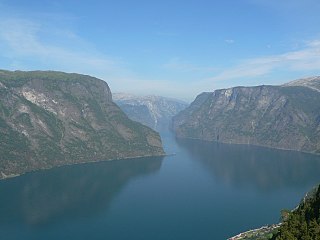
Sogn og Fjordane is a county in western Norway, bordering Møre og Romsdal, Oppland, Buskerud, and Hordaland. The county administration is in the village of Hermansverk in Leikanger municipality. The largest town in the county is Førde.

The Hardangerfjord is the fourth longest fjord in the world, and the second longest fjord in Norway. It is located in Hordaland county in the Hardanger region. The fjord stretches 179 kilometres (111 mi) from the Atlantic Ocean into the mountainous interior of Norway along the Hardangervidda plateau. The innermost point of the fjord reaches the town of Odda.

The Sognefjord or Sognefjorden, nicknamed the King of the Fjords, is the largest and deepest fjord in Norway. Located in Sogn og Fjordane county in Western Norway, it stretches 205 kilometres (127 mi) inland from the ocean to the small village of Skjolden in the municipality of Luster. The fjord takes its name from the traditional district of Sogn, which covers the southern part of the county.

The Nærøyfjord is a fjord in the municipality of Aurland in Sogn og Fjordane, Norway. The narrow fjord is a branch of the large Sognefjord, and it is featured on the "Norway in a Nutshell" daytrips for tourists. The 18-kilometre (11 mi) long fjord is only 500 metres (1,600 ft) wide in some parts.

Sjøvegan is the administrative centre of Salangen Municipality in Troms county, Norway. The village is located at the end of the Sagfjorden, a branch of the Salangen fjord. The river Salangselva empties into the fjord at Sjøvegan. The river flows through the lakes Nervatnet and Øvrevatnet just to the east of the village.

The Folgefonna Tunnel is a 11,150-meter (36,580 ft) long road tunnel in Hordaland county, Norway. The tunnel connects the village of Eitrheim and the town of Odda at the head of Sørfjorden in Odda municipality to the village of Austrepollen at the head of Maurangsfjorden in Kvinnherad municipality. The tunnel runs under the large Folgefonna glacier and Folgefonna National Park. The tunnel opened in 2001 and is Norway's third longest road tunnel. It reduced travel time between these two places from four hours all the way down to ten minutes. It is part of County Road 551.

Hopvatnet is a lake in the municipality of Steigen in Nordland county, Norway. The 3.83-square-kilometre (1.48 sq mi) lake lies about 15 kilometres (9.3 mi) northeast of the village of Nordfold. The lake is located just above sea level and it empties into the nearby Nordfolda branch of the Folda fjord.
Juklavatnet is a lake on the border of the municipalities of Kvinnherad and Jondal in Hordaland county, Norway. The 3.61-square-kilometre (1.39 sq mi) lake lies just outside Folgefonna National Park and immediately to the west of the Nordre Folgefonna glacier. The only road access comes from the small village of Nordrepollen in the Mauranger area of Kvinnherad municipality, about 10 kilometres (6.2 mi) south of the lake. There is a dam on the western end of the lake which regulates the depth of the water so that it can be used for hydroelectric power generation. The lake is the largest reservoir that feeds into the Mauranger power station.
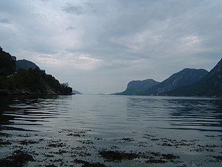
Høgsfjorden is a fjord in Rogaland county, Norway. The innermost part of the fjord is located at the village of Frafjord in the municipality of Gjesdal. It flows west to Dirdal and then heads northwards. At the village of Forsand, the Lysefjord branches off to the northeast. The Høgsfjorden continues to the northwest past the islands of Idsal and Idse before emptying into the Horgefjorden and ultimately into the vast Boknafjorden. The fjord runs through the municipalities of Gjesdal, Forsand, Sandnes, and Strand.

Mauranger is the northernmost district of Kvinnherad municipality in Hordaland county, Norway. The district is centered on the Maurangsfjorden on the western side of the vast Folgefonna glacier. Mauranger consists of the villages of Sundal, Austrepollen, Nordrepollen, and Gjetingsdalen. The scenery is characterised by its closeness to Folgefonna, several valleys, and precipitous mountainsides. The main industries in Mauranger are tourism, agriculture, fish farming and power production.

Gjetingsdalen is a village in the Mauranger area of Kvinnherad municipality in Hordaland county, Norway. The village is located in the Gjetingsdalen valley, on a hillside overlooking the Maurangsfjorden. The village of Austrepollen lies about 5 kilometres (3.1 mi) to the east, across the fjord. There is only one road leading into and out of the village, making it rather isolated, but its close proximity to the Jondal Tunnel and Folgefonna Tunnel, give it good access to nearby urban areas. There is a hydroelectric power plant located along the river which runs through this valley.

Nordrepollen is a village in the Mauranger area of Kvinnherad municipality in Hordaland county, Norway. The village is located at the northern end of the Maurangsfjorden, about half-way between the villages of Gjetingsdalen and Austrepollen. The southeastern entrance to the Jondal Tunnel is located in Nordrepollen. The lake Juklavatnet lies high up in the mountains to the north of Nordrepollen. That lake has a dam at the end, and its water is used to hydroelectric power generation. There are several farms that make up Nordrepollen, the largest of which are Flatebø and Øyre.
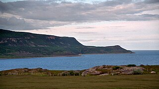
The Tanafjord or Tanafjorden is a large fjord in Finnmark county, Norway. It is located in the municipalities of Tana, Gamvik, and Berlevåg. Its orientation is mainly north-south, reaching approximately 65 kilometres (40 mi) from the small village of Smalfjord in Tana Municipality in the south to the mouth of the fjord at the Barents Sea. The fjord separates the Nordkinn Peninsula in the west from the Varanger Peninsula in the east.

Sørfjorden is a 38-kilometre (24 mi) long fjord that is one of the innermost branches of the main Hardangerfjorden in Hordaland county, Norway. It is the longest arm that branches off of the Hardangerfjord. Sørfjorden stretches from just north of the village of Kinsarvik straight south to the industrial town of Odda. The Folgefonna glacier and Folgefonna National Park are located just to the west of the fjord and the Hardangervidda mountain plateau lies to its east.

Sørfolda is a fjord in Nordland county, Norway. It is located in the municipalities of Sørfold and Bodø. The 40-kilometre (25 mi) Sørfolda is a southeastern branch of the main Folda fjord. Side branches include the Nevelsfjorden, Eidekjosen, Skjunkfjorden, and Leirfjorden. The deepest part of the fjord reaches 573 metres (1,880 ft) below sea level.

Ullsfjorden (Norwegian) or Moskavuotna (Northern Sami) is a fjord in Troms county, Norway. The fjord runs through the municipalities of Tromsø, Karlsøy, and Lyngen. The 75-kilometre (47 mi) fjord flows from the village of Sjøvassbotn northwards along the west side of the Lyngen Peninsula. The Kjosen fjord branches off to the east side and the Grøtsundet strait branches off to the west. The islands of Reinøya and Karlsøya lie along the western side of the fjord. The southern part of the Ullsfjorden is also known as Sørfjorden. The area surrounding the Ullsfjorden was part of the municipality of Ullsfjord for about 60 years during the 20th century.

Nordfjorden is the sixth longest fjord in Norway and the second longest fjord in all of Sogn og Fjordane county. It flows through the municipalities of Stryn, Gloppen, Eid, Bremanger, and Vågsøy, and it is the central feature of the entire Nordfjord region which makes up the northern third of the county.
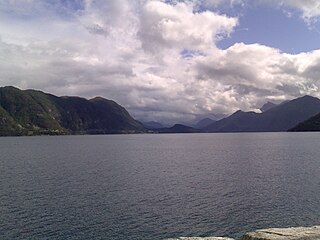
Voldsfjorden or Voldafjorden is a fjord in Volda Municipality in Møre og Romsdal county, Norway. The 18-kilometre (11 mi) long fjord begins at the confluence of the Austefjorden and the Kilsfjorden.
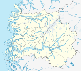
Fjærlandsfjorden is a fjord in Sogn og Fjordane county, Norway. It is a fjord arm that branches off the main Sognefjorden to the north, running through the municipalities of Balestrand, Leikanger, and Sogndal. The 25-kilometre (16 mi) long fjord begins at the village of Fjærland in Sogndal, flowing to the south until it joins the Sognefjorden near the village of Balestrand. The Esefjorden and Vetlefjorden are two small fjord arms that branch off the Fjærdlandsfjorden. The fjord is about 1.5 kilometres (0.93 mi) wide, with steep mountains on both sides of the fjord. The head of the fjord is the only habitable area around the fjord. It is a flat river valley extending north of the fjord. The inner part of the fjord where the village of Fjærland is located is only accessible by boat or via long road tunnels through the surrounding mountains. The western end of the Frudal Tunnel sits very near the shore of the fjord.


