Rodinia was a Mesoproterozoic and Neoproterozoic supercontinent that assembled 1.26–0.90 billion years ago (Ga) and broke up 750–633 million years ago (Ma). Valentine & Moores 1970 were probably the first to recognise a Precambrian supercontinent, which they named "Pangaea I." It was renamed "Rodinia" by McMenamin & McMenamin 1990, who also were the first to produce a plate reconstruction and propose a temporal framework for the supercontinent.

The Mesoproterozoic Era is a geologic era that occurred from 1,600 to 1,000 million years ago. The Mesoproterozoic was the first era of Earth's history for which a fairly definitive geological record survives. Continents existed during the preceding era, but little is known about them. The continental masses of the Mesoproterozoic were more or less the same ones that exist today, although their arrangement on the Earth's surface was different.

Columbia, also known as Nuna or Hudsonland, is a hypothetical ancient supercontinent. It was first proposed by John J.W. Rogers and M. Santosh in 2002 and is thought to have existed approximately 2,500 to 1,500 million years ago (Ma), in the Paleoproterozoic era. The assembly of the supercontinent was likely completed during global-scale collisional events from 2,100 to 1,800 Ma.

The Miller Range is a mountain range extending south from Nimrod Glacier for 80 km (50 mi) along the western edge of the Marsh Glacier in Antarctica.

The Shackleton Range is a mountain range in Antarctica that rises to 1,875 metres (6,152 ft) and extends in an east–west direction for about 100 miles (160 km) between the Slessor and Recovery Glaciers.

The Naturaliste Plateau is one of several large submarine plateaus extending from Western Australia into the Indian Ocean. It is a rectilinear plateau that covers an area of 90,000 square kilometres. Its width is about 400 kilometres (250 mi) east-west and 250 km (160 mi) north-south. The water depths are from 1500 to 5000 metres.

The geology of Australia includes virtually all known rock types, spanning a geological time period of over 3.8 billion years, including some of the oldest rocks on earth. Australia is a continent situated on the Indo-Australian Plate.
The Pan-African orogeny was a series of major Neoproterozoic orogenic events which related to the formation of the supercontinents Gondwana and Pannotia about 600 million years ago. This orogeny is also known as the Pan-Gondwanan or Saldanian Orogeny. The Pan-African orogeny and the Grenville orogeny are the largest known systems of orogenies on Earth. The sum of the continental crust formed in the Pan-African orogeny and the Grenville orogeny makes the Neoproterozoic the period of Earth's history that has produced most continental crust.

Vaalbara is a hypothetical Archean supercontinent consisting of the Kaapvaal Craton and the Pilbara Craton. E. S. Cheney derived the name from the last four letters of each craton's name. The two cratons consist of continental crust dating from 2.7 to 3.6 Ga, which would make Vaalbara one of Earth's earliest supercontinents.

The geology of Antarctica covers the geological development of the continent through the Archean, Proterozoic and Phanerozoic eons.

The Rio de la Plata Craton (RPC) is a medium-sized continental block found in Uruguay, eastern Argentina and southern Brazil. During its complex and protracted history it interacted with a series other blocks and is therefore considered important for the understanding of the amalgamation of West Gondwana. Two orogenic cycles have been identified in the RPC: a 2000 Ma-old western domain representing the old craton and a 700–500 Ma-old eastern domain assigned to the Brasiliano Cycle. It is one of the five cratons of the South American continent. The other four cratons are: Amazonia, São Francisco, Río Apa and Arequipa–Antofalla.

The Wyoming Craton is a craton in the west-central United States and western Canada – more specifically, in Montana, Wyoming, southern Alberta, southern Saskatchewan, and parts of northern Utah. Also called the Wyoming Province, it is the initial core of the continental crust of North America.

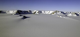
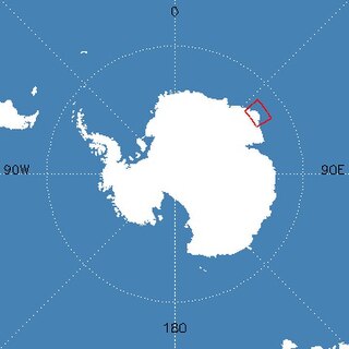
Mount Elkins, also known as Jökelen is a dark, steep-sided mountain with three major peaks, the highest 2,300 meters (7,500 ft) above sea level, in the Napier Mountains of Enderby Land. Enderby Land is part of East Antarctica and is claimed by Australia as part of the Australian Antarctic Territory. The mountain was named after Terence James Elkins, an ionospheric physicist with the Australian National Antarctic Research Expeditions at Mawson Station in 1960.

The Grouse Creek block is a Precambrian basement province of 2.45 to 2.70 billion year old orthogneisses. The Grouse Creek block is one of several Proterozoic and Archean accreted terranes that lie to the north and west of the Wyoming craton, including the Farmington Canyon Complex, the Selway terrane, the Medicine Hat block and the Priest River complex. Together, these terranes comprise part of the basement rock of the North American continent and have been critical to studies of crustal accretion in the Precambrian. Ongoing study of the Grouse Creek block will contribute to understanding the paleogeography of the Wyoming craton prior to its incorporation into the supercontinent Laurentia approximately 1.86 billion years ago. The name was proposed by David Foster and others.

The East Antarctic Shield or Craton is a cratonic rock body that covers 10.2 million square kilometers or roughly 73% of the continent of Antarctica. The shield is almost entirely buried by the East Antarctic Ice Sheet that has an average thickness of 2200 meters but reaches up to 4700 meters in some locations. East Antarctica is separated from West Antarctica by the 100–300 kilometer wide Transantarctic Mountains, which span nearly 3,500 kilometers from the Weddell Sea to the Ross Sea. The East Antarctic Shield is then divided into an extensive central craton that occupies most of the continental interior and various other marginal cratons that are exposed along the coast.

The Aravalli Mountain Range is a northeast-southwest trending orogenic belt in the northwest part of India and is part of the Indian Shield that was formed from a series of cratonic collisions. The Aravalli Mountains consist of the Aravalli and Delhi fold belts, and are collectively known as the Aravalli-Delhi orogenic belt. The whole mountain range is about 700 km long. Unlike the much younger Himalayan section nearby, the Aravalli Mountains are believed much older and can be traced back to the Proterozoic Eon. They are arguably the oldest geological feature on Earth. The collision between the Bundelkhand craton and the Marwar craton is believed to be the primary mechanism for the development of the mountain range.

The Huangling Anticline or Complex represents a group of rock units that appear in the middle of the Yangtze Block in South China, distributed across Yixingshan, Zigui, Huangling, and Yichang counties. The group of rock involves nonconformity that sedimentary rocks overlie the metamorphic basement. It is a 73-km long, asymmetrical dome-shaped anticline with axial plane orientating in the north-south direction. It has a steeper west flank and a gentler east flank. Basically, there are three tectonic units from the anticline core to the rim, including Archean to Paleoproterozoic metamorphic basement, Neoproterozoic to Jurassic sedimentary rocks, and Cretaceous fluvial deposit sedimentary cover. The northern part of the core is mainly tonalite-trondhjemite-gneiss (TTG) and Cretaceous sedimentary rock called the Archean Kongling Complex. The middle of the core is mainly the Neoproterozoic granitoid. The southern part of the core is the Neoproterozoic potassium granite. Two basins are situated on the western and eastern flanks of the core, respectively, including the Zigui basin and Dangyang basin. Both basins are synforms while Zigui basin has a larger extent of folding. Yuanan Graben and Jingmen Graben are found within the Dangyang Basin area. The Huangling Anticline is an important area that helps unravel the tectonic history of the South China Craton because it has well-exposed layers of rock units from Archean basement rock to Cretaceous sedimentary rock cover due to the erosion of the anticline.
The Kimban orogeny, also termed the Strangways orogeny, affected the Gawler Craton in what is now Australia between 1.73 and 1.69 billion years ago in the Proterozoic. As the most widespread orogenic event in the craton's evolution, the Kimban orogeny led to widely variable metamorphism included granulite and greenschist-grade on the sequence of metamorphic facies, preserved in the Tunkillia, Moody and Middlecamp rock suites. The Moody Suite formed late in the orogeny and was intruded with hornblende-rich granitoids and muscovite-rich leucogranites.


