Mayfield, Washington

Last updated

Mayfield is an unincorporated community in Lewis County, in the U.S. state of Washington. [1]

Lewis County, Washington County in the United States

Lewis County is a county in the U.S. state of Washington. As of the 2010 census, the county's population was 75,455. The county seat is Chehalis, and its largest city is Centralia. The county was created as Vancouver County on December 19, 1845, by the Provisional Government of Oregon, named for George Vancouver. In 1849, the county name was changed, to honor Meriwether Lewis. At the time, the county included all U.S. lands north of the Cowlitz River, including much of the Puget Sound region and British Columbia.

U.S. state constituent political entity of the United States

In the United States, a state is a constituent political entity, of which there are currently 50. Bound together in a political union, each state holds governmental jurisdiction over a separate and defined geographic territory and shares its sovereignty with the federal government. Due to this shared sovereignty, Americans are citizens both of the federal republic and of the state in which they reside. State citizenship and residency are flexible, and no government approval is required to move between states, except for persons restricted by certain types of court orders. Four states use the term commonwealth rather than state in their full official names.
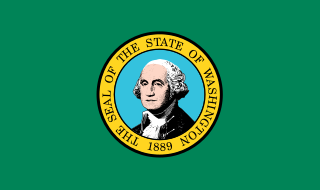
Washington (state) State of the United States of America

Washington, officially the State of Washington, is a state in the Pacific Northwest region of the United States. Named for George Washington, the first president of the United States, the state was made out of the western part of the Washington Territory, which was ceded by Britain in 1846 in accordance with the Oregon Treaty in the settlement of the Oregon boundary dispute. It was admitted to the Union as the 42nd state in 1889. Olympia is the state capital; the state's largest city is Seattle. Washington is sometimes referred to as Washington State to distinguish it from Washington, D.C., the capital of the United States.

History

A post office called Mayfield was established in 1895, and remained in operation until 1962. [2] The community has the name of W. H. Mayfield. [3]

Related Research Articles

Cave City, California Unincorporated community in California, United States

Cave City is an unincorporated community in Calaveras County, California. It lies at an elevation of 1,617 feet (493 m) and is located at 38°12′09″N120°30′31″W. The community is in ZIP code 95222 and area code 209.

Ethel is an unincorporated community on U.S. Route 12 in east Lewis County, Washington, United States. It is near Salkum.

Cinebar is an unincorporated community in Washington State between State Route 508 and U.S. Route 12. Named for the cinnabar present in the mountains to the northeast, Cinebar is a rural area with a post office and fire station on State Route 508. Other towns near Cinebar include Silver Creek, Salkum, Morton, Onalaska, Napavine, Chehalis, and Centralia.

Mundo, California Unincorporated community in California, United States

Mundo is an unincorporated community in Imperial County, California. It is located on the Southern Pacific Railroad 7.5 miles (12 km) southeast of Frink, at an elevation of 190 feet below sea level.

Alpha is an unincorporated community located in Lewis County, Washington about 3.5 miles away from Cinebar. Due to its rural setting with little settlement concentration, it did not meet qualifications as a Census Designated Place, a program used by the U.S. Census Bureau for unincorporated communities. Alpha appears on the Mayfield Lake U.S. Geological Survey Map. Alpha is located within the Pacific time zone UTC-8. It is the home to the Shoestring Cemetery, located on the Main Avenue, Washington State Route 508.

Ostrander, Washington Unincorporated community in Washington

Ostrander is an unincorporated community in Cowlitz County, Washington, north of the city of Kelso. Ostrander is located north on North Pacific Avenue from exit 42 of Interstate 5. The Ostrander community is part of the Kelso School District, a K-12 school district of nearly 5,000 students.

Olequa, Washington Unincorporated community in Washington

Olequa, also known as Olequah, is an unincorporated community in Cowlitz County, Washington. Olequa is located north of the city of Castle Rock on the west bank of the Cowlitz River. Olequa is accessed by traveling 7.5 miles (12.1 km) north on West Side Highway from Castle Rock. The Olequa community is part of the Castle Rock School District, a K-12 school district of about 1,300 students.

Forest is an unincorporated community in Lewis County, in the U.S. state of Washington.

Islandale is an unincorporated community in San Juan County, in the U.S. state of Washington.

Leber is an unincorporated community in Pierce County, in the U.S. state of Washington.

Mendota is an extinct town in Lewis County, in the U.S. state of Washington.

Offutt Lake is an unincorporated community in Thurston County, in the U.S. state of Washington.

Swofford is an unincorporated community in Lewis County, in the U.S. state of Washington.

Union Mill is an unincorporated community in Thurston County, in the U.S. state of Washington.

Rhyse is an unincorporated community in Dent County, in the U.S. state of Missouri.

Belmore is an unincorporated community in Thurston County, in the U.S. state of Washington.

Maytown is an unincorporated community in Thurston County, in the U.S. state of Washington.

McIntosh is an unincorporated community in Thurston County, in the U.S. state of Washington.

Plumb is an unincorporated community in Thurston County, in the U.S. state of Washington.

Vail is an unincorporated community in Thurston County, in the U.S. state of Washington.

References

  1. U.S. Geological Survey Geographic Names Information System: Mayfield, Washington
  2. "Post Offices". Jim Forte Postal History. Retrieved 14 August 2016.
  3. Meany, Edmond S. (1923). Origin of Washington geographic names. Seattle: University of Washington Press. p. 161.

Coordinates: 46°30′31″N122°34′09″W / 46.50861°N 122.56917°W / 46.50861; -122.56917

Geographic coordinate system Coordinate system

A geographic coordinate system is a coordinate system that enables every location on Earth to be specified by a set of numbers, letters or symbols. The coordinates are often chosen such that one of the numbers represents a vertical position and two or three of the numbers represent a horizontal position; alternatively, a geographic position may be expressed in a combined three-dimensional Cartesian vector. A common choice of coordinates is latitude, longitude and elevation. To specify a location on a plane requires a map projection.