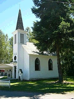
Ashford is a census-designated place (CDP) in Pierce County, Washington, United States. The population was 217 as of the 2010 census. Located just a few miles west of the main entrance to Mount Rainier National Park, it features numerous shops and accommodations for visitors. The surrounding mountains and narrow Nisqually River valley are heavily forested.

Elbe is a census-designated place (CDP) in Pierce County, Washington, Washington, United States. The population was 29 at the 2010 census.

Bryant is a census-designated place (CDP) in Snohomish County, Washington, United States. The population was 1,870 at the 2010 census.

Cougar is an unincorporated community and former town in Cowlitz County, Washington, northeast of the city of Woodland. Cougar is located 29 miles (47 km) northeast of Woodland along Washington State Route 503 and situated along the northwest bank of Yale Lake, a reservoir on the Lewis River. The population was 122 at the 1990 Census, when it was still incorporated as a town, but disincorporated before the 2000 Census. The Cougar community is part of the Woodland School District, a K-12 school district of about 2,200 students. Cougar is the nearest community to Mount St. Helens, which lies 13 miles (20.9215 km) to its northeast. The eruption of Mount St. Helens on May 18, 1980 was the deadliest and most economically destructive volcanic event in the history of the United States.

Burnett is an unincorporated community in Pierce County, Washington, United States. It is located just south of Buckley, Washington. It is on State Route 165 between Buckley, Washington and Mt. Rainier National Park. It is located at 47°7′45.98″N122°2′52.01″W.
Cinebar is an unincorporated community in Washington State between State Route 508 and U.S. Route 12. Named for the cinnabar present in the mountains to the northeast, Cinebar is a rural area with a post office and fire station on State Route 508. Other towns near Cinebar include Silver Creek, Salkum, Morton, Onalaska, Napavine, Chehalis, and Centralia.

Alder is a census-designated place (CDP) in Pierce County, Washington, United States. The population was 227 at the 2010 census. The community is located along the shore of Alder Lake on State Route Highway 7 near the entrance to Mount Rainier National Park.

Ostrander is an unincorporated community in Cowlitz County, Washington, north of the city of Kelso. Ostrander is located north on North Pacific Avenue from exit 42 of Interstate 5. The Ostrander community is part of the Kelso School District, a K-12 school district of nearly 5,000 students.

Olequa, also known as Olequah, is an unincorporated community in Cowlitz County, Washington. Olequa is located north of the city of Castle Rock on the west bank of the Cowlitz River. Olequa is accessed by traveling 7.5 miles (12.1 km) north on West Side Highway from Castle Rock. The Olequa community is part of the Castle Rock School District, a K-12 school district of about 1,300 students.

Ethel is an unincorporated community in Greenfield Township, Orange County, in the U.S. state of Indiana.
Forest is an unincorporated community in Lewis County, in the U.S. state of Washington.
Leber is an unincorporated community in Pierce County, in the U.S. state of Washington.
Lisabeula is an unincorporated community in King County, Washington, United States.
Mayfield is an unincorporated community in Lewis County, in the U.S. state of Washington.
Mendota is an extinct town in Lewis County, in the U.S. state of Washington.
Offutt Lake is an unincorporated community in Thurston County, in the U.S. state of Washington.
Swofford is an unincorporated community in Lewis County, in the U.S. state of Washington.
Vail is an unincorporated community in Thurston County, in the U.S. state of Washington.


