Related Research Articles

The Challenger Deep is the deepest known point of the seabed in the Earth's hydrosphere, with a depth of 10,902 to 10,929 m by direct measurement from deep-diving submersibles, remotely operated underwater vehicles, and benthic landers and (sometimes) slightly more by sonar bathymetry.

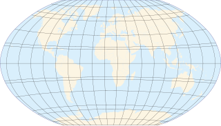
In geography, latitude is a geographic coordinate that specifies the north–south position of a point on the Earth's surface. Latitude is an angle which ranges from 0° at the Equator to 90° at the poles. Lines of constant latitude, or parallels, run east–west as circles parallel to the equator. Latitude is used together with longitude to specify the precise location of features on the surface of the Earth. On its own, the term latitude should be taken to be the geodetic latitude as defined below. Briefly, geodetic latitude at a point is the angle formed by the vector perpendicular to the ellipsoidal surface from that point, and the equatorial plane. Also defined are six auxiliary latitudes that are used in special applications.

Aberdeen Proving Ground (APG) is a U.S. Army facility located adjacent to Aberdeen, Harford County, Maryland, United States. Part of the facility is a census-designated place (CDP), which had a population of 3,116 at the 2000 census, and 2,093 as of the 2010 census. More than 7,500 civilians and 5,000 military personnel work at APG.

A circle of latitude or line of latitude on Earth is an abstract east–west small circle connecting all locations around Earth at a given latitude coordinate line.

A grid reference system, also known as grid reference or grid system, is a geographic coordinate system that defines locations in maps using Cartesian coordinates based on a particular map projection. Grid lines on maps illustrate the underlying coordinate system. Such coordinate lines are numbered to provide a unique reference to each location on the map. Grid coordinates are normally eastings and northings.

Miandoab or Qushachay is a city and capital of Miandoab County, West Azerbaijan Province, Iran. At the 2012 census, its population was 135,880, in 38,704 families.
Ford Motor Company operates several proving grounds worldwide, for development and validation testing of new vehicles.

The Laoshan Velodrome is a velodrome that is located in Laoshan, Shijingshan District, Beijing, China. It was built for the 2008 Summer Olympics. The venue was tested during the UCI Track World Cup in December 2007.

Barauli is a town and a notified area in Gopalganj district in the state of Bihar, India.
General Motors operates several proving grounds.
Greenwood Park Mall is a shopping mall located in Greenwood, Indiana. The mall is the hub of the retail and commercial corridor along U.S. Highway 31 on the south side of the Indianapolis Metropolitan Area. As with several other central Indiana shopping centers, Greenwood Park Mall is owned and operated by Simon Property Group.
Stellantis North America, more commonly known as Chrysler, operates proving grounds around North America for development and validation testing of new vehicles.

Lake Onalaska is a reservoir located on the Black River and Mississippi River between Wisconsin, and Minnesota. It is approximately 4 miles (6.4 km) across, and is the widest point on the Mississippi River. Located in La Crosse County in the state of Wisconsin, its latitude and longitude are 43°52′01″N091°18′26″W. The lake is 7,688 acres (31.11 km2) and is shored by the city from which its name came from: Onalaska, Wisconsin. It sits at an altitude of 633 feet and is 43 feet (13 m) deep at its deepest.

Isiolo Airport, also Isiolo International Airport is an airport located in Isiolo, Isiolo County, and Meru County, Kenya.
Kampala Tower, sometimes referred to as the East African Trade Centre, is a proposed building in Kampala, the capital of Uganda and the largest city in that country.
The Baiyang River, also known under a Mongolian name transcribed in Chinese as Namuguolei, is a river in Xinjiang Uighur Autonomous Region of China. It flows through the region's Tacheng Prefecture and the Urho District of Karamay City. The river's total length is estimated at 170 kilometres (110 mi), and the average annual flow at 109 million cubic metres (88,000 acre⋅ft). The river's basin occupies 16,400 square kilometres (6,300 sq mi),

Lower Manair Dam also known as LMD was constructed across the Manair River, at Alugunur village, Thimmapur mandal, Karimnagar District, in the Indian state of Telangana during 1974 to 1985. It provides irrigation to a gross command area of 163,000 hectares.

Adjumani General Hospital, also Adjumani Hospital, is a hospital in Adjumani Town, Adjumani District, in the Northern Region of Uganda. It is a public hospital, owned by the Ugandan Government and is administered by the Uganda Ministry of Health.

Hathua is a census town in Gopalganj district in the Indian states of Bihar.
References
- ↑ http://www.mazda.com/csr/social/domestic/miyoshi.html
- ↑ "Archived copy". Archived from the original on 2016-03-04. Retrieved 2015-01-06.CS1 maint: archived copy as title (link)
- ↑ http://www.mazda.com/about/outline/rd.html
- ↑ http://www.mazda.com/publicity/release/2006/200605/060518.html
- ↑ "Archived copy". Archived from the original on 2007-12-20. Retrieved 2014-12-30.CS1 maint: archived copy as title (link)
- ↑ http://www.mazda.com/csr/social/domestic/hokkaido.html
- ↑ "Archived copy". Archived from the original on 2015-02-24. Retrieved 2013-09-03.CS1 maint: archived copy as title (link)