Ruvuma Region(Mkoa wa Ruvuma in Swahili) is one of Tanzania's 31 administrative regions The region covers a land area of 63,669 km2 (24,583 sq mi). The region is comparable in size to the combined land area of the nation state of Latvia. The region is also bordered to the north by the Morogoro Region, to the northeast by the Lindi Region, to the east by the Mtwara Region,the west by Lake Nyasa with Malawi and to the northwest by the Njombe Region. The regional capital is the municipality of Songea.

Songea is the capital of Ruvuma Region in southwestern Tanzania. It is located along the A19 road. The city has a population of 286,285, and is the seat of the Roman Catholic Archdiocese of Songea. Between 1905 and 1907, the city was a centre of African resistance during the Maji Maji Rebellion in German East Africa. The city is poised to experience significant economic growth in the near future as the Mtwara Corridor opens up in a few years. It is projected to be the sixth fastest growing city on the African continent between 2020 and 2025, with a 5.74% growth.

Lindi Region is one of Tanzania's 31 administrative regions. The region covers an area of 66,040 km2 (25,500 sq mi). The region is comparable in size to the combined land area of the nation state of Sri Lanka. The regional capital is the municipality of Lindi.

Nachingwea is a district in the Lindi Region of Tanzania. The district is bordered to the north by the Ruangwa District, to the east by the Lindi Rural District, to the south-east by the Mtwara Region, and to the south-west by the Ruvuma Region.

Masasi is one of the six districts of the Mtwara Region of Tanzania. It is bordered to the north by the Lindi Region, to the east by the Newala District, to the south by the Ruvuma River and Mozambique and to the west by Nanyumbu District.
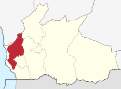
Namtumbo District is one of the five districts of the Ruvuma Region of Tanzania. It is bordered to the north by the Morogoro Region, to the east by the Tunduru District, to the south by Mozambique and to the west by the Songea Urban District and Songea Rural District.

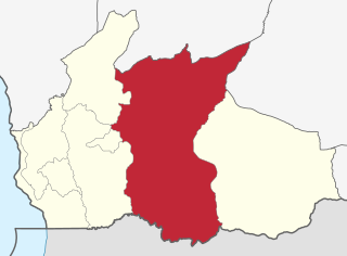
Songea Urban District is one of the five districts in the Ruvuma Region of Tanzania. It is bordered to the north by the Songea Rural District, to the east by the Namtumbo District, to the south by Mozambique and to the west by the Mbinga District.

Songea Rural District is one of five districts in the Ruvuma Region of Tanzania. It is bordered to the north by the Morogoro Region, to the east by the Namtumbo District, to the south by the Songea Urban District, to the west by the Mbinga District and to the Northwest by the Iringa Region.

The following outline is provided as an overview of and topical guide to Tanzania:
Makambako is a medium-sized town and district in the Njombe Region of the Tanzanian Southern Highlands, located roughly 40 miles north of Njombe city by road. It is located at junction of the A104 and B4 roads between Njombe, Iringa, and Mbeya. Its population according to the 2002 Tanzanian census was 51,049.

The Matengo Highlands are located in the western part of the mountainous area of Mbinga District, Ruvuma Region in southern Tanzania. They are home to the Matengo people. Kindimba is the historical center of the highlands. It is located on highland's western side, approximately 15 km west of Mbinga. Its subvillages include Kindimba, Kitanda, Mkanya, Mutugu, Ndembo, Torongi, Walarzi. In 2006, the total Kindimba population was 2440. Other towns and villages include Litembo and Lipumba.

The Mtwara–Mbamba Bay Road, also called the A19 Road, connects the city of Mtwara on the Indian Ocean coast, to the town of Mbamba Bay on the eastern coast of Lake Malawi. It is a busy and important transport corridor in the southern regions of Tanzania. It is also an integral part of the Mtwara Development Corridor that spans four Southern African countries; Malawi, Mozambique, Tanzania and Zambia.
Nyoni is a ward in Mbinga District the Ruvuma Region of the Tanzanian Southern Highlands. It is located along the A19 road.
Mbinga is a town and ward in the Ruvuma Region of southwestern Tanzania. It is located along the A19 road, to the northeast of Ndengo and southwest of Kigonsera.

William Percival Johnson was an Anglican missionary to Nyasaland. After education at Bedford School (1863–1873) and graduation from University College, Oxford, he went to Africa with the Universities' Mission to Central Africa, under the Bishop Edward Steere.

Liuli, formerly known as Sphinx Hafen, is a settlement on the Tanzanian shore of Lake Malawi in the Mbinga District of Ruvuma province. It is notable for being the site of the first naval action of World War I.

The Mtwara Development Project is a major infrastructure development project involving southern Tanzania, northern Mozambique, eastern Malawi and Eastern Zambia. The goal of this project is to provide road, rail and waterway access from the surrounding region to the Port of Mtwara. The region and the corridor has been neglected by the respective governments for over 40 years and the recent discovery of oil, gas and various minerals has kick started the development of the project. A road and rail link is to be built from the port of Mtwara to Mbamba Bay on Lake Nyasa to link Malawi to the corridor and further road links into Mozambique will facilitate access to northern Mozambique.
Makambako Urban District is one of the six districts of the Njombe Region of Tanzania. Its administrative seat is Makambako town. It is bordered to the north and east by Mufindi District, to the south by Njombe Rural District and to the west by Wanging'ombe District.
Kikonge Hydroelectric Power Station project is a proposed 300 MW (400,000 hp) hydroelectric dam in Ruvuma Region, Tanzania.
The Liparamba Game Reserve is a protected area located in Mbinga District, Songea & Nyasa District Districts of Ruvuma Region of Tanzania that covers an area of 571 km2 (220 sq mi). The Liparamba Game Reserve was established by Government Notice Number 289 of the year 2000. Following designation, Mbinga District Council managed it until 2006, when Director of Wildlife at Tanzania Wildlife Management Authority (TAWA) took over its management.