
Kilimanjaro Region is one of Tanzania's 31 administrative regions. The regional capital and largest city is the municipality of Moshi. With the 3rd highest HDI of 0.640 in the country, Kilimanjaro is one among the top five most developed regions of Tanzania. According to the 2012 national census, the region had a population of 1,640,087, which was lower than the pre-census projection of 1,702,207. For 2002–2012, the region's 1.8 percent average annual population growth rate was the 24th highest in the country. It was also the eighth most densely populated region with 124 people per square kilometer. The most well-known tribes in the Kilimanjaro region are the chagga, rombos, and pare.
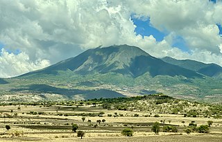
Manyara Region is one of Tanzania's 31 administrative regions. The regional capital is the town of Babati. According to the 2012 national census, the region had a population of 1,425,131, which was lower than the pre-census projection of 1,497,555. For 2002–2012, the region's 3.2 percent average annual population growth rate was tied for the third highest in the country. It was also the 22nd most densely populated region with 32 people per square kilometre.

Babati Rural District is a district of Manyara Region of Tanzania, East Africa. The administrative capital of the district is Babati town, 172 km (107 mi) south of Arusha. The district covers an area of 6,069 km2 (2,343 sq mi), a large proportion (640 km2) of which is covered by the water bodies of Lake Babati, Lake Burunge and Lake Manyara. The district is bordered to the north by Arusha Region, to the south east by Simanjiro District, to the south by Dodoma Region, to the south west by Hanang District, and to the north west by Mbulu District. Babati Urban District is located within the district.

Arusha Region is one of Tanzania's 31 administrative regions and is located in the north of the country. The region's capital and largest city is the city of Arusha. The region is bordered by Kajiado County and Narok County in Kenya to the north, the Kilimanjaro Region to the east, the Manyara and Singida Regions to the south, and the Mara and Simiyu regions to the west. Arusha Region is home to Ngorongoro Conservation Area, a UNESCO World Heritage Site. The region is comparable in size to the combined land and water areas of the state of Maryland in the United States.
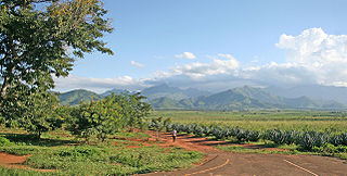
Morogoro Region is one of Tanzania's 31 administrative regions. The region covers an area of 70,624 km2 (27,268 sq mi). The region is comparable in size to the combined land area of the nation state of Ireland. Morogoro Region is bordered to the north by the Manyara Region and Tanga Region, to the east by the Pwani and Lindi Regions, to the south by the Ruvuma Region and to the west by the Iringa Njombe and Dodoma Regions. The regional capital is the municipality of Morogoro. According to the 2022 national census, the region had a population of 3,197,104.

Kahama Urban District is one of the five districts of the Shinyanga Region of Tanzania. Its administrative centre is the town of Kahama. It is bordered to the north and south by Kahama Rural District, to the east by Nzega District and to the west by Bukombe District.
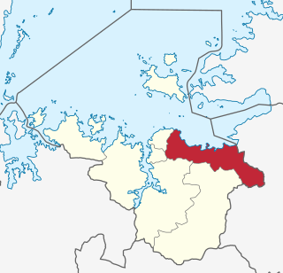
Magu District is one of the seven districts of the Mwanza Region of Tanzania, East Africa. Its administrative centre is the town of Magu on the Simiyu River. It is bordered to the north by Lake Victoria and Busega District, to the east by Bariadi District, to the south by Itilima District, Maswa District, Kwimba District and Misungwi District, and to the west by the city of Mwanza, which consists of Nyamagana District and Ilemela District.

Tarime District is one of the seven districts of the Mara Region of Tanzania, East Africa. It was previously known as the "North Mara District". Its district capital is Tarime town. It is bordered from the north to east by the Kenyan districts of Migori, Trans Mara and Kuria East and West Districts, and to the east by the Maasai Mara game reserve. To the south it is bordered across the Mara River by the Serengeti and Butiama districts, and to the west by Rorya District.

Karatu District is one of seven districts of the Arusha Region of Tanzania. The district is bordered to the north by the Ngorongoro District and to the west by the Meatu District in the Simiyu Region. The district is bordered to the east by the Monduli District, and to the south and southeast by the Mbulu District and the Babati District. The district covers an area of 3,207 km2 (1,238 sq mi). The district is comparable in size to the land area of Samoa. The district has an max elevation of 1,739 m (5,705 ft) on Oldeani Peak. Karatu district is home to the hunter-gatherer community of the Hadza people. Also Karatu is known agriculturally as the onion capital of Tanzania. The district capital is the town of Karatu. According to the 2022 census, the population of the district was 280,454.

Iringa Rural District is one of the four districts of the Iringa Region of Tanzania, East Africa. It is bordered to the north by the Dodoma Region, to the east by Kilolo District and encircles Iringa Urban District, to the south by the Mufindi District, to the southwest by the Mbeya Region and to the northwest by the Singida Region.

Morogoro Rural District is one of the six districts of the Morogoro Region of Tanzania. Morogoro Rural District covers 19,056 square kilometres (7,358 sq mi). It is bordered to the north and east by the Pwani Region, to the south by Kilombero District, to the southwest by the Kilosa District and to the west by the Mvomero District and the Morogoro Urban District.
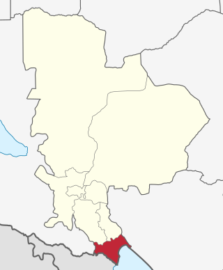
Kyela is one of the seven districts of Mbeya Region, Tanzania. It is bordered to the north by Rungwe District, to the northeast by Njombe Region, to the southeast by Lake Nyasa, to the south by Malawi and to the west by Ileje District.

Hanang District is one of the six districts of the Manyara Region of Tanzania. It is bordered to the north by the Mbulu District and Babati Rural District, to the southeast by the Dodoma Region and to the southwest by the Singida Region. Mount Hanang is located within the boundaries of the district.

Monduli Mjini is an administrative ward and district capital located in the Monduli District of the Arusha Region of Tanzania.The ward is totally surrounded by the Engototo ward. In 2016 the Tanzania National Bureau of Statistics report there were 8,699 people in the ward, from 7,796 in 2012. The average elevation of Monduli Mjini is 1,553m.
Mto wa Mbu is an administrative ward and town in the Monduli district of the Arusha Region of Tanzania. According to the 2012 census, the ward had a total population of 11,405. The name Mto wa Mbu means " The river of Mosquitoes " in the Swahili Language.
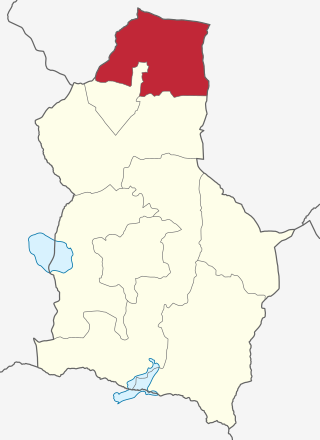
Kondoa District is one of the seven districts of the Dodoma Region of Tanzania. It is bordered to the north by Manyara Region, and to the south by Chemba District. Its district capital is the town of Kondoa.
The Yaeda Valley, or Yaida Valley, is a swampy valley located in Mbulu District of Manyara Region, Tanzania. The Valley is situated south of Lake Eyasi.

The Mbulu Highlands is a plateau in north-central Tanzania.
Haydom is a town and a ward in Mbulu District, in the Manyara Region of Tanzania.
Bitale is an administrative ward in Kigoma District of Kigoma Region in Tanzania. The ward covers an area of 48.2 km2 (18.6 sq mi), and has an average elevation of 1,035 m (3,396 ft). In 2016 the Tanzania National Bureau of Statistics report there were 22,482 people in the ward, from 20,425 in 2012.


