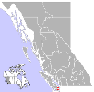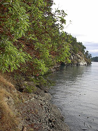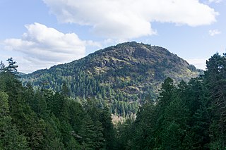
Mayne Island is a 21-square-kilometre (8.1 sq mi) island in the southern Gulf Islands chain of British Columbia. It is midway between the Lower Mainland of BC and Vancouver Island, and has a population of 995. Mount Parke in the south-central heart of the island is its highest peak at 255 metres.
The District of Highlands is a district municipality near Victoria, British Columbia, Canada. As one of the Western Communities, or West Shore municipalities, outside Victoria, Highlands has a population of 2,225 as of 2016. The region stretches along the Saanich Inlet shoreline from north of Goldstream to Mackenzie Bight. Highlands is one of the more undeveloped areas of the Greater Victoria region; it is one of the newest Greater Victoria municipalities created within the Capital Regional District.

Brentwood Bay is a small village in the municipality of Central Saanich, on the Saanich Peninsula in British Columbia, Canada. It lies north of the city of Victoria, east of the community of Willis Point, and south of the town of Sidney.

Collinson Point Provincial Park is a provincial park on Galiano Island, British Columbia, Canada. It is located between Mount Galiano and the western approaches to Active Pass. The area is 24 hectares, with c. 500 metres of waterfront.

Gowlland Tod Provincial Park is a provincial park in British Columbia, Canada. The park protects 1,219 hectares of mixed forest of Douglas-fir, Arbutus, western redcedar, western hemlock, shore pine, grand fir, red alder, and Garry oak within the District Municipality of Highlands and the Juan de Fuca Electoral Area. Rocky outcroppings support Manzanita, Scotch broom, and Oregon grape. The peaks of the Gowlland Range, from which the park derives its name, loom over 400 m (1,300 ft) above Saanich Inlet, providing vistas of The Malahat to the west. Farther north, the park curves around inland, bounded to the north by the municipality of Central Saanich. The park also encompasses the rural community of Willis Point. There are 25 km (16 mi) of maintained trails within the park, accessible in the south from roads leading to the park from Highlands, as well as from trails alongside Tod Inlet and McKenzie Bight to the north. Trails connect to Mount Work Regional Park and Lone Tree Hill Regional Park.
Saanich Peninsula is located north of Victoria, British Columbia, Canada. It is bounded by Saanich Inlet on the west, Satellite Channel on the north, the small Colburne Passage on the northeast, and Haro Strait on the east. The exact southern boundary of what is referred to as the "Saanich Peninsula" is somewhat fluid in local parlance.
Otter Point is a rural forestry district between other rural district of Shirley and town of Sooke.

Moresby Island is one of the Gulf Islands of British Columbia, located on the west side of Swanson Channel and east of the southern end of Saltspring Island. It is not to be confused with Moresby Island, the second largest of the Haida Gwaii Islands off the north coast of BC. It is currently a privately owned island, and is used by its current owners to raise beef cattle. The island is not open to the general public. Its current population is 2 people, a manager and his wife.

Saanich Inlet is a body of salt water that lies between the Saanich Peninsula and the Malahat highlands of Vancouver Island, British Columbia, Canada. Located just northwest of Victoria, the inlet is 25 km (16 mi) long, has a surface area of 67 km2 (26 sq mi), and its maximum depth is 226 m (741 ft). It extends from Satellite Channel in the north to Squally Reach and Finlayson Arm in the south. The only major tributary feeding the inlet is the Goldstream River.

The Vancouver Island Ranges, formerly called the Vancouver Island Mountains, are a series of mountain ranges extending along the length of Vancouver Island which has an area of 31,788 km2 (12,273 sq mi). The Vancouver Island Ranges comprise the central and largest part of the island. The Geological Survey of Canada refers to Vancouver Island, Haida Gwaii, and the Alaska Panhandle as the Insular Belt including the sea floor out to 100 km (62 mi) west of Vancouver Island. The Vancouver Island Ranges are a sub-range of the Insular Mountains.

Gordon Head is a seaside neighbourhood in the municipality of Saanich in Greater Victoria, British Columbia, Canada. Gordon Head lies north of McKenzie Avenue and east of the Blenkinsop Valley. The University of Victoria is located partly within Gordon Head along the southeast boundary. Finnerty Road separates Gordon Head from the adjacent neighbourhood of Cadboro Bay. The local area is dominated physically by Mount Douglas, a coastline along Haro Strait, and the central plateau.

Victoria Harbour is a harbour, seaport, and seaplane airport in the Canadian city of Victoria, British Columbia. It serves as a cruise ship and ferry destination for tourists and visitors to the city and Vancouver Island. It is both a port of entry and an airport of entry for general aviation. Historically it was a shipbuilding and commercial fishing centre. While the Inner Harbour is fully within the City of Victoria, separating the city's downtown on its east side from the Victoria West neighbourhood, the Upper Harbour serves as the boundary between the City of Victoria and the district municipality of Esquimalt. The inner reaches are also bordered by the district of Saanich and the town of View Royal. Victoria is a federal "public harbour" as defined by Transport Canada. Several port facilities in the harbour are overseen and developed by the Greater Victoria Harbour Authority, however the harbour master's position is with Transport Canada.
The Hartland landfill is the waste disposal site for the city of Victoria, British Columbia and the Greater Victoria area. The landfill began operating in the early 1950's under private ownership and management. Phase 1 of the landfill reached capacity in 1996, Phase 2 filled in Heal Lake which was drained and was 2.5-hectares. The landfill was later purchased by the Capital Regional District in 1975 and has been directly operated by its Environmental Sustainability Department since 1985. The landfill, located in the District of Saanich on the southern slope of Mount Work, between Victoria and Sidney, at the end of Hartland Avenue is adjacent to Mount Work Regional Park to the west and the Department of National Defence rifle range is located across Willis Point Road to the northeast. To the east and southeast of the site are residential properties. Undeveloped CRD property lies to the west and south of the landfill site and is now being used by CRD Parks as a mountain bike recreation area under a land use agreement. Private residential properties exist to the east and southeast of the landfill.
Robson Bight is a small Vancouver Island bay at the west end of Johnstone Strait across from West Cracroft Island in British Columbia, Canada that includes a protected killer whale habitat famous for its whale-rubbing beaches. The bight is adjacent to Lower Tsitika River Provincial Park. The nearest access point is Telegraph Cove on the east coast of Northern Vancouver Island.

Mount Finlayson is a 419-metre (1,375 ft) mountain located on the border of Highlands and Langford, British Columbia, about 14 km northwest of Victoria.

Portland Island is an island of the Southern Gulf Islands of the South Coast of British Columbia, Canada. It is located in the Salish Sea west of Moresby Island and off the south tip of Saltspring Island, adjacent to the main BC Ferries route just offshore from the terminal at Swartz Bay at the tip of the Saanich Peninsula. It was named after HMS Portland, the flagship of Rear-Admiral Fairfax Moresby, Commander in Chief of the Pacific Station 1850–1853.

Salt Point State Marine Conservation Area (SMCA) is a marine protected area that lies onshore from Fisk Mill Cove and south along Salt Point State Park in Sonoma County on California’s north central coast. The marine protected area covers 3.12 square miles. Salt Point SMCA prohibits the take of all living marine resources, except the recreational take of abalone and finfish.
Mount Work is a 449 m (1,473 ft) mountain in the Gowlland Range on southern Vancouver Island. It is located within Mount Work Regional Park in the District of Highlands, near Gowlland Tod Provincial Park and Goldstream Provincial Park, 14 km (9 mi) northwest of Victoria, being the highest mountain of the range.

The Sea to Sea Green Blue Belt is a 62 kilometre long greenbelt surrounding the Greater Victoria metropolitan area in Canada. The greenbelt includes green space, forests, farms, and wetlands stretching from Sooke to Salt Spring Island. It also includes the "blue spaces" of Sooke Basin and Saanich Inlet.

Willis Point is a small, rural community in the Canadian province of British Columbia, located in the Juan de Fuca Electoral Area within the Capital Regional District and Greater Victoria. It is located on the Saanich Peninsula and faces north toward the Saanich Inlet. The community is bounded by the District of Highlands to the south, the District of Saanich to the southeast and the District of Central Saanich to the east. It is located west of the village of Brentwood Bay and north of the city of Victoria.


