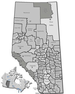
Strathcona County is a specialized municipality in central Alberta, Canada between Edmonton and Elk Island National Park.

The County of Grande Prairie No. 1 is a municipal district in northwestern Alberta, Canada in Census Division No. 19.

Beaumont is a city in Leduc County within the Edmonton Metropolitan Region of Alberta, Canada. It is located at the intersection of Highway 625 and Highway 814, adjacent to the City of Edmonton and 6.0 kilometres (3.7 mi) northeast of the City of Leduc. The Nisku Industrial Park and the Edmonton International Airport are located 4.0 kilometres (2.5 mi) to the west and 8.0 kilometres (5.0 mi) to the southwest respectively.

The Municipal District of Taber is a municipal district in southern Alberta, Canada. It is located in Census Division 2.

Aldersyde is a hamlet in Alberta, Canada within the Municipal District of Foothills No. 31. Located between Highway 2 and Highway 2A south of Highway 7, the hamlet is approximately 8 kilometres (5.0 mi) southeast of Okotoks, 10 kilometres (6.2 mi) north of High River and 25 kilometres (16 mi) south of Calgary. A Canadian Pacific Railway line runs through the hamlet.

The County of Vermilion River is a municipal district located in the eastern part of central Alberta, Canada in Census Division #10. The municipal district was formerly named the County of Vermilion River No. 24 prior to an official name change that became effective on September 13, 2006.

Yellowhead County is a municipal district in west central Alberta, Canada.

Dalemead is a hamlet in southern Alberta under the jurisdiction of Rocky View County.

Cardston County is a municipal district in southern Alberta, Canada. It is located in Census Division 3 around the Town of Cardston.

Lacombe County is a municipal district in central Alberta, Canada, located in Census Division No. 8 north of the City of Red Deer. Its municipal office is 4 km (2.5 mi) west of Highway 2 and the City of Lacombe, and 6 km (3.7 mi) east of the Summer Village of Gull Lake, at the intersection of Highway 12 and Spruceville Road.

Mackenzie County is a specialized municipality in northern Alberta, Canada. It is located in Census Division 17, along the Mackenzie Highway. Incorporated as a municipal district in 1995 from the former Improvement District No. 23., its status was changed to specialized municipality in 1999 to address the particularities of managing such a large territory, which is 10% larger than New Brunswick. Mackenzie County municipal office is located in the Hamlet of Fort Vermilion. The name was changed from the Municipal District of Mackenzie No. 23 to Mackenzie County in 2007.

The Municipal District of Willow Creek No. 26 is a municipal district in southern Alberta, Canada. Located in Census Division No. 3, its municipal office is located adjacent to Claresholm Industrial Airport, west of the Town of Claresholm.

Wandering River is a hamlet in Alberta, Canada within Athabasca County. It is located approximately 95 kilometres (59 mi) north of Athabasca and 200 kilometres (120 mi) south of Fort McMurray on Highway 63.

Breynat is a hamlet in northern Alberta in Athabasca County, located 1 kilometre (0.62 mi) west of Highway 63, 189 kilometres (117 mi) northeast of Edmonton.

Caslan is a hamlet in central Alberta in Athabasca County, located 21 kilometres (13 mi) south of Highway 55, 152 kilometres (94 mi) west of Cold Lake. The first baby in the area was born in 1921.


