Doel is a subdivision of the municipality of Beveren in the Flemish province of East Flanders in Belgium. It is located near the river the Scheldt, in a polder of the Waasland. Since 1965, there have been plans to extend the Port of Antwerp into Doel and demolish the village. However, protests have caused a stalemate. On 30 March 2022, a deal was reached and the village is allowed to exist.

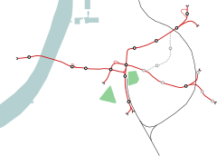
The Antwerp Premetro is a network consisting of lines 2, 3, 5, 6, 8, 9, 10 and 15 of the Antwerp Tram system. It is a metre gauge system which runs underground in the city centre and further out on surface lines, which are mostly separated from motor vehicle traffic. The network is operated by De Lijn.
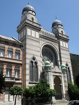
The Hollandse Synagoge, officially the Synagogue Shomré Hadas, and also known as the Bouwmeester Synagoge, is an Orthodox Jewish congregation and synagogue, located on Bouwmeestersstraat 7, in Antwerp, Belgium. Whilst the first Jews arrived in Antwerp in the 14th century, the congregation was not officially established until 1816. Descendants of Jews who came to Antwerp from the Netherlands in the early 19th century, built the synagogue in 1893 and it was the first large synagogue in Antwerp.

The Antwerp premetro tram route 3 is a tram route connecting Merksem with Melsele in the city of Antwerp. The route is operated by the Flemish transport company De Lijn and historically also by its Antwerp predecessor, MIVA.

Beerzel is a Belgian village in Antwerp Province and a deelgemeente of the municipality Putte. Beerzel was a municipality until 1977, at which time it had an area of 7.83 square kilometres (3.02 sq mi) with 4,971 inhabitants in 1995. At 51.6 metres (169 ft), Antwerp's highest point—the Beerzelberg—is located in Beerzel.

Hingene is a village and deelgemeente (sub-municipality) of the municipality of Bornem in the province of Antwerp, Belgium. The village is bordered to the north by the Scheldt and to the east by the Rupel. It is located about 16 kilometres (9.9 mi) south-west of the city of Antwerp.
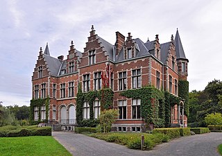
Oelegem is a village and deelgemeente (sub-municipality) of the municipality of Ranst in the province of Antwerp, Belgium. The village is located about 14 kilometres (8.7 mi) east of the city of Antwerp.
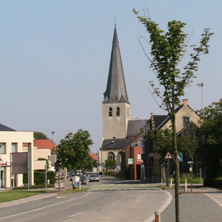
Vrasene is a village in the municipality of Beveren in the Belgian province of East Flanders. It is located about 15 kilometres (9.3 mi) west of Antwerp.

Haasdonk is a village and deelgemeente (sub-municipality) of Beveren in East Flanders, Belgium. Haasdonk was an independent municipality until 1 January 1977, when it merged with Beveren as part of the fusion of municipalities in Belgium. It is located about 12 kilometres (7.5 mi) west of Antwerp.

Waarloos is a village and deelgemeente (sub-municipality) of the municipality of Kontich in the province of Antwerp, Belgium. The village is located about 13 kilometres (8.1 mi) south of the city of Antwerp.

Liezele is a village and deelgemeente (sub-municipality) of the municipality of Puurs-Sint-Amands in the province of Antwerp, Belgium. The village is located about 20 kilometres (12 mi) south-south-west of the city of Antwerp. On the night of 4 to 5 September 1914, the entire village was destroyed by the Belgian Army to deny the Germany Army cover.

The Botanic Garden of Antwerp, which also carries the name Den Botaniek, is a landscaped botanical garden created in 1825 in the inner city of Antwerp located at the Leopoldstraat, covering an area of slightly less than 1 hectare. Before that the park was, at the end of the 18th century, a plant garden for the Ecole Centrale and then the herb garden and later the vegetable garden of the Sint-Elisabethgasthuis in Antwerp.

Opera is a station in the Antwerp premetro network, lying under the Leien near the Teniersplaats in the city centre. The station was opened on 25 March 1975 along with the initial opening of the Antwerp premetro network. The station was temporarily closed in 2016 in order to undergo a full renovation and expansion and reopened in its current form on 8 December 2019. The station lies in the immediate proximity of the Antwerp opera building and is a part of the central east-west premetro axis. It is served by the tram routes 3, 5, 9, 10 and 15.

Sport is an underground station in the Antwerp premetro network. The station was opened on April 1, 1996 as the last station on the northern premetro axis. At present, the station is served by tram routes 2, 3 and 6. Tram route 5 also passes through the northern premetro axis, but leaves the premetro tunnel via the Ten Eekhovelei exit between Schijnpoort and Sport. It does not stop at the Sport station, but has a stop called "Sportpaleis" at the Ten Eekhovelei.

Tram route 9 is a route in the Antwerp tram network connecting the Eksterlaar neighborhood in southern Deurne with Linkeroever using the Antwerp premetro network between Plantin and Van Eeden stations. The present day route was officially opened on September 1, 2012, as part of a revision of the network map.

The Antwerp Jazz Club is an association in Antwerp, Belgium, founded in 1938 by Hans Philippi, which delivers weekly lectures about and presentations of jazz music, at no cost, open to the public at large. Its sessions are held in Dutch. Other than these sessions, the club organizes concerts, including helping to organize blues concerts; and has aided in the screenings of jazz documentaries.
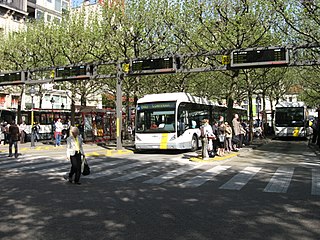
The Franklin Rooseveltplaats is a large square in the city of Antwerp, Belgium, placed at the crossing of the Leien and Turnhoutsebaan, and within walking distance of the Koningin Astridplein and Antwerp-Central station. The square functions primarily as the main bus station in Antwerp, which with its 28 platforms handles a large part of all bus transport in the city, as well as several tram routes.

The Art Nouveau movement of architecture and design appeared in Antwerp, Belgium, between roughly 1898 and the start of the First World War in 1914. It was principally practiced by the architects Joseph Bascourt, Jacques De Weerdt, Jules Hofman, Émile Van Averbeke, Émile Thielens, Frans Smet-Verhas as well as August Cols and Alfried Defever. Its principal characteristics in Antwerp buildings include whiplash lines and irregular curves in moldings, ironwork, and incised decoration; gentle arches; colorful ceramic tiles, mosaics, and stained glass; gilded asymmetrical ornament; sgraffito; and keyhole windows and screens.
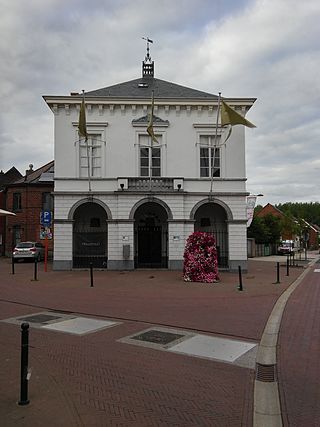
Ruisbroek is a village in the municipality of Puurs-Sint-Amands located in the Antwerp Province of Belgium.

Tongerlo is a village and deelgemeente (sub-municipality) of the municipality of Westerlo in the province of Antwerp, Belgium. The village is located about 10 kilometres (6.2 mi) south-east of the city of Herentals. Tongerlo is best known for Tongerlo Abbey founded in 1128 which became one of the most important abbeys of Belgium.

