Meladhanur

Last updated

Meladhanur is a village located in Tittakudi taluk, Cuddalore district in the state of Tamil Nadu, India. [1] Tittakudi is the nearest town for this village and the Trichy to Chennai highway (NH45) is the nearest one.

Titakudi taluk is a taluk of Cuddalore district of the Indian state of Tamil Nadu. The headquarters of the taluk is the town of Tittakudi.

Cuddalore district District in Tamil Nadu, India

Cuddalore District is one of the districts of the south Indian state of Tamil Nadu. The city of Cuddalore is the district headquarters. According to the 2011 Census, Cuddalore district had a population of 2,605,914 with a sex-ratio of 987 females for every 1,000 males.

Tamil Nadu State in Southern India

Tamil Nadu, formerly Madras State, is one of the 29 states of India. Its capital and largest city is Chennai. Tamil Nadu lies in the southernmost part of the Indian subcontinent and is bordered by the union territory of Puducherry and the South Indian states of Kerala, Karnataka, and Andhra Pradesh. It is bounded by the Eastern Ghats on the north, by the Nilgiri Mountains, the Meghamalai Hills, and Kerala on the west, by the Bay of Bengal in the east, by the Gulf of Mannar and the Palk Strait on the southeast, and by the Indian Ocean on the south. The state shares a maritime border with the nation of Sri Lanka.

Demographics

In 2011, the population was 1,015 people with 518 males and 497 females. [2]

The village is located near Wellington Lake and it has a PUM School and Perumal, Vinayagar, Mariamman and Aiyanar temples. Most of the population being farmers.

Wellington Lake is a lake situated in the Keelachiruvoi Village, Tittakudi taluk of the Cuddalore district in the Indian state of Tamil Nadu. It is the second-largest lake in Tamil Nadu after the Veeranam Lake, which also is situated in the Cuddalore district.

Mariamman Hindu goddess of rain; worshipped as a mother goddess mainly in Tamil Nadu and surrounding states

Māri, also known as Mariamman and Mariaai, both meaning "Mother Mari", spelt also Maariamma, or simply Amman or Aatha is a Hindu goddess of rain especially popular in Tamil Nadu and surrounding regions. She is the main mother goddess predominant in the rural areas of Tamil Nadu and Thirucherai. Māri is closely associated with the Hindu goddesses Parvati and Durga as well as with her northern counterpart Shitala devi. The goddess Mariamman is considered by many to be the incarnation of Goddess Kali. It is said that when Kali went to southern India as Mariamman, Bhairava followed her as Madurai Veeran. Her festivals are held during the late summer/early autumn season of "Aadi". Throughout the Tamil Nadu and deccan region, grand festival known as "Aadi Thiruvizha" are taken for Maariamman. Her worship mainly focuses on bringing rains and curing diseases like cholera, smallpox, and chicken pox.

Aiyanar God

Ayyanar, Sastha or Saththan is a Hindu deity particularly praised in South India and Sri Lanka. His worship is prevalent among Tamils, Malayalis and Sinhalese. Some studies suggest that Ayyanar may have also been worshipped in South east Asian countries in the past. He is primarily worshiped as one of the guardian folk deities of Tamil Nadu. The village temples of Ayyanar are usually flanked by gigantic and colorful statues of him and his companions riding horses or elephants. The well known shrine at Sabarimala is actually a Sastha temple though its main deity Ayyappan has now developed distinctly from Ayyanar.

Related Research Articles

Panruti developing city in Tamil Nadu, India

Panruti is a developing city, municipality and taluk headquarters of Cuddalore district, Tamil Nadu, India. Panruti is located between Cuddalore and Neyveli. Panruti is famous for jackfruit and cashews. The jackfruit grown here is exported worldwide and is very sweet. It is a business center of Cuddalore district. Kananchavadi one of the village in panruti taluk,famous for palm juice(கள்ளு).It has been a great commercial area for more than 200 years. The name Panruti came from the Tamil words Pann(பண்) and Urutti (உருட்டி) meaning composing song and music, as the place is where many saints and great religious singers such as nayanmars and vainavas sung. A 150-year-old government school was built here by the British East India Company and a more-than-1000-year-old temple Veeratteswarar temple is nearby in Thiruvathigai. As of 2011, the town had a population of 60,323.

Neyveli Township in Tamil Nadu, India

Neyveli is a township in Cuddalore district in the Indian state of Tamil Nadu. It is located 62 kilometres (39 mi) inland from Bay of Bengal, west of Pondicherry and 197 kilometres (122 mi) south of Chennai. The town was developed in 1956 after the establishment of Neyveli Lignite Corporation, a public sector enterprise.

Thiyagadurgam is a panchayat town in kallakurichi district in the Indian state of Tamil Nadu.

Tindivanam Town in Tamil Nadu, India

Tindivanam is a town and a municipality in Viluppuram district in the Indian state of Tamil Nadu. Its second largest town in villupuram District after headquarters town Villupuram. Important roads from north to south Tamil Nadu pass through Tindivanam and similarly from west to east.

Valavanur town in Tamil Nadu, India

Valavanur is a panchayat town in Viluppuram district in the Indian state of Tamil Nadu. It is situated near to the Tamil Nadu–Puducherry border on NH 45A.

Virudhachalam Railway Town in Tamil Nadu, India

Viruddhachalam is a railway town and taluk headquarters in Cuddalore district in the Indian state of Tamil Nadu. The ancient name of this town is Thirumudhukundram. As of 2011, the town had a population of 73,585.
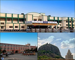
Viluppuram Town in Tamil Nadu, India

Viluppuram(pronunciation ) is a Municipality and the administrative headquarters of Viluppuram district, the largest district in the state of Tamil Nadu, India.

Cuddalore (Lok Sabha constituency) Lok Sabha Constituency in Tamil Nadu

Cuddalore is a Lok Sabha constituency in Tamil Nadu.

Panruti is the legislative assembly in Cuddalore district, which includes the city, Panruti. It is part of the Cuddalore. This constituency is notable for Mr. Panruti Ramachandran or Panruttiar, who was elected to this constituency 6 times, under 3 different parties, DMK, AIADMK and PMK. Elections were not held in year 1957 and 1962.

Kurinjipadi is the legislative assembly in Cuddalore district, which includes the city, Kurinjipadi. It is part of the Cuddalore. Before 1977, Kurinjipadi constituency was reserved for scheduled caste.

Bhuvanagiri is the legislative assembly in Cuddalore district, which includes the city, Bhuvanagiri, Tamil Nadu. It is part of the Chidambaram.

Kattumannarkoil is the legislative assembly in Cuddalore district, which includes the city, Kattumannarkoil. It is part of the Chidambaram.

Vridhachalam is a legislative assembly constituency in Cuddalore district in the Indian state of Tamil Nadu. Before 2009, it was part of the Chidambaram. After 2009, it is part of Cuddalore. This constituent was won by popular actor Vijaykanth, during the 2006 Assembly election, under his new party Desiya Murpokku Dravida Kazhagam.

Cuddalore taluk is a taluk of Cuddalore district of the Indian state of Tamil Nadu. The headquarters of the taluk is the town of Cuddalore.

Cuddalore block is a revenue block of Cuddalore district of the Indian state of Tamil Nadu. This revenue block consist of 51 panchayat villages.

Avinangudi

Avinangudi is a village panchayat located in the Cuddalore district of Tamil-Nadu state,India. The latitude of Avinangudi is 11.3851707 and its longitude is 79.1606569. Chennai is the state capital for Avinangudi village. It is located around 226.3 kilometer away from Avinangudi. The nearest state capital from Avinangudi is Pondicherry and its distance is 95.5 km. The other surrouning state capitals are Pondicherry 95.5 km., Bangalore 247.6 km., Thiruvananthapuram 392.3 km.,it have an social organisation called united states of friendship.

References

  1. Microsoft; Nokia (12 March 2017). "Meladhanur" (Map). Bing Maps . Microsoft. Retrieved 12 March 2017.
  2. "Meladhanur Population - Cuddalore, Tamil Nadu". censusindia.gov.in. Retrieved 11 March 2017.

Coordinates: 11°27′45″N79°06′03″E / 11.4624623°N 79.1007502°E / 11.4624623; 79.1007502

Geographic coordinate system Coordinate system

A geographic coordinate system is a coordinate system that enables every location on Earth to be specified by a set of numbers, letters or symbols. The coordinates are often chosen such that one of the numbers represents a vertical position and two or three of the numbers represent a horizontal position; alternatively, a geographic position may be expressed in a combined three-dimensional Cartesian vector. A common choice of coordinates is latitude, longitude and elevation. To specify a location on a plane requires a map projection.