Scouting in the U.S. state of Oregon includes the Boy Scouts of America (BSA) and Girl Scouts (GSUSA) youth organizations, as well as newer organizations like the Baden-Powell Service Association.

Lake Washington is a large freshwater lake adjacent to the city of Seattle. It is the largest lake in King County and the second largest natural lake in the state of Washington, after Lake Chelan. It borders the cities of Seattle on the west, Bellevue and Kirkland on the east, Renton on the south and Kenmore on the north, and encloses Mercer Island. The lake is fed by the Sammamish River at its north end and the Cedar River at its south.

Rocky Mountain National Park is an American national park located approximately 76 mi (122 km) northwest of Denver International Airport in north-central Colorado, within the Front Range of the Rocky Mountains. The park is situated between the towns of Estes Park to the east and Grand Lake to the west. The eastern and western slopes of the Continental Divide run directly through the center of the park with the headwaters of the Colorado River located in the park's northwestern region. The main features of the park include mountains, alpine lakes and a wide variety of wildlife within various climates and environments, from wooded forests to mountain tundra.

McArthur–Burney Falls Memorial State Park is the second oldest state park in the California State Parks system, located approximately 6 miles (9.7 km) north of Burney, California. The park offers camping, fishing, watersports, hiking and horseback riding facilities. The park is mainly known for the waterfall, Burney Falls, at the entrance of the park. Wildlife in the park includes bass, trout, Steller's jay, squirrels, woodpeckers, deer, and on rare occasion, black bear.

Alpental, named after the German word for alpine valley, is both a valley in eastern King County, Washington, United States and a ski area in the valley. The valley is about 50 miles (80 km) east of Seattle, Washington and is north of Snoqualmie Pass, in the Washington Cascades. It is a popular outdoor recreation destination in both the summer and winter. The ski area is one of four areas which make up The Summit at Snoqualmie.

Uncompahgre Peak is the sixth highest summit of the Rocky Mountains of North America and the U.S. state of Colorado. The prominent 14,321-foot (4365.0 m) fourteener is the highest summit of the San Juan Mountains and the highest point in the drainage basin of the Colorado River and the Gulf of California. It is located in the Uncompahgre Wilderness in the northern San Juans, in northern Hinsdale County approximately 7 miles (11 km) west of the town of Lake City.

Snowmass Mountain is a fourteen thousand foot tall mountain in the U.S. state of Colorado, and is the thirty-fourth highest mountain peak in the state. Located in the Elk Mountains, within the Maroon Bells-Snowmass Wilderness of the White River National Forest, it lies along the border between the Pitkin and Gunnison counties, west of Aspen and southwest of the town of Snowmass Village.
Blanca Lake is located in the Henry M. Jackson Wilderness Area in the Cascade Mountains of the U.S. state of Washington.

Ross Lake National Recreation Area is a US National Recreation Area located in north central Washington just south of the Canada–US border. It is the most accessible part of the North Cascades National Park Complex which also includes North Cascades National Park and Lake Chelan National Recreation Area. Ross Lake NRA follows the Skagit River corridor from the Canada–US border to the western foothills of the Cascades. The NRA contains a portion of scenic Washington State Route 20, the North Cascades Highway, and includes three reservoirs: 12,000-acre (4,900 ha) Ross Lake, 910-acre (370 ha) Diablo Lake, and 210-acre (85 ha) Gorge Lake. These reservoirs make up the Skagit Hydroelectric Project operated by Seattle City Light. Nestled in the "American Alps" the Ross Lake NRA bisects the north and south units of North Cascades National Park.

The Alpine Lakes Wilderness is a large wilderness area spanning the Central Cascades of Washington state in the United States. The wilderness is located in parts of Wenatchee National Forest and Snoqualmie National Forest, and is approximately bounded by Interstate 90 and Snoqualmie Pass to the south and U.S. Route 2 and Stevens Pass to the north. The Alpine Lakes is the largest wilderness area near the population centers of Puget Sound, counted at 414,161 acres (167,605 ha) following the 2014 expansion.

The Stehekin River is a river located in Washington state in the Pacific Northwest of the United States. It is the main river flowing into Lake Chelan. Miners arrived in Stehekin River Valley in the late 19th century. They were followed by homesteaders in the early 20th century. Today, the Stehekin River Valley is still a remote area that can only be reached by way of a 55-mile boat ride up Lake Chelan.
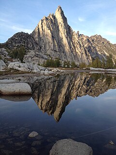
The Enchantments is an area comprising an upper and a lower basin, the lakes and tarns contained within them, and the peaks of the Stuart Range bounding the basins. The area is located entirely within the Alpine Lakes Wilderness about 15 miles (24 km) southwest of Leavenworth, Washington in the United States. The Enchantments is regarded as one of the most spectacular locations in the Cascade Range.

The Napeequa River is a 19-mile (31 km) long river in the U.S. state of Washington on the east side of the Cascade Range. It rises in northwest Chelan County and flows southwest into the White River near Twin Lakes. The White River flows into Lake Wenatchee. The Napeequa River and its valley are notable for their beauty and isolation, as well as their interesting geological history. It flows through an isolated southeast-trending valley characterized by a broad meadows surrounded by rugged mountains. The Chiwawa Mountains, or Chiwawa Ridge mark the east side of the valley, separating the Napeequa and Chiwawa Rivers. To the west the White Mountains separate the Napeequa from the White River. Both are sub-ranges of the Cascade Range.

Skihist Mountain, also sometimes referred to as Skihist Peak, is the highest mountain in the Cantilever Range and in southwestern British Columbia, Canada. It is located on the southern boundary of Stein Valley Nlaka'pamux Heritage Park, about 20 km (12 mi) west of Lytton. It is the highest summit in the Lillooet Ranges, which lie between the Lillooet and Fraser Rivers, south of the Gates Valley and Seton and Anderson Lakes.

Pyramid Mountain is located high above Lake Crescent's north shore. Once known as Sugarloaf Mountain, it received its present name in 1928. It contains the ruins of an old fire lookout at the summit. It dominates the view from Barnes Point and Lake Crescent Lodge. It is accessible by trail from the Spruce Railroad Trail. On a clear day, Mount Baker is visible in the Cascade Range across the Puget Sound.

The Pratt River is a river in King County in Washington. It is a tributary of the Middle Fork Snoqualmie River. It was named for prospector George A Pratt, who discovered nearby iron deposits in 1887.

Hayden Valley is a large, sub-alpine valley in Yellowstone National Park straddling the Yellowstone River between Yellowstone Falls and Yellowstone Lake. The valley floor along the river is an ancient lake bed from a time when Yellowstone Lake was much larger. The valley is well known as one of the best locations to view wildlife in Yellowstone.

Salt Creek Falls is a cascade and plunge waterfall on Salt Creek, a tributary of the Middle Fork Willamette River, that plunges into a gaping canyon near Willamette Pass in the Willamette National Forest, near Oakridge, Oregon. The waterfall is notable for its main drop of 286 feet (87 m) which makes it the third highest plunge waterfall in Oregon after Multnomah Falls and Watson Falls the second highest, which was re-measured in 2009 and found to be 293 feet rather than an earlier measurement of 272 feet passing Salt Creek Falls. The pool at the bottom of the waterfall is 20 metres (66 ft) deep.

The High Sierra Camps are nine rustic lodging facilities located in two national parks and a national monument in California's Sierra Nevada mountain range. Open most years from June or July to September, they are staffed camps with tent cabins and food service facilities. The backcountry camps receive their supplies by pack mules.

Mount Sniktau is a high mountain summit in the Front Range of the Rocky Mountains of North America. The 13,240-foot (4,036 m) thirteener is located in Arapaho National Forest, 1.6 miles (2.5 km) northeast of Loveland Pass in Clear Creek County, Colorado, United States.
