Śladków Górny is a village in the administrative district of Gmina Zgierz, within Zgierz County, Łódź Voivodeship, in central Poland. It lies approximately 17 kilometres (11 mi) north of Zgierz and 25 km (16 mi) north of the regional capital Łódź.
Białe is a village in the administrative district of Gmina Gostynin, within Gostynin County, Masovian Voivodeship, in east-central Poland.
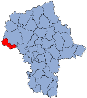
Białotarsk is a village in the administrative district of Gmina Gostynin, within Gostynin County, Masovian Voivodeship, in east-central Poland. It lies approximately 11 kilometres (7 mi) west of Gostynin and 118 km (73 mi) west of Warsaw.
Bolesławów is a village in the administrative district of Gmina Gostynin, within Gostynin County, Masovian Voivodeship, in east-central Poland. It lies approximately 6 kilometres (4 mi) north-east of Gostynin and 104 km (65 mi) west of Warsaw.
Huta Zaborowska is a village in the administrative district of Gmina Gostynin, within Gostynin County, Masovian Voivodeship, in east-central Poland.
Jaworek is a village in the administrative district of Gmina Gostynin, within Gostynin County, Masovian Voivodeship, in east-central Poland. It lies approximately 5 kilometres (3 mi) east of Gostynin and 103 km (64 mi) west of Warsaw.
Kiełpieniec is a village in the administrative district of Gmina Gostynin, within Gostynin County, Masovian Voivodeship, in east-central Poland. It lies approximately 7 kilometres (4 mi) south-east of Gostynin and 103 km (64 mi) west of Warsaw.
Leśniewice is a village in the administrative district of Gmina Gostynin, within Gostynin County, Masovian Voivodeship, in east-central Poland. It lies approximately 4 kilometres (2 mi) south of Gostynin and 107 km (66 mi) west of Warsaw.
Łokietnica is a village in the administrative district of Gmina Gostynin, within Gostynin County, Masovian Voivodeship, in east-central Poland. It lies approximately 6 kilometres (4 mi) east of Gostynin and 102 km (63 mi) west of Warsaw.
Marianka is a village in the administrative district of Gmina Gostynin, within Gostynin County, Masovian Voivodeship, in east-central Poland. It lies approximately 10 kilometres (6 mi) north-west of Gostynin and 116 km (72 mi) west of Warsaw.
Nagodów is a village in the administrative district of Gmina Gostynin, within Gostynin County, Masovian Voivodeship, in east-central Poland.
Nowa Jastrzębia is a village in the administrative district of Gmina Gostynin, within Gostynin County, Masovian Voivodeship, in east-central Poland.
Podgórze is a village in the administrative district of Gmina Gostynin, within Gostynin County, Masovian Voivodeship, in east-central Poland. It lies approximately 4 kilometres (2 mi) north-east of Gostynin and 104 km (65 mi) west of Warsaw.
Rogożewek is a village in the administrative district of Gmina Gostynin, within Gostynin County, Masovian Voivodeship, in east-central Poland. It lies approximately 6 kilometres (4 mi) north-east of Gostynin and 105 km (65 mi) west of Warsaw.
Stanisławów is a village in the administrative district of Gmina Gostynin, within Gostynin County, Masovian Voivodeship, in east-central Poland. It lies approximately 5 kilometres (3 mi) south-east of Gostynin and 104 km (65 mi) west of Warsaw.
Stanisławów Skrzański is a village in the administrative district of Gmina Gostynin, within Gostynin County, Masovian Voivodeship, in east-central Poland. It lies approximately 5 kilometres (3 mi) south-east of Gostynin and 104 km (65 mi) west of Warsaw.
Stefanów is a village in the administrative district of Gmina Gostynin, within Gostynin County, Masovian Voivodeship, in east-central Poland. It lies approximately 7 kilometres (4 mi) north-east of Gostynin and 102 km (63 mi) west of Warsaw.
Strzałki is a village in the administrative district of Gmina Gostynin, within Gostynin County, Masovian Voivodeship, in east-central Poland. It lies approximately 3 kilometres (2 mi) west of Gostynin and 109 km (68 mi) west of Warsaw.
Zieleniec is a village in the administrative district of Gmina Gostynin, within Gostynin County, Masovian Voivodeship, in east-central Poland. It lies approximately 10 kilometres (6 mi) west of Gostynin and 116 km (72 mi) west of Warsaw.
Marijan is a village in Behrestagh Rural District, in the Central District of Amol County, Mazandaran Province, Iran. At the 2006 census, its population was 28, in 7 families.