Adamów is a village in the administrative district of Gmina Szczawin Kościelny, within Gostynin County, Masovian Voivodeship, in east-central Poland. It lies approximately 3 kilometres (2 mi) south-east of Szczawin Kościelny, 15 km (9 mi) south-east of Gostynin, and 94 km (58 mi) west of Warsaw.
Budki Suserskie is a village in the administrative district of Gmina Szczawin Kościelny, within Gostynin County, Masovian Voivodeship, in east-central Poland. It lies approximately 4 kilometres (2 mi) south of Szczawin Kościelny, 13 km (8 mi) south-east of Gostynin, and 97 km (60 mi) west of Warsaw.
Budy Kaleńskie is a village in the administrative district of Gmina Szczawin Kościelny, within Gostynin County, Masovian Voivodeship, in east-central Poland. It lies approximately 3 kilometres (2 mi) north-west of Szczawin Kościelny, 10 km (6 mi) east of Gostynin, and 98 km (61 mi) west of Warsaw.
Dobrów is a village in the administrative district of Gmina Szczawin Kościelny, within Gostynin County, Masovian Voivodeship, in east-central Poland. It lies approximately 6 kilometres (4 mi) south of Szczawin Kościelny, 15 km (9 mi) south-east of Gostynin, and 97 km (60 mi) west of Warsaw.
Janki is a village in the administrative district of Gmina Szczawin Kościelny, within Gostynin County, Masovian Voivodeship, in east-central Poland. It lies approximately 6 kilometres (4 mi) south-east of Szczawin Kościelny, 17 km (11 mi) south-east of Gostynin, and 92 km (57 mi) west of Warsaw.
Kaleń is a village in the administrative district of Gmina Szczawin Kościelny, within Gostynin County, Masovian Voivodeship, in east-central Poland. It lies approximately 3 kilometres (2 mi) north-west of Szczawin Kościelny, 10 km (6 mi) east of Gostynin, and 98 km (61 mi) west of Warsaw.
Kamieniec is a village in the administrative district of Gmina Szczawin Kościelny, within Gostynin County, Masovian Voivodeship, in east-central Poland. It lies approximately 9 kilometres (6 mi) south of Szczawin Kościelny, 17 km (11 mi) south-east of Gostynin, and 96 km (60 mi) west of Warsaw.
Lubieniek is a village in the administrative district of Gmina Szczawin Kościelny, within Gostynin County, Masovian Voivodeship, in east-central Poland. It lies approximately 5 kilometres (3 mi) west of Szczawin Kościelny, 8 km (5 mi) south-east of Gostynin, and 101 km (63 mi) west of Warsaw.
Modrzew is a village in the administrative district of Gmina Szczawin Kościelny, within Gostynin County, Masovian Voivodeship, in east-central Poland. It lies approximately 4 kilometres (2 mi) south-west of Szczawin Kościelny, 11 km (7 mi) south-east of Gostynin, and 99 km (62 mi) west of Warsaw.
Mościska is a village in the administrative district of Gmina Szczawin Kościelny, within Gostynin County, Masovian Voivodeship, in east-central Poland. It lies approximately 6 kilometres (4 mi) west of Szczawin Kościelny, 6 km (4 mi) south-east of Gostynin, and 102 km (63 mi) west of Warsaw.
Osowia is a village in the administrative district of Gmina Szczawin Kościelny, within Gostynin County, Masovian Voivodeship, in east-central Poland. It lies approximately 6 kilometres (4 mi) west of Szczawin Kościelny, 8 km (5 mi) south-east of Gostynin, and 102 km (63 mi) west of Warsaw.
Pieryszew is a village in the administrative district of Gmina Szczawin Kościelny, within Gostynin County, Masovian Voivodeship, in east-central Poland. It lies approximately 9 kilometres (6 mi) south-west of Szczawin Kościelny, 15 km (9 mi) south-east of Gostynin, and 99 km (62 mi) west of Warsaw.
Stefanów Suserski is a village in the administrative district of Gmina Szczawin Kościelny, within Gostynin County, Masovian Voivodeship, in east-central Poland. It lies approximately 4 kilometres (2 mi) south of Szczawin Kościelny, 13 km (8 mi) south-east of Gostynin, and 97 km (60 mi) west of Warsaw.
Suserz is a village in the administrative district of Gmina Szczawin Kościelny, within Gostynin County, Masovian Voivodeship, in east-central Poland. It lies approximately 4 kilometres (2 mi) south of Szczawin Kościelny, 13 km (8 mi) south-east of Gostynin, and 97 km (60 mi) west of Warsaw.
Swoboda is a village in the administrative district of Gmina Szczawin Kościelny, within Gostynin County, Masovian Voivodeship, in east-central Poland. It lies approximately 10 kilometres (6 mi) south-west of Szczawin Kościelny, 14 km (9 mi) south of Gostynin, and 101 km (63 mi) west of Warsaw.
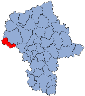
Szczawin Kościelny is a village in Gostynin County, Masovian Voivodeship, in east-central Poland. It is the seat of the gmina called Gmina Szczawin Kościelny. It lies approximately 12 kilometres (7 mi) south-east of Gostynin and 96 km (60 mi) west of Warsaw.
Teodorów is a village in the administrative district of Gmina Szczawin Kościelny, within Gostynin County, Masovian Voivodeship, in east-central Poland. It lies approximately 6 kilometres (4 mi) south of Szczawin Kościelny, 15 km (9 mi) south-east of Gostynin, and 97 km (60 mi) west of Warsaw.
Trębki is a village in the administrative district of Gmina Szczawin Kościelny, within Gostynin County, Masovian Voivodeship, in east-central Poland. It lies approximately 8 kilometres (5 mi) south-west of Szczawin Kościelny, 12 km (7 mi) south-east of Gostynin, and 101 km (63 mi) west of Warsaw.
Tuliska is a village in the administrative district of Gmina Szczawin Kościelny, within Gostynin County, Masovian Voivodeship, in east-central Poland. It lies approximately 6 kilometres (4 mi) west of Szczawin Kościelny, 9 km (6 mi) south-east of Gostynin, and 101 km (63 mi) west of Warsaw.
Wola Trębska is a village in the administrative district of Gmina Szczawin Kościelny, within Gostynin County, Masovian Voivodeship, in east-central Poland. It lies approximately 8 kilometres (5 mi) south-west of Szczawin Kościelny, 10 km (6 mi) south of Gostynin, and 102 km (63 mi) west of Warsaw.