Mendoza River

Last updated
Mendoza River
RioMendoza-01.jpg
Mendoza River
Relief Map of Argentina.jpg
Red pog.svg
Location of mouth
Location
Country Argentina
Physical characteristics
Mouth  
  coordinates
32°07′41″S68°12′20″W / 32.1281°S 68.2056°W / -32.1281; -68.2056

The Mendoza River is a river in the province of Mendoza, Argentina. [1] It is formed in the Andes range between the Aconcagua and the Tupungato, by the confluence of the Vacas, the Cuevas and the Tupungato rivers, the last being its major tributary.

Contents

Course

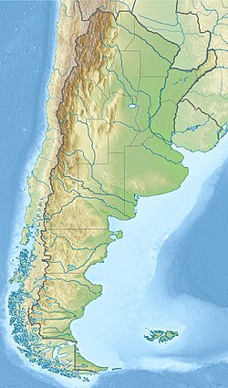
The upper valley of the Mendoza begins at around 2,600 metres (8,500 ft) above mean sea level, and it is U-shaped, of glacial origin. The river reaches Uspallata, then crosses the Precordillera through the Potrerillos Valley, flows along the Cacheuta Canyon and reaches the plain. It forms an arc and turns northeast, finally emptying into the Bañados de Guanacache, which join the San Juan River, part of the system of the Desaguadero River.

The river has a mean flow of 50 cubic metres per second (1,800 cu ft/s), and supplies water for the main oasis in the otherwise arid province. Its course through Potrerillos, at about 1,350 metres (4,430 ft) above sea level, features rapids, which are employed for rafting (level III–IV on the International Scale of River Difficulty during the summer). In Potrerillos the river is also dammed, forming a reservoir, which feeds a hydroelectric power station.

Rafting at Mendoza River Rafting Mendoza River.jpg
Rafting at Mendoza River

The Cacheuta Spa and the Potrerillos Dam are tourist destinations along the river.

Mendoza River irrigates the Maipú and Lujan vineyards, located in Mendoza piedmont, at 30° south latitude. This region hosts 17 percent of the Mendoza vineyards, and about 360 wineries. [2]

Location

Point Coordinates
(links to map & photo sources)
Notes
Source confluence 32°51′10″S69°45′15″W / 32.85278°S 69.75417°W / -32.85278; -69.75417 (Source confluence) Punta de Vacas
abeam Uspallata 32°40′15″S69°21′55″W / 32.67083°S 69.36528°W / -32.67083; -69.36528 (abeam Uspallata) Uspallata
Potrerillos Dam 32°59′40″S69°07′35″W / 32.99444°S 69.12639°W / -32.99444; -69.12639 (Potrerillos Dam) Potrerillos Dam
abeam Mendoza 33°02′40″S68°52′45″W / 33.04444°S 68.87917°W / -33.04444; -68.87917 (abeam Mendoza) Mendoza
Palmira 33°02′45″S68°34′25″W / 33.04583°S 68.57361°W / -33.04583; -68.57361 (Palmira) (es)
Confluence 32°07′40″S68°12′20″W / 32.12778°S 68.20556°W / -32.12778; -68.20556 (Confluence) San Juan River
Map all coordinates using: OpenStreetMap

Related Research Articles

<span class="mw-page-title-main">Douro</span> River in Portugal and Spain

The Douro is the highest-flow river of the Iberian Peninsula. It rises near Duruelo de la Sierra in the Spanish province of Soria, meanders south briefly then flows generally west through the northern part of the Meseta Central in Castile and León into northern Portugal. Its most plentiful tributary is the right-bank Esla river. At Douro's mouth at Porto, the second largest city of Portugal, the river meets the Atlantic Ocean.

<span class="mw-page-title-main">Sihl</span> River in the canton of Schwyz, Switzerland

The Sihl is a Swiss river that rises near the Druesberg mountain in the canton of Schwyz, and eventually flows into the Limmat in the centre of the city of Zürich. It has a length of 73 km (45 mi), including the Sihlsee reservoir, through which the river flows. Water is abstracted from the river at the Sihlsee, leading to decreased downstream water flows and a consequent reduction in water quality.

<span class="mw-page-title-main">Argentine wine</span> Fifth largest producer of wine in the world

Argentina is the fifth largest producer of wine in the world. Argentine wine, as with some aspects of Argentine cuisine, has its roots in Spain. During the Spanish colonization of the Americas, vine cuttings were brought to Santiago del Estero in 1557, and the cultivation of the grape and wine production stretched first to neighboring regions, and then to other parts of the country.

<span class="mw-page-title-main">Minho (river)</span> River in Portugal and Spain

The Minho or Miño is the longest river in Galicia, sharing the border with Portugal, with a length of 340 kilometres (210 mi). By discharge, it is the fourth river of the Iberian peninsula, after the Douro, Ebro, and Tagus.

<span class="mw-page-title-main">Potrerillos, Mendoza</span>

Potrerillos is a district of the Luján de Cuyo Department of the province of Mendoza, Argentina. It includes a number of small settlements along Provincial Routes 82 and 89, National Route 7, and the rivers Blanco and Mendoza. The center of Potrerillos is 63 km south from Mendoza City.

<span class="mw-page-title-main">King River (Victoria)</span> River in Victoria (Australia)

The King River, a perennial river of the North-East Murray catchment of the Murray-Darling basin, is located in the Alpine and Hume regions of Victoria, Australia. It flows from the northwestern slopes of the Alpine National Park in the Australian Alps, through the King Valley, and joining with the Ovens River at the rural city of Wangaratta.

<span class="mw-page-title-main">Segundo River</span> River in Argentina

The Segundo River, also known as Xanaes, is a river in the center-north of the province of Córdoba, Argentina. It is born in the Paravachasca Valley at the confluence of the Los Molinos and Anizacate rivers, on the eastern slopes of the Cumbres de Achala, about 2,000 metres (6,600 ft) above mean sea level. It flows west–east and its course forms a reservoir at the Los Molinos Dam, which is employed to generate hydroelectricity. It then flows to the northeast and divides into two main arms, which empty in the Mar Chiquita salt lake, 340 kilometres (210 mi) from its origin. The average inflow is 12.2 cubic metres per second (430 cu ft/s).

<span class="mw-page-title-main">Los Molinos Dam</span> Dam in Córdoba

The Los Molinos Dam is a dam over the course of the Los Molinos River in the center-west of the province of Córdoba, Argentina, about 769 metres (2,523 ft) above mean sea level.

<span class="mw-page-title-main">Geography of Himachal Pradesh</span>

The state of Himachal Pradesh is spread over an area 55,673 km2 (21,495 sq mi) and is bordered by Jammu and Kashmir and Ladakh on the north, Punjab on the southwest, Haryana on the south, Uttarakhand on the southeast, a small border with Uttar Pradesh in the south, and Tibet on the east. Entire Himachal Pradesh lies in the mountainous Himalaya region, rich in natural resources

<span class="mw-page-title-main">Atuel River</span> River in Argentina

The Atuel River is a river located mainly in the south of the Argentine province of Mendoza, with its last part in La Pampa. It is a tributary of the Desaguadero River.

<span class="mw-page-title-main">San Juan River (Argentina)</span> River in San Juan, Argentina

The San Juan River is, together with the Jáchal, the most important river of the Argentine province of San Juan. Both join the Desaguadero/Colorado system that ends at the Atlantic Ocean.

<span class="mw-page-title-main">El Carrizal Dam</span> Dam in Mendoza

The El Carrizal Dam is a dam on the upper-middle course of the Tunuyán River, in the center-north of the province of Mendoza, Argentina upstream from the city of Rivadavia. Its reservoir measures about 15 by 5 kilometres, and its maximum water level stands at 785.5 metres (2,577 ft) above the sea, covering an area of 34.8 square kilometres (13.4 sq mi). It has a maximum volume of 462 million cubic metres.

<span class="mw-page-title-main">Piedra del Águila Dam</span> Dam in Patagonia

The Piedra del Águila Dam is the second of five dams on the Limay River in northwestern Argentine Patagonia and 590 metres (1,940 ft) above mean sea level, downstream from the confluence of the Limay and the Collón Curá River. It was inaugurated in 1993.

<span class="mw-page-title-main">El Chocón Dam</span> Dam in Villa El Chocon, Argentina

The El Chocón Dam is the fourth of the five dams on the Limay River in the northwestern Argentine Patagonia, at 381 metres (1,250 ft) above mean sea level. El Chocón is on the Limay River at about 80 km (50 mi) upstream of its confluence with the Neuquén River.

<span class="mw-page-title-main">Tupungato Department</span> Department in Argentina

Tupungato is a department located in the province of Mendoza, Argentina. The cabecera, Tupungato, is located approximately 70 km (43 mi) south of Mendoza city, in the Valle de Uco.

<span class="mw-page-title-main">Tupungatito</span> Volcano in Chile

Volcán Tupungatito is the northernmost historically active stratovolcano of the southern Andes. Part of the Chilean Andes' volcanic segment, it is the northernmost member of the Southern Volcanic Zone (SVZ), which is one of several distinct volcanic belts in the Andes. Over 70 Pleistocene or Holocene age volcanoes make up this volcanic belt, which on average has one eruption per year.

<span class="mw-page-title-main">Lake Qaraoun</span> Multipurpose reservoir in Beqaa Valley

Lake Qaraoun is an artificial lake or reservoir located in the southern region of the Beqaa Valley, Lebanon. It was created near Qaraoun village in 1959 by building a 61 m-high (200 ft) concrete-faced rockfill dam in the middle reaches of the Litani River. The reservoir has been used for hydropower generation, domestic water supply, and for irrigation of 27,500 ha.

<span class="mw-page-title-main">Mendoza wine</span> Wine-producing region in Argentina

Mendoza Province is Argentina's most important wine region, accounting for nearly two-thirds of the country's entire wine production. Located in the eastern foothills of the Andes, in the shadow of Aconcagua, vineyards are planted at some of the highest altitudes in the world, with the average site located 600–1,100 metres (2,000–3,600 ft) above sea level. The principal wine producing areas fall into two main departments-Maipú and Luján, which includes Argentina's first delineated appellation established in 1993 in Luján de Cuyo. The pink-skinned grapes of Criolla Grande and Cereza account for more than a quarter of all plantings but Malbec is the region's most important planting, followed closely by Cabernet Sauvignon, Tempranillo and Chardonnay. Mendoza is considered the heart of the winemaking industry in Argentina with the vast majority of large wineries located in the provincial capital of Mendoza.

<span class="mw-page-title-main">Potrerillos Dam</span> Dam in Mendoza, Argentina

Potrerillos Dam is located on the Mendoza River, in Argentina's Potrerillos Valley. The dam was built between 1999 and 2003 by a consortium consisting of Industrias Metalúrgicas Pescarmona (IMPSA) and Cartellone to provide flood control, hydroelectricity and irrigation water. The dam cost US$ 312 million to construct. Located about 30 kilometres (19 mi) southwest of Mendoza, the concrete-faced rockfill dam is 116 metres (381 ft) high and 395 metres (1,296 ft) long, impounding the 12 km (7.5 mi) long Potrerillos Reservoir.

<span class="mw-page-title-main">Cacheuta Spa</span>

The Cacheuta Spa is a bathing establishment in Argentina exploiting the natural hot springs at Cacheuta on the Mendoza River in the foothills of the Andes. The spa lies on the old road leading from the city of Mendoza to the Uspallata Pass over the mountains into Chile.

References