Findon or Finnan is a fishing village eight miles south of Aberdeen, famous for originating the smoked haddock known as Finnan haddie. The Findon moor has a number of paths through it, many of which run along the cliffs. Deer can often be seen there. Nearby features include the Portlethen Moss Nature Reserve.

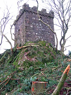
Ury House is a large ruined mansion in Aberdeenshire, Scotland, built in the Elizabethan style in 1885 by Sir Alexander Baird, 1st Baronet. It is situated on the north-east coast about 1 mile (1.6 km) north of Stonehaven in the former county of Kincardineshire.
Red Moss is a wetland bog in Aberdeenshire, Scotland, located at the northwestern edge of the village of Netherley. The moss is designated a national Site of Special Scientific Interest by Scottish Natural Heritage, due to its biodiversity and undisturbed character. The elevation of Red Moss is 113 metres above mean sea level. The upland areas above Red Moss are characterised as agricultural and woodland parcels which are generally attractive and separated by ancient drystone walls or hedgerows.
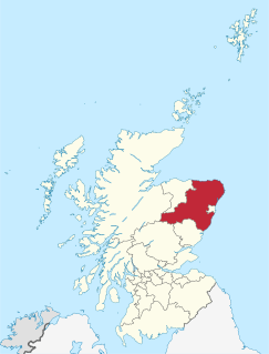
Netherley, Scotland is a village in Aberdeenshire, situated approximately five miles northwest of Stonehaven. Netherley is located in the Mounth area of the Grampian Highlands. At the eastern edge of Netherley is a significant wetland bog known as Red Moss. To the southwest of Netherley lie Meikle Carewe Hill and Curlethney Hill. At the south edge of Netherley is the peak of Craggie Cat.
The Burn of Elsick is a coastal stream in Aberdeenshire, Scotland that discharges to the North Sea. This watercourse drains primarily agricultural lands and enters the North Sea at Newtonhill.
The Causey Mounth is an ancient drovers' road over the coastal fringe of the Grampian Mountains in Aberdeenshire, Scotland. This route was developed as the main highway between Stonehaven and Aberdeen around the 12th century AD and it continued to function as the principal route connecting these two cities until the mid 20th century, when modern highway construction of the A90 road occurred in this area. There are extant paved and usable sections of this road over part of the alignment; however, many parts of the ancient route are no more than footpaths, and in some cases the road has vanished into agricultural fields. Constructed in the Middle Ages, the Causey Mounth was created as an elevated rock causeway to span many of the boggy areas such as the Portlethen Moss. A considerable portion of the alignment of the Causey Mounth is illustrated on the UK Ordnance Survey Map, although a large fraction of the route cannot be navigated by a conventional passenger vehicle.

Elsick House is an historic house in Kincardineshire, northeast Scotland.
Cammachmore is a hamlet in the coastal region near the North Sea in Aberdeenshire. It lies slightly west of the A90 road and the ancient Causey Mounth passes through the community. Historic Elsick House is situated due west of Cammachmore. Other nearby historic features include Gillybrands, Saint Ternan's Church, Muchalls Castle and the Lairhillock Inn.
Cairnie Burn is a stream that rises in the Mounth, or eastern range of the Grampian Mountains, north of Netherley, Aberdeenshire, Scotland. Cairnie Burn is a generally northeast flowing watercourse that is a tributary to the Crynoch Burn. Cairnie Burn rises in the eastern part of the Durris Forest, east of the Elsick Mounth passage.
Banchory-Devenick is a village approximately two kilometres south of the city of Aberdeen, Scotland in the Lower Deeside area of Aberdeenshire. The village should not be confused with the historic civil parish of the same name which spanned the River Dee until 1891, its northern part lying in Aberdeenshire and its southern part in Kincardineshire. In that year the northern part became part of the neighbouring parish of Peterculter, the southern part remaining as the parish of Banchory-Devenick. The village of Banchory-Devenick lies slightly west of the A90 road, and the ancient Causey Mounth passes directly through the village. An historic graveyard dating to 1157 AD is present at the village of Banchory-Devenick. Other historic features in the vicinity include Saint Ternan's Church, Muchalls Castle and the Lairhillock Inn.
Megray Hill is a low-lying coastal mountainous landform in Aberdeenshire, Scotland within the Mounth Range of the Grampian Mountains. The peak elevation of this mountain is 120 metres above mean sea level. This hill has been posited as a likely location for the noted Battle of Mons Graupius between the Romans and the indigenous Caledonians. The major Roman Camp of Raedykes is situated about three kilometres to the west. From Megray Hill there are expansive views to the North Sea facing east. The summit affords scenic vies of the historic harbour of Stonehaven.
Craggie Cat is a hill landform in the Mounth of the Grampian Mountains at the southern edge of Netherley, Aberdeenshire, Scotland. The peak elevation of Craggie Cat is 198 metres according to the Ordnance Survey. This hill's southwestern flanks form the northwest boundary of the moorland of Curlethney Hill.

Durris Forest is a chiefly coniferous forest south of the River Dee approximately three kilometres west of Netherley in Aberdeenshire, Scotland. The A957 road forms the southwest boundary of Durris Forest, separating it from Fetteresso Forest. The Durris Forest includes several smaller named woodlands. The ancient route of Elsick Mounth crosses the Grampian Mounth within the Durris Forest. Notable natural features in the vicinity include Red Moss and Meikle Carewe Hill. Notable historic features in this area include Raedykes Roman Camp, Muchalls Castle and Maryculter House.
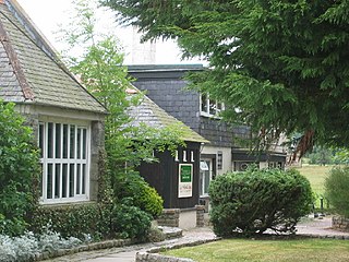
The Lairhillock Inn is an historic coaching inn along an old carriage route approximately four miles north of Netherley, Aberdeenshire, Scotland.

The Elsick Mounth is an ancient trackway crossing the Grampian Mountains in the vicinity of Netherley, Scotland. This trackway was one of the few means of traversing the Grampian Mounth area in prehistoric and medieval times. The highest pass of the route is attained within the Durris Forest. Notable historical structures in the vicinity are Maryculter House, Lairhillock Inn and Muchalls Castle. Most of the lands through which the Elsick Mounth passes are within the Durris Forest; while this forest would have been a mixed deciduous forest in ancient times, currently it is managed as a coniferous monoculture with extensive amounts of clearfelling and subsequent replanting.
Coalford is a village in Aberdeenshire, Scotland situated slightly north of the River Dee. A statue of Rob Roy MacGregor is located near to Coalford. A number of noted historical structures lie in the vicinity of Coalford including Crathes Castle, Muchalls Castle, Maryculter House and the Lairhillock Inn. Considerable prehistory occurs in the local region along the Deeside, as evinced by the ancient sites of Balbridie and Bucharn. Coalford is situated near the ancient Roman Camp of Normandykes, which was accessed by a march northward from Raedykes via the Elsick Mounth trackway.

Cairn Mon Earn or Cairn-mon-earn is a hill in Aberdeenshire, Scotland.
Lochton is a settlement on the Slug Road in Aberdeenshire, Scotland. Roman legions marched from Raedykes to Normandykes Roman Camp somewhat east of Lochton, using higher ground evading the bogs of Red Moss and other low-lying areas including the Burn of Muchalls. That march used the nearby Elsick Mounth, an ancient trackways crossing the Mounth of the Grampian Mountains, lying westerly of Netherley.
Balfour, Aberdeenshire is a settlement on Royal Deeside in Aberdeenshire, Scotland. Balfour lies south of the River Dee.
Borrowfield is a settlement in Aberdeenshire, Scotland in proximity to Netherley.