MetroHero

Last updated

MetroHero
Developer(s)
  • James Pizzurro
  • Jennifer Pizzurro
Initial releaseSeptember 2015;8 years ago (2015-09)
Repository
Written in
Operating system
Successor
License GPL-3.0

MetroHero is a semi-defunct real-time transit tracking and performance analysis application for the Washington Metro rapid transit system. Originally available on iOS, Android, and the web, it allows users to view live maps of all trains on a specific line, summary statistics relating to real-time system performance, and user feedback on current Metro conditions.

Contents

The app launched in 2015, followed by ARIES for Transit, a related project from the same developers, and continued functioning until its original developers shut it down in 2023. Afterwards, forks of the application went live to allow for its continued public use, and the Washington Metropolitan Area Transit Authority (WMATA), Metro's operator, announced that it would launch a similar app. The app has been described by local news media as popular and well-liked among Washington, D.C.-area residents.

History and main development

MetroHero was initially developed by James and Jennifer Pizzurro, who both attended George Washington University and studied computer science. [1] [2] They said that they were inspired to create the app after experiencing train delays and searching for an app to track a train after boarding; [2] such an app did not exist for the Washington Metro. [3] The development of the app was not endorsed by WMATA, but it did use publicly available data from the agency. [1]

MetroHero launched as an Android application in September 2015, followed by the release of an iOS-compatible web app in December of that year. [1] A standalone iOS app launched in April 2018, but the web app remained supported. By April 2018, MetroHero had approximately 13,000 monthly active users. James Pizzurro has stated that the app's intended audience was regular Metro commuters who wanted to communicate with each other about active problems, as opposed to tourists and riders who only wanted train time data. [2]

Throughout the application's development, the Pizzurros had been advocates for Metro's transparency with riders and the community by providing more high-quality data and taking on the feedback of developers. In particular, they criticized Metro's reluctance to uniquely identify individual train trips and its decision to obscure data under certain circumstances, which have posed problems for MetroHero's data collection. [1]

In addition to their work on MetroHero, the app's developers led or participated in other initiatives related to transit in the Greater Washington area. In 2019, MetroHero partnered with a local transit group to analyze Metrobus data and publish a "Metrobus Report Card", along with proposed goals and recommendations based on the report's findings. [4] Based on this experience, MetroHero's developers began a sister project, the Adherence + Reliability + Integrity Evaluation System for Transit (ARIES for Transit), which displays data and issues grades for Washington- and Baltimore-area transit systems. [3] [5] [6] Separately, James Pizzurro used MetroHero data to inform Rail Transit OPS, an independent Metro oversight group, and assist in its documentation of Metro system incidents. [7]

Application

Line map view for a part of the Silver Line Screenshot of MetroHero fork SV line map.png
Line map view for a part of the Silver Line

The MetroHero application uses several interfaces, including an overall dashboard and a live map, to display data to its users. [1] [3] On the dashboard, system-wide train summary data, such as the number of operating trains and headway adherence, is visible. [1] The map offers a visual representation of all trains' positions throughout the system, filtered by line. [1] Individual stations and trains can be selected to see ratings and comments provided by other users, including both positive and negative notes like cleanliness and crowdedness. [2] [3] Additionally, a list of train wait times is given, along with aggregate data like average wait time. [1] [3] Any train delays or service incidents are visible in the app. [2]

MetroHero uses several data sources for the various components of its application. Train positions and other operational data are provided by WMATA as part of its initiative to release open data for third-party developers. [1] However, MetroHero's developers noted that the Metro-provided information is sometimes inaccurate and incomplete, thereby limiting the accuracy of MetroHero. [1] The app also collects crowdsourced data from its users, who can report conditions in train cars and stations and add to reports sent by other people. [2] Additionally, MetroHero parses data from Twitter feeds to learn about system incidents, including delays and fires. [2]

In addition to the web app, Android app, and iOS app, MetroHero's initial developers maintained automated social media accounts that alerted customers about Metro service; these accounts were discontinued upon the original app's eventual shutdown. [5] MetroHero also hosts archived performance data for later review, a feature that is sometimes used after major incidents. [3] [7]

Shutdown and future

In February 2023, James Pizzurro announced that MetroHero would be shut down on July 1, 2023, citing "positive changes ... in the app landscape and in WMATA's data management and communication" and the costs and time associated with maintaining the app. [3] [5] Shortly before the application's end date, the Pizzurros shared MetroHero's source code on GitHub, which prompted others to fork the code and begin maintaining new instances of MetroHero to succeed the original app. The original website went offline on July 1, as planned. [5]

Historically, WMATA has not offered its own real-time map or similar service, citing other apps from third parties which accomplished the same task. [1] [lower-alpha 1] However, on June 30, 2023, Randy Clarke, WMATA's general manager, announced that Metro would begin offering a similar service as MetroHero did. [5] [8] The app, initially named MetroMeter, was planned to begin operating in early July and would provide real-time information on trains, headways, and service schedules. Metro also noted its intentions to extend this service to Metrobus and MetroAccess. [5] On July 20, Metro announced that the app had been renamed to MetroPulse and launched it in beta. [9]

MetroHero's other project, ARIES for Transit, was not affected by the shutdown. [5]

Reception

MetroHero was generally well-received and has been recognized for its usage among Washington-area commuters. DCist called it one of the "most praised" Metro tracking apps, [3] and WMATA publicly acknowledged its popularity when announcing its decision to establish MetroPulse. [5] Chris Barnes, a member of the Metro Riders' Advisory Council, said that the app is considered important among riders because it fulfills a need for riders to have reliable and transparent transit information, albeit somewhat hindered by flaws in WMATA's data. [1]

Notes

  1. Metro has offered web apps to track an individual rider's previous trips, but these did not provide live tracking.

Related Research Articles

<span class="mw-page-title-main">Washington Metro</span> Rapid transit system serving the Washington metropolitan area

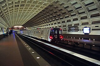
The Washington Metro, often abbreviated as the Metro and formally the Metrorail, is a rapid transit system serving the Washington metropolitan area of the United States. It is administered by the Washington Metropolitan Area Transit Authority (WMATA), which also operates the Metrobus service under the Metro name. Opened in 1976, the network now includes six lines, 98 stations, and 129 miles (208 km) of route.

<span class="mw-page-title-main">Silver Spring station (Maryland)</span> Washington Metro and MARC Train station

Silver Spring station is a train station on the Red Line of the Washington Metro and the Brunswick Line of the MARC Train commuter rail system. The Metro station averaged 4,536 daily riders in 2023, making it the 19th-busiest stop in the network and the busiest in the state of Maryland. Trains travelling south from the station quickly cross the border into Washington, D.C., while northbound trains head underground and make their way further into Montgomery County.

<span class="mw-page-title-main">West Falls Church station</span> Washington Metro station

West Falls Church station is a Washington Metro station in Idylwood, Virginia on the Orange Line, the first station inside the Capital Beltway on the Orange Line going east. It is one of only two stations in the system to have three tracks, the other being the National Airport station. The center track is used for storage and relaying trains to the adjacent Falls Church Yard.

<span class="mw-page-title-main">Huntington station (Washington Metro)</span> Washington Metro station

Huntington station is an island-platformed Washington Metro station in the Huntington area of Fairfax County, Virginia, United States. The station was opened on December 17, 1983, and is operated by the Washington Metropolitan Area Transit Authority (WMATA). Serving as the southern terminus for the Yellow Line, the station is built into a hillside; the south mezzanine, along with escalator access, is accessible via an incline elevator.

<span class="mw-page-title-main">College Park–University of Maryland station</span> Washington Metro and MARC Train station

College Park–University of Maryland station is a Washington Metro station in Prince George's County, Maryland, on the Green Line. It also serves MARC's Camden Line, though only select trains stop at the station.

<span class="mw-page-title-main">Greenbelt station</span> Washington Metro and MARC Train station

Greenbelt station is a Washington Metro and MARC station in Prince George's County, Maryland. The station is the northeastern terminus of the Green Line of the Washington Metro. MARC commuter rail trains on the Camden Line also stop at Greenbelt on a set of tracks parallel to the Metro tracks.

<span class="mw-page-title-main">SmarTrip</span> Contactless transit card system used in the Washington, D.C. metro area

SmarTrip is a contactless stored-value smart card payment system managed by the Washington Metropolitan Area Transit Authority (WMATA). The Maryland Transit Administration (MTA) uses a compatible payment system called CharmCard. A reciprocity agreement between the MTA and WMATA allows either card to be used for travel on any of the participating transit systems in the Baltimore-Washington metropolitan area. Unlike traditional paper farecards or bus passes, SmarTrip/CharmCard is designed to be permanent and reloadable; the term "SmarTrip" may refer to both payment systems unless otherwise noted.

<span class="mw-page-title-main">Washington Metropolitan Area Transit Authority</span> Public transit authority

The Washington Metropolitan Area Transit Authority, commonly referred to as Metro, is a tri-jurisdictional non-government organization that operates transit service in the Washington metropolitan area. WMATA was created by the United States Congress as an interstate compact between Washington, D.C., Maryland, and Virginia.

<span class="mw-page-title-main">Fairfax Connector</span> Public bus service serving Fairfax County, Virginia

Fairfax Connector is a public bus service provided by Fairfax County, Virginia, United States, and is managed by the county government. The bus system provides service within Fairfax County, and connects to Metrobus, Metrorail stations, Virginia Railway Express, and other local bus systems. Fairfax Connector serves all of Fairfax Metrorail Stations, the city of Alexandria, the city of Fairfax, the Washington Dulles International Airport, and the Pentagon Metrorail station. In 2022, the system had a ridership of 4,851,200, or about 31,400 per weekday as of the third quarter of 2023.

<span class="mw-page-title-main">Metrobus (Washington, D.C.)</span> Bus transit service in the US federal district

Metrobus is a bus service operated by the Washington Metropolitan Area Transit Authority (WMATA). Its fleet consists of 1,595 buses covering an area of 1,500 square miles (3,900 km2) in Washington, D.C., Maryland, and Virginia. There are 269 bus routes serving 11,129 stops, including 2,554 bus shelters. In 2022, the system had a ridership of 90,123,200, or about 355,800 per weekday as of the third quarter of 2023.

<span class="mw-page-title-main">Metro Transit Police Department</span>

The Metro Transit Police Department (MTPD) is the transit police agency of the Washington Metropolitan Area Transit Authority (WMATA), created by the WMATA Compact on June 4, 1976.

<span class="mw-page-title-main">Transportation in Washington, D.C.</span> Overview of the transportation in Washington, DC

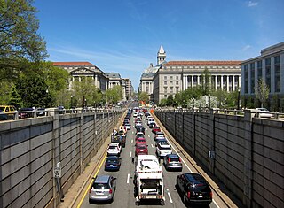
Washington, D.C. has a number of different modes of transportation available for use. Commuters have a major influence on travel patterns, with only 28% of people employed in Washington, D.C. commuting from within the city, whereas 33.5% commute from the nearby Maryland suburbs, 22.7% from Northern Virginia, and the rest from Washington, D.C.'s outlying suburbs.

<span class="mw-page-title-main">Passenger information system</span> Electronic public transit communication

A passenger information system, or passenger information display system, is an automated system for supplying users of public transport with information about the nature and the state of a public transport service through visual, voice or other media. It is also known as a customer information system or an operational information system. Among the information provided by such systems, a distinction can be drawn between:

<span class="mw-page-title-main">Metroway</span> Bus rapid transit line operated by the Washington Metropolitan Area Transit Authority

Metroway is a bus rapid transit (BRT) line operated by the Washington Metropolitan Area Transit Authority (WMATA) as part of their Metrobus system. It consists of a single line operating in Arlington and Alexandria, Virginia. It opened on August 24, 2014. It was the first bus rapid transit line to open in Virginia and in the Washington metropolitan area.

<span class="mw-page-title-main">Apple Maps</span> Map application operated by Apple Inc.

Apple Maps is a web mapping service developed by Apple Inc. The default map system of iOS, iPadOS, macOS, and watchOS, it provides directions and estimated times of arrival for driving, walking, cycling, and public transportation navigation. A "Flyover" mode shows certain densely populated urban centers and other places of interest in a 3D landscape composed of models of buildings and structures.

Firebase, Inc. is a set of backend cloud computing services and application development platforms provided by Google. It hosts databases, services, authentication, and integration for a variety of applications, including Android, iOS, JavaScript, Node.js, Java, Unity, PHP, and C++.

Flash BRT is a bus rapid transit network in Montgomery County, Maryland with one operational line and two more under development. When complete, the network will run along U.S. 29 from Silver Spring to Burtonsville, Maryland Route 355 from Bethesda to Clarksburg, and Maryland Route 586 from Wheaton to Rockville.

<span class="mw-page-title-main">Metrobus fleet (Washington, D.C.)</span> Listing of WMATAs current bus fleet

This is a roster of the bus fleet of Metrobus, the fixed-route bus service run by the Washington Metropolitan Area Transit Authority in Washington, D.C.

The College Park–North Bethesda Line, designated Route C8, is a bus route that operates Monday to Saturday that is operated by the Washington Metropolitan Area Transit Authority, United States, between College Park–University of Maryland station of the Green Line and North Bethesda station of the Red Line of the Washington Metro. The line operates every 30 minutes at all times. Trips are roughly 70–80 minutes long.

<span class="mw-page-title-main">Georgia Avenue Limited Line</span>

The Georgia Avenue Limited Line, designated as Route 79, is a daily bus route that is operated by the Washington Metropolitan Area Transit Authority between Silver Spring station of the Red Line of the Washington Metro and Archives station of the Green and Yellow lines of the Washington Metro. The line operates every 10–12 minutes at all times. Trips are roughly 50 minutes. This line provides additional express service for route 70 daily between 6:00 AM and 9:00 PM, serving select stops along Georgia Avenue.

References

  1. 1 2 3 4 5 6 7 8 9 10 11 12 Siddiqui, Faiz (February 13, 2016). "How developers are trying to keep Metro honest using its own data". The Washington Post . Archived from the original on March 25, 2023. Retrieved July 6, 2023.
  2. 1 2 3 4 5 6 7 Dynes, Matt (April 30, 2018). "Alumni develop app that alleviates train troubles, provides unique train scheduling". The GW Hatchet . Vol. 115, no. 1. Hatchet Publications. Archived from the original on November 27, 2022. Retrieved July 6, 2023.
  3. 1 2 3 4 5 6 7 8 Pascale, Jordan (February 10, 2023). "As Popular Metro Watchdog App Shuts Down, Transit Agency Promises More Transparency On Service Performance". DCist . WAMU 88.5. Archived from the original on July 6, 2023. Retrieved July 6, 2023.
  4. Pascale, Jordan (July 11, 2019). "Metrobus Gets Low Marks For Speed And Schedule Reliability". WAMU 88.5 . Archived from the original on July 6, 2023. Retrieved July 6, 2023.
  5. 1 2 3 4 5 6 7 8 Lyons, Ivy (July 2, 2023). "'This is my stop': MetroHero hands conductor's hat to new WMATA commuters, watchdogs". WTOP News . Archived from the original on July 6, 2023. Retrieved July 6, 2023.
  6. "Frequently Asked Questions". ARIES for Transit. Archived from the original on July 6, 2023. Retrieved July 6, 2023.
  7. 1 2 Siddiqui, Faiz (January 5, 2016). "On Metro, rail enthusiasts fill communications void for riders". The Washington Post . Archived from the original on December 2, 2021. Retrieved August 9, 2023.
  8. "Metro launching MetroMeter, a new real-time rail service tracking tool". Washington Metropolitan Area Transit Authority . June 30, 2023. Archived from the original on July 6, 2023. Retrieved July 6, 2023.
  9. @wmata (July 20, 2023). "We're beta launching #MetroPulse (previously MetroMeter), an interactive web tool that gives real-time customer info + system performance data. ..." (Tweet). Retrieved August 9, 2023 via Twitter.