The Trent and Mersey Canal is a 93+1⁄2-mile (150 km) canal in Derbyshire, Staffordshire and Cheshire in north-central England. It is a "narrow canal" for the vast majority of its length, but at the extremities to the east of Burton upon Trent and north of Middlewich, it is a wide canal.

Longdendale is a valley in the Peak District of England, north of Glossop and southwest of Holmfirth. The name means "long wooded valley" and the valley is mostly in the counties of Derbyshire and Greater Manchester.

The River Mersey is a river in the North West of England. Its name is derived from Old English and means "boundary river", possibly referring to its having been a border between the ancient kingdoms of Mercia and Northumbria. For centuries it has formed part of the boundary between the historic counties of Lancashire and Cheshire.

The River Douglas, also known as the River Asland or Astland, flows through parts of Lancashire and Greater Manchester in North West England. It is a tributary of the River Ribble and has several tributaries, the major ones being the River Tawd and the River Yarrow.

The River Goyt is a tributary of the River Mersey in North West England.

For the river in the West Midlands, see River Tame, West Midlands.

Cheadle Hulme is a suburb in the Metropolitan Borough of Stockport, Greater Manchester, England,. Historically in the county of Cheshire, Cheadle Hulme is 2.3 miles (3.7 km) south-west of Stockport and 7.5 miles (12.1 km) south-east of Manchester. It lies in the Ladybrook Valley, on the Cheshire Plain, and the drift consists mostly of boulder clay, sands and gravels. In 2011, it had a population of 26,479.
The River Gowy is a river in Cheshire, England, a tributary of the River Mersey.

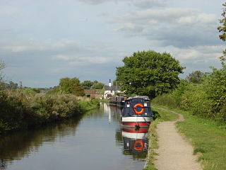
Caldon Canal is a branch of the Trent and Mersey Canal which opened in 1779. It runs 18 miles (29 km) from Etruria, Stoke-on-Trent, to Froghall, Staffordshire. The canal has 17 locks and the 76-yard (69 m) Froghall Tunnel.

Poynton is a town in Cheshire, England, on the easternmost fringe of the Cheshire Plain. It is 11 miles (18 km) southeast of Manchester, 7 miles (11 km) north of Macclesfield and 5 miles (8 km) south of Stockport.
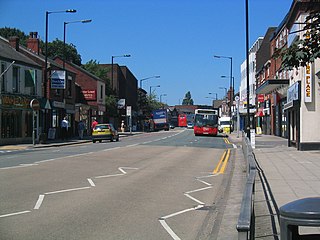
Hazel Grove is a suburb in the Metropolitan Borough of Stockport, Greater Manchester, England, close to the Peak District national park.

The Macclesfield Canal is a canal in east Cheshire, England. There were various proposals for a canal to connect the town of Macclesfield to the national network from 1765 onwards, but it was not until 1824 that a scheme came to fruition. There were already suggestions by that date that a railway would be better, but the committee that had been formed elected for a canal, and the engineer Thomas Telford endorsed the decision. The canal as built was a typical Telford canal, constructed using cut and fill, with numerous cuttings and embankments to enable it to follow as straight a course as possible, although Telford had little to do with its construction, which was managed by William Crosley.

Woodford is a suburban village in the Metropolitan Borough of Stockport, Greater Manchester, England, 5.2 miles (8.4 km) south of Stockport, 5.7 miles (9.2 km) north-west of Macclesfield and 10.7 miles (17.2 km) south-east of Manchester. Woodford is the most southerly point of Greater Manchester and consists of a ribbon of properties along the A5102 road, around which is open countryside.

The M63 motorway was a major road in the United Kingdom. It was completely renumbered, in 1998, to become a substantial part of the M60 motorway which orbits part of Greater Manchester.

The River Roddlesworth is a river in Lancashire, England, a tributary of the River Darwen.

A large number of canals were built in Cheshire, England, during the early phases of the Industrial Revolution to transport goods and raw materials. This resulted in a significant canal network which is now enjoyed by holiday-makers, anglers, walkers, and others.

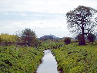
The Ladybrook Valley begins in the English Peak District and runs through Stockport. In its 15 kilometres (9.3 mi) course the brook falls 275 metres (902 ft). At various points it is called Bollinhurst Brook, Norbury Brook, Bramhall Brook, the Ladybrook and the Mickerbrook.

The Cheshire Ring is a canal cruising circuit or canal ring, which includes sections of six canals in and around Cheshire and Greater Manchester in North West England: the Ashton Canal, Peak Forest Canal, Macclesfield Canal, Trent and Mersey Canal, Bridgewater Canal and Rochdale Canal.

The Four Counties Ring is a canal ring which links the four English counties of Cheshire, Staffordshire, Shropshire and the West Midlands.

Stockport bus station in Stockport, Greater Manchester was a bus terminus for approximately sixty-five bus services. It opened on 2 March 1981 on the site of a former car park. Before the bus station opened, most services terminated at Mersey Square.
