
Rendezvous Mountain is a large mountain massif located in the southern Teton Range in the U.S. state of Wyoming. The highest point on Rendezvous Mountain is Rendezvous Peak. The west and northern flanks of the mountain are in Grand Teton National Park, Wyoming, while much of the remainder of the massif is in Bridger-Teton National Forest. The mountain massif extends for a distance of 5 miles (8.0 km) between Granite Canyon to the north and Phillips Canyon to the south. Though there are numerous summits above 10,000 feet (3,000 m), the one that is most commonly visited is the North Peak, where the Jackson Hole Mountain Resort aerial tram provides access to the summit for skiers in the winter and sightseerings and hikers in the summer. The hike down the Rendezvous Mountain Trail to the Granite Canyon Trail has a descent of 4,100 feet (1,200 m) over 12.3 miles (19.8 km).

The Teton Crest Trail is a 40-mile (64 km) long hiking trail in the U.S. state of Wyoming that extends from Phillips Pass, on the border of Bridger Teton and Caribou-Targhee National Forests, to String Lake in Grand Teton National Park. Backpacker Magazine calls the Trail one of the "Best Hikes Ever," with "mesmerizing and constant views of jagged peaks."
The Berry Creek Trail is a 12-mile (19 km) long hiking trail in the far northern region of Grand Teton National Park in the U.S. state of Wyoming. The trail begins at the National Park Service patrol cabin north of Wilcox Point on Jackson Lake and extends to Jackass Pass at the border between the park and Caribou-Targhee National Forest. Located in the remote northern backcountry of Grand Teton National Park, the trail is not connected to maintained trails in the southern part of the park and must be accessed from the Glade Creek trailhead in the John D. Rockefeller, Jr. Memorial Parkway. From Glade Creek, it is a 7.5 mi (12.1 km) hike to the Berry Creek Trail and then another 6.7 mi (10.8 km) to Jackass Pass. The Berry Creek Trail provides the easiest access to Survey Peak. The trail requires numerous stream crossings which can be dangerous during spring melt.
The Owl Creek Trail is a 7.3-mile (11.7 km) long hiking trail in the far northern region of Grand Teton National Park in the U.S. state of Wyoming. The trail begins at a junction on the Berry Creek Trail and traverses west then south to Moose Basin Divide where it meets the Webb Canyon Trail. Located in the remote northern backcountry of Grand Teton National Park, the trail is not connected to maintained trails in the southern part of the park and must be accessed from the Glade Creek trailhead in the John D. Rockefeller, Jr. Memorial Parkway. From Glade Creek, it is a 7.5 mi (12.1 km) hike to the Berry Creek Trail and then another 4 mi (6.4 km) to the trail junction. The Owl Creek Trail follows Owl Creek west then south and passes south of Forellen Peak. The trail requires numerous stream crossings which can be dangerous during spring melt.
The Webb Canyon Trail is a 9.9-mile (15.9 km) long hiking trail in the far northern region of Grand Teton National Park in the U.S. state of Wyoming. The trail begins near the National Park Service backcountry patrol cabin near Wilcox Point on Jackson Lake. Located in the remote northern backcountry of Grand Teton National Park, the trail is not connected to maintained trails in the southern part of the park and must be accessed from the Glade Creek trailhead in the John D. Rockefeller, Jr. Memorial Parkway. From Glade Creek, it is a 7.5 mi (12.1 km) hike to the patrol cabin and the beginning of the Webb Canyon Trail. The trail follows Moose Creek west and after several miles, is flanked by both Owl Peak and Elk Mountain to the north and several unnamed peaks nearing 11,000 ft (3,400 m) to the south. At Moose Basin Divide the trail meets the Owl Creek Trail.

The Alaska Basin Trail is a 7.5 mi (12.1 km) long hiking trail in Grand Teton National Park and Bridger-Teton National Forest in the U.S. state of Wyoming. The trail begins at a junction on the Death Canyon Trail near the Death Canyon Barn and climbs steeply to Static Peak Divide. From the divide, the trail soon splits with a western branch descending into Alaska Basin and the eastern trail continuing north to junction with the Teton Crest Trail. There are no camping zones on the trail within Grand Teton National Park, however in National Forest lands within Alaska Basin, camping is permitted anywhere more than 200 ft (61 m) away from lakes, though no open fires are allowed. The Alaska Basin Trail is oftentimes used by climbers attempting to make ascents of Buck Mountain and Veiled Peak.
The Death Canyon Trail is a 10.5 mi (16.9 km) long hiking trail in Grand Teton National Park in the U.S. state of Wyoming. The trail begins west of the White Grass Ranger Station Historic District and ends at Fox Creek Pass where it intercepts the Teton Crest Trail. The trail follows the length of Death Canyon. To get to the trail, the Valley Trail must be accessed at the White Grass Grass Ranger Station then by trending westward just to the north of Phelps Lake. Near Phelps Lake Overlook, the Death Canyon Trail heads west and is flanked by Albright Peak to the north and Prospectors Mountain to the south. After over 2 mi (3.2 km), the canyon widens and is intercepted by the Alaska Basin Trail. The Death Canyon Trail continues west then southwest, climbing steadily to Fox Creek Pass. The camping zone in the canyon extends from just west of the Alaska Basin Trail junction to .5 mi (0.80 km) below Fox Creek Pass and is available by permit.
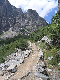
The Granite Canyon Trail is a 8.2 mi (13.2 km) long hiking trail in Grand Teton National Park in the U.S. state of Wyoming. The trail begins at the Granite Canyon trailhead on the Moose-Wilson Road, about 2 miles (3.2 km) north of Teton Village and ends at the junction with the Teton Crest Trail near Marion Lake. The trail follows the length of Granite Canyon. Just over a mile before the junction with the Teton Crest Trail, the Open Canyon Trail intercepts this trail from the north. An alternative route is to take the Jackson Hole Mountain Resort ski lift to the top of Rendezvous Mountain and descend 3 mi (4.8 km) down the Rendezvous Mountain Trail to junction with the Granite Canyon Trail, a distance of 12 mi (19 km) and mostly downhill. There are three different camping zones in the canyon which are available by permit.
The Granite Canyon Trail is a 4.8-mile (7.7 km) long hiking trail in Grand Teton National Park in the U.S. state of Wyoming. Most often used to descend from the top of Rendezvous Mountain after riding the Jackson Hole Mountain Resort ski lift to the top of the peak, the trail descends 4.8 mi (7.7 km) to junction with the Granite Canyon Trail adjacent to the Upper Granite Canyon Patrol Cabin.
The Open Canyon Trail is a 8.3 mi (13.4 km) long hiking trail in Grand Teton National Park in the U.S. state of Wyoming. The trail begins at a junction with the Valley Trail and is most easily accessed with a 3 mi (4.8 km) hike on the Valley Trail from the trailhead near the White Grass Ranger Station Historic District. From there the trail heads west from Phelps Lake to Mount Hunt Divide and then descends into Granite Canyon. The trail traverses the entire length of Open Canyon. Indian Lake and Coyote Lake as well as Mount Hunt can also be reached from the trail but each require off trail navigation to access. There are two different camping zones in the canyon which are available by permit.

The Amphitheater Lake Trail is a 5-mile (8.0 km) long hiking trail in Grand Teton National Park in the U.S. state of Wyoming. The trailhead is at the Lupine Meadows parking area and climbs steeply more than 3,000 feet (910 m) in just over 5 miles (8.0 km) to Amphitheater Lake. At the 2-mile (3.2 km) point, the trail forks and the Garnet Canyon Trail heads south and then west into Garnet Canyon. Shortly before arriving at Amphitheater Lake, hikers pass Surprise Lake where there is a backcountry camping site available if one obtains a free permit. Amphitheater Lake is southwest of Disappointment Peak.

The Garnet Canyon Trail is a 4.8-mile (7.7 km) long hiking trail in Grand Teton National Park in the U.S. state of Wyoming. The trailhead is at the Lupine Meadows parking area and climbs steeply more than 2,500 feet (760 m) in just under 5 miles (8.0 km) into Garnet Canyon. At the 2-mile (3.2 km) point, the trail forks from the Amphitheater Lake Trail and heads south and then west into Garnet Canyon. Garnet Canyon is the most popular approach route for climbers attempting to summit not only Grand Teton but also Middle Teton, South Teton, Teepe Pillar and Disappointment Peak. Though the trail becomes unmaintained once it enters boulder fields at approximately the 9,500-foot (2,900 m) elevation point, climbers continue on to other destinations such as the Lower Saddle, a high altitude mountain pass situated between Middle and Grand Teton. The altitude gain from the Lupine Meadows trailhead to the Lower Saddle is nearly 5,000 feet (1,500 m).

The Two Ocean Lake Trail is a 6.4-mile (10.3 km) long hiking trail in Grand Teton National Park in the U.S. state of Wyoming. The trail is accessed from the Two Ocean Lake trailhead and loops completely around Two Ocean Lake, providing views of the lake and the Teton Range. Connecting trails lead to the Emma Matilda Lake Trail and a loop of both Two Ocean and Emma Matilda Lakes can be done which covers 13.2 mi (21.2 km).
The Bradley Lake Trail is a 4-mile (6.4 km) long round-trip hiking trail in Grand Teton National Park in the U.S. state of Wyoming. The trail is accessed from the Taggart Lake trailhead and provides access to Bradley Lake, with views of the lake and the Teton Range. At Bradley lake, the trail intercepts the Valley Trail which heads north towards Garnet Canyon or south to Taggart Lake. Using the Valley Trail and the Taggart Lake Trail, a loop hike starting from the Taggart Lake Trailhead is 5.9 mi (9.5 km) long.
The Taggart Lake Trail is a 3-mile (4.8 km) long round-trip hiking trail in Grand Teton National Park in the U.S. state of Wyoming. The trail is accessed from the Taggart Lake trailhead and provides access to Taggart Lake, with views of the lake and the Teton Range. At Taggart Lake, the trail intercepts the Valley Trail which heads north towards Bradley Lake or south to Death Canyon. Using the Valley Trail and the Bradley Lake Trail, a loop hike starting from the Taggart Lake Trailhead is 5.9 mi (9.5 km) long.
The Signal Mountain Trail is a 6.8-mile (10.9 km) long roundtrip hiking trail in Grand Teton National Park in the U.S. state of Wyoming. The trail begins near Signal Mountain Lodge on Jackson Lake and provides hiking access to the summit of Signal Mountain. The trail passes through Lodgepole Pine forests most of the way and the view from the summit of Signal Mountain provide sweeping views of the entire Teton Range and much of Jackson Hole.
The Cascade Canyon Trail is a 13.6-mile (21.9 km) round-trip long hiking trail in Grand Teton National Park in the U.S. state of Wyoming. The trailhead is at the South Jenny Lake parking area and follows the Jenny Lake Trail around the south shore of Jenny Lake to the Forks of Cascade Canyon. The trail passes near Hidden Falls after almost 3 miles (4.8 km) then goes west into the heart of Cascade Canyon, flanked by Teewinot Mountain and Mount Owen to the south and The Jaw and Rock of Ages to the north. At the Forks of Cascade Canyon, the trail splits with the Lake Solitude Trail heading to Lake Solitude and Paintbrush Divide, while the South Fork Cascade Canyon Trail leads to Hurricane Pass. There are no camping areas along the trail though not far from the Forks, camping zones exist to the north and south. At South Jenny Lake, a boat shuttle operates during the summer which shortens the hike by 4 miles (6.4 km).
The Lake Solitude Trail is a 4.8-mile (7.7 km) long hiking trail in Grand Teton National Park in the U.S. state of Wyoming. The trail begins at the Forks of Cascade Canyon and follows Cascade Creek up through North Cascade Canyon to Lake Solitude. Beyond Lake Solitude, the trail becomes steep and climbs to Paintbrush Divide where it ends at the Paintbrush Canyon Trail. The only way to access the trail is by way of either the Paintbrush Canyon or Cascade Canyon Trails. Except at and above Lake Solitude, backcountry camping is allowed with a permit along the trail. At South Jenny Lake, a boat shuttle operates during the summer which shortens the hike by 4 miles (6.4 km). The Lake Solitude Trail is part of a popular 19-mile (31 km) long loop hike which runs through both Cascade and Paintbrush Canyons.

The South Fork Cascade Canyon Trail is a 5.6-mile (9.0 km) long hiking trail in Grand Teton National Park in the U.S. state of Wyoming. The trail begins at the Forks of Cascade Canyon and extends to Hurricane Pass. A short connector trail just before Hurricane Pass leads to Schoolroom Glacier. From the Forks of Cascade Canyon and most of the way through South Cascade Canyon, backcountry camping is allowed with a permit. The South Fork Cascade Canyon Trail is also part of the Teton Crest Trail its entire length and to the south beyond Hurricane Pass lies Alaska Basin.


