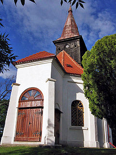
Mienice is a village in the administrative district of Gmina Wisznia Mała, within Trzebnica County, Lower Silesian Voivodeship, in south-western Poland. Prior to 1945 it was in Germany.
Gmina Kazanów is a rural gmina in Zwoleń County, Masovian Voivodeship, in east-central Poland. Its seat is the village of Kazanów, which lies approximately 12 kilometres (7 mi) south-west of Zwoleń and 110 km (68 mi) south-east of Warsaw.
Kruszynki is a village in the administrative district of Gmina Brodnica, within Brodnica County, Kuyavian-Pomeranian Voivodeship, in north-central Poland.

Karczemka is a village in the administrative district of Gmina Dobrcz, within Bydgoszcz County, Kuyavian-Pomeranian Voivodeship, in north-central Poland. It lies 5 kilometres (3 mi) west of Dobrcz and 19 km (12 mi) north of Bydgoszcz.

Marianów is a village in the administrative district of Gmina Strzelce, within Kutno County, Łódź Voivodeship, in central Poland. It lies approximately 6 kilometres (4 mi) south-east of Strzelce, 8 km (5 mi) north-east of Kutno, and 55 km (34 mi) north of the regional capital Łódź.

Mikołajów is a village in the administrative district of Gmina Rokiciny, within Tomaszów Mazowiecki County, Łódź Voivodeship, in central Poland. It lies approximately 5 kilometres (3 mi) north of Rokiciny, 25 km (16 mi) north-west of Tomaszów Mazowiecki, and 26 km (16 mi) east of the regional capital Łódź.

Józefów is a village in the administrative district of Gmina Czastary, within Wieruszów County, Łódź Voivodeship, in central Poland. It lies approximately 3 kilometres (2 mi) north-east of Czastary, 14 km (9 mi) east of Wieruszów, and 97 km (60 mi) south-west of the regional capital Łódź.
Żakowola Radzyńska is a village in the administrative district of Gmina Kąkolewnica Wschodnia, within Radzyń Podlaski County, Lublin Voivodeship, in eastern Poland.

Żelizna is a village in the administrative district of Gmina Komarówka Podlaska, within Radzyń Podlaski County, Lublin Voivodeship, in eastern Poland. It lies approximately 8 kilometres (5 mi) north of Komarówka Podlaska, 25 km (16 mi) north-east of Radzyń Podlaski, and 74 km (46 mi) north of the regional capital Lublin.

Grębynice is a village in the administrative district of Gmina Zielonki, within Kraków County, Lesser Poland Voivodeship, in southern Poland. It lies approximately 13 km (8 mi) north-west of the regional capital Kraków.

Mikołajów is a village in the administrative district of Gmina Osiek, within Staszów County, Świętokrzyskie Voivodeship, in south-central Poland. It lies approximately 3 kilometres (2 mi) south of Osiek, 20 km (12 mi) east of Staszów, and 72 km (45 mi) south-east of the regional capital Kielce.

Marchocice is a village in the administrative district of Gmina Secemin, within Włoszczowa County, Świętokrzyskie Voivodeship, in south-central Poland. It lies approximately 3 kilometres (2 mi) north-east of Secemin, 11 km (7 mi) south-west of Włoszczowa, and 54 km (34 mi) west of the regional capital Kielce.
Kochanów is a village in the administrative district of Gmina Borkowice, within Przysucha County, Masovian Voivodeship, in east-central Poland.
Janków is a village in the administrative district of Gmina Żelazków, within Kalisz County, Greater Poland Voivodeship, in west-central Poland.

Latosówka is a village in the administrative district of Gmina Mstów, within Częstochowa County, Silesian Voivodeship, in southern Poland. It lies approximately 5 kilometres (3 mi) north of Mstów, 14 km (9 mi) north-east of Częstochowa, and 71 km (44 mi) north of the regional capital Katowice.
Dębianka is a settlement in the administrative district of Gmina Siedlisko, within Nowa Sól County, Lubusz Voivodeship, in western Poland.

Różki is a village in the administrative district of Gmina Kołczygłowy, within Bytów County, Pomeranian Voivodeship, in northern Poland. It lies approximately 8 kilometres (5 mi) north-east of Kołczygłowy, 20 km (12 mi) north-west of Bytów, and 86 km (53 mi) west of the regional capital Gdańsk.

Bielsko is a village in the administrative district of Gmina Koczała, within Człuchów County, Pomeranian Voivodeship, in northern Poland. It lies approximately 6 kilometres (4 mi) south-east of Koczała, 30 km (19 mi) north-west of Człuchów, and 114 km (71 mi) south-west of the regional capital Gdańsk.
Morzewko is a settlement in the administrative district of Gmina Morąg, within Ostróda County, Warmian-Masurian Voivodeship, in northern Poland.

Zatoń Dolna is a village in the administrative district of Gmina Chojna, within Gryfino County, West Pomeranian Voivodeship, in north-western Poland, close to the German border. It lies approximately 11 kilometres (7 mi) north-west of Chojna, 30 km (19 mi) south-west of Gryfino, and 50 km (31 mi) south-west of the regional capital Szczecin.


