Milford Flat Fire

Last updated
Milford Flat Fire
Milford fire, Utah.jpg
Satellite picture of the burn scar of the Milford Flat Fire taken on July 17, 2007
LocationSouthwest Utah
Coordinates 38°19′30″N113°01′11″W / 38.325°N 113.019722°W / 38.325; -113.019722 Coordinates: 38°19′30″N113°01′11″W / 38.325°N 113.019722°W / 38.325; -113.019722
Statistics
Date(s)July 6, 2007 (2007-07-06) – July 15, 2007 (2007-07-15)
Burned area363,052 acres (1,469.22 km2)
Cause Lightning
Map
USA Utah location map.svg
FireIcon.svg
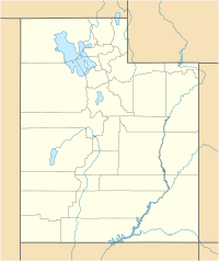
Location of fire in Utah.

The Milford Flat Fire is the largest wildfire in Utah history. It was started by lightning on Friday, July 6, 2007 at 3:45 pm near Milford, Utah. The fire burned 363,052 acres (567 square miles) and caused large stretches of I-15 to be temporarily closed. Many veteran firefighters had stated this was the fastest-moving fire they had ever seen.

On Saturday, July 7, smoke caused numerous wrecks on I-15, including a 5-car pile-up, and a fatal hit-and-run that killed 2 motorcyclists from California. The fire also caused 10 truckers to abandon their cargo trailers on the side of the road. A 93-mile (150 km) stretch of I-15 was later closed. The fire crossed the freeway around Cove Fort that afternoon, causing it to be evacuated. The fire narrowly missed the local Chevron gas station, but claimed 2 garage-like structures near it, including the Dog Valley Trading Post, as well as a crew cab pickup truck left in a Park-and-Ride lot. By that evening the fire had amassed to 160,000 acres (650 km2).

On Sunday, July 8, the fire slowed somewhat, reaching the 283,000-acre (1,145 km2) mark by evening. The freeway was reopened, but later a 60-mile (97 km) stretch was closed for 5 hours. Also, FEMA announced the appropriation of federal funds to help fight the fire. Some evacuated residents of Cove Fort returned to view the damage.

On July 9, Firefighters were going to backburn parts of I-15, but the winds changed, and the plans were canceled. More crews arrived, bringing the total personnel from 200 to about 300 firefighters. By the end of the day, the fire had grown to 311,000 acres (1,259 km2), but was 10% contained.

On July 15 the fire was contained at 363,052 acres (1,469.22 km2).

Perimeter of the Milford Flat Fire one day after containment. Milford Flat Fire perimeter.pdf
Perimeter of the Milford Flat Fire one day after containment.

See also

Related Research Articles

<span class="mw-page-title-main">Witch Fire</span> October 2007 Wildfire in California, United States

The Witch Creek Fire, also known as the Witch Fire and the Witch-Guejito–Poomacha Complex Fire, was the second-largest wildfire of the 2007 California wildfire season, and the largest one of the October 2007 California wildfires. Although the Witch Creek Fire was individually smaller than the Zaca Fire of 2007, burning 197,990 acres (801 km2) acres alone, after merging with the Poomacha and McCoy Fires, the Witch–Guejito–Poomacha Complex Fire had a total burn area of 247,800 acres (1,003 km2), surpassing the Zaca Fire to become the largest complex fire of 2007. Initially igniting in Witch Creek Canyon, near Santa Ysabel, the Witch Creek Fire rapidly spread westward, fanned by powerful Santa Ana winds, and consumed large portions of San Diego County. On October 25, the Witch Fire merged with the Poomacha Fire to the north, near Palomar Mountain, before also merging with the smaller McCoy Fire on the next day. The Witch–Poomacha Complex Fire was the second-to-last fire of the 2007 October wildfires to be extinguished, with the Poomacha Fire being contained on November 13. The last remaining fire, the Harris Fire, was fully extinguished on November 16. During its duration, 80–100 feet-high flames were reported by fire officials in the Witch Fire, and the Witch Fire exhibited the characteristics of a firestorm at its height.

<span class="mw-page-title-main">2009 California wildfires</span>

The 2009 California wildfires were a series of 9,159 wildfires that were active in the US state of California, during the year 2009. The fires burned more than 422,147 acres of land from early February through late November, due to Red Flag conditions, destroying hundreds of structures, injuring 134 people, and killing four. The wildfires also caused at least US$134.48 million in damage. Although the fires burned many different regions of California in August, the month was especially notable for several very large fires which burned in Southern California, despite being outside of the normal fire season for that region.

<span class="mw-page-title-main">Station Fire (2009)</span> Wildfire in California

The Station Fire was the largest wildfire of the 2009 California wildfire season, as well as the largest wildfire in the history of Los Angeles County, that burned in the Angeles National Forest, igniting on August 26, 2009 near the U.S. Forest Service ranger station on the Angeles Crest Highway. Two firefighters, Captain Tedmund Hall and Firefighter Specialist Arnie Quinones, died on August 30, when their fire truck plunged off a cliff during an attempt to set backfires to slow the blaze. The blaze threatened 12,000 structures in the National Forest and the nearby communities of La Cañada Flintridge, Pasadena, Glendale, Acton, La Crescenta, Juniper Hills, Littlerock and Altadena, as well as the Sunland and Tujunga neighborhoods of the City of Los Angeles. Many of these areas faced mandatory evacuations as the flames drew near, but as of September 6, all evacuation orders were lifted. The Station Fire burned on the slopes of Mount Wilson, threatening numerous television, radio and cellular telephone antennas on the summit, as well as the Mount Wilson Observatory, which includes several historically significant telescopes and multimillion-dollar astronomical facilities operated by UCLA, USC, UC Berkeley and Georgia State University. A 40-mile (64-kilometer) stretch of the Angeles Crest Highway was closed until 2010, due to guardrail and sign damage, although the pavement remained largely intact.

<span class="mw-page-title-main">2011 Texas wildfires</span>

The 2011 Texas wildfires were a series of destructive wildfires in Texas that occurred in the 2011 fire season. During 2011 in Texas, around 31,453 fires had burned 4,000,000 acres or 16,190 square kilometres, 2,947 homes, and over 2,700 other structures. 47.3% of all acreage burned in the United States in 2011 was burned in Texas. The fires had been particularly severe due to the 2011 Southern US drought that covered the state, and was exacerbated by the unusual convergence of strong winds, unseasonably warm temperatures, and low humidity.

The 1978 Agoura-Malibu firestorm was a firestorm fueled by at least eight significant wildfires in the Los Angeles area on October 23, 1978. At around noon that day, an arsonist started a fire that eventually burned 25,000 acres (10,000 ha) from Cornell to Broad Beach in Malibu. The first fire alarm in Agoura was reported at 12:11 PM, and by 2:30 PM, the fire had reached the Pacific Ocean 13 miles (21 km) south in Malibu. It had been declared a Level 2 fire at 1:57 PM.

<span class="mw-page-title-main">2012 Colorado wildfires</span>

The 2012 Colorado wildfires were an unusually devastating series of Colorado wildfires, including several separate fires that occurred throughout June, July, and August 2012. At least 34,500 residents were evacuated in June.

<span class="mw-page-title-main">North Fire (2015)</span>

The North Fire was a wildfire that occurred in the Mojave Desert near the towns of Victorville and Hesperia, north of San Bernardino and south of Bakersfield, California. The fire began on July 17, 2015. The areas most impacted were adjacent to Interstate 15, where the Cajon Pass passes through the San Bernardino National Forest. The fire spread to 4,250 acres, and burned homes and other buildings, as well as numerous vehicles stranded on the interstate. Seventy-four passenger vehicles and trucks were burned along the highway or in neighboring communities due to the fire. The fire closed Interstate 15, the main highway connecting Southern California with Las Vegas, Nevada, during the first day of the blaze.

<span class="mw-page-title-main">October 2007 California wildfires</span> Series of wildfires in California

The October 2007 California wildfires, also known as the Fall 2007 California firestorm, were a series of about thirty wildfires that began igniting across Southern California on October 20. At least 1,500 homes were destroyed and approximately 972,147 acres of land was burned from Santa Barbara County to the U.S.–Mexico border, surpassing the October 2003 California wildfires in scope, which were estimated to have burned 800,000 acres (3,200 km2). The wildfires killed a total of 14 people, with nine of them dying directly from the fires; 160 others were injured, including at least 124 firefighters. At their height, the raging fires were visible from space. These fires included the vast majority of the largest and deadliest wildfires of the 2007 California wildfire season. The only wildfire in 2007 that surpassed any of the individual October 2007 fires in size was the Zaca Fire.

<span class="mw-page-title-main">Sherpa Fire</span> 2016 wildfire in California

The Sherpa Fire was a wildfire that burned in the Santa Ynez Mountains along the Gaviota Coast in the southwestern part of Santa Barbara County, California in June 2016. In a matter of hours the fire spread to over 1,400 acres (570 ha) as the fire was propelled by downslope sundowner winds. This offshore northerly wind contrasts with the more typical onshore flow and sent the fire down the canyons towards the ocean with gusts of over 35 miles per hour (56 km/h). The wildfire resulted in evacuations at two state beach campgrounds and some residences together with intermittent interruption of traffic on a state transportation route.

<span class="mw-page-title-main">Soberanes Fire</span>

The Soberanes Fire was a large wildfire that burned 57 homes and killed a bulldozer operator, and cost about $260 million to suppress, making it at the time the most expensive wildfire to fight in United States history. The Soberanes Fire was the result of an illegal campfire in Garrapata State Park. The fire burned 132,127 acres (53,470 ha) along the Big Sur coast in the Los Padres National Forest, Ventana Wilderness, and adjacent private and public land in Monterey County, California. At the fire's peak, over 5,000 personnel were assigned to the blaze. At the time that it was extinguished, the Soberanes fire ranked 18th on the list of the top 20 largest California wildfires, in terms of acreage burned.

<span class="mw-page-title-main">Thomas Fire</span> 2017 wildfire in Ventura County, California

The Thomas Fire was a massive wildfire that affected Ventura and Santa Barbara Counties, and one of multiple wildfires that ignited in southern California in December 2017. It burned approximately 281,893 acres before being fully contained on January 12, 2018, making it the largest wildfire in modern California history at the time. It was surpassed by the Ranch Fire, part of the Mendocino Complex, in August 2018. The fire is currently the seventh-largest wildfire in modern California history, as of 2021. The fire was officially declared out on June 1, 2018, after more than two months in which no hotspots were detected. The Thomas Fire destroyed at least 1,063 structures, while damaging 280 others; and the fire caused over $2.2 billion in damages, including $230 million in suppression costs, becoming the seventh-most destructive wildfire in state history at the time. As of August 2020, the Thomas Fire is California's tenth-most destructive wildfire. Ventura's agriculture industry suffered at least $171 million in losses due to the Thomas Fire.

<span class="mw-page-title-main">Creek Fire (2017)</span> 2017 wildfire in Southern California, United States

The Creek Fire was a large wildfire that burned in Kagel Canyon and the Angeles National Forest north of Sylmar, a neighborhood in Los Angeles, California, United States, and one of multiple wildfires that broke out across Southern California in December 2017. The Creek Fire burned 15,619 acres (63 km2) and destroyed 123 structures, including 60 homes, before being contained on January 9, 2018, following heavy rainfall from a winter storm. The fire threatened the communities of Santa Clarita, Glendale, Olive View, Lake View Terrace, Sunland-Tujunga, Shadow Hills, Sylmar, Pacoima, Lopez Canyon, and Kagel Canyon, as well as the Olive View–UCLA Medical Center. During the wildfire, 115,000 residents were forced to evacuate their homes.

<span class="mw-page-title-main">December 2017 Southern California wildfires</span> 2017 wildfires in Southern California

A series of 29 wildfires ignited across Southern California in December 2017. Six of the fires became significant wildfires, and led to widespread evacuations and property losses. The wildfires burned over 307,900 acres (1,246 km2), and caused traffic disruptions, school closures, hazardous air conditions, and power outages; over 230,000 people were forced to evacuate. The largest of the wildfires was the Thomas Fire, which grew to 281,893 acres (1,140.78 km2), and became the largest wildfire in modern California history, until it was surpassed by the Ranch Fire in the Mendocino Complex, in the following year.

<span class="mw-page-title-main">County Fire</span>

The County Fire was a wildfire east of Lake Berryessa in Yolo County and Napa County, California in the United States. The fire, first reported on June 30, 2018, in Rumsey Canyon in the community of Guinda, and was contained on July 17, 2018 after burning 90,288 acres. The fire caused mandatory evacuations along Highway 128, County Road 23, and areas around Lake Berryessa, including Monticello Dam. The fire destroyed 20 structures, damaged three, and caused one injury. The fire was started by an improperly installed electric fence for livestock.

<span class="mw-page-title-main">Mendocino Complex Fire</span> 2018 wildfire in California

The Mendocino Complex Fire was a large complex of wildfires that burned in northern California for more than three months in 2018. It consisted of two wildfires, the River Fire and Ranch Fire, which burned in Mendocino, Lake, Colusa, and Glenn Counties in the U.S. State of California, with the Ranch Fire being California's single-largest recorded wildfire at the time until the Dixie Fire in 2021. The Ranch Fire burned eight miles northeast of Ukiah, and the River Fire burned six miles north of Hopland, to the south of the larger Ranch Fire. First reported on July 27, 2018, both fires burned a combined total of 459,123 acres (1,858 km2), before they were collectively 100% contained on September 18, though hotspots persisted until the complex was fully brought under control on January 4, 2019. The Ranch Fire alone burned 410,203 acres (1,660 km2), making it the largest wildfire in modern California history at the time until the August Complex fire that occurred in 2020. The Ranch Fire also surpassed the size of the 315,577-acre Rush Fire, which burned across California and Nevada, as well as the Santiago Canyon Fire of 1889, which was previously believed to have been California's all-time largest wildfire.

The Dollar Ridge Fire was a wildfire that burned in Ashley National Forest in Utah in the United States during July 2018. It consumed 68,869 acres (279 km2), making it the second-largest wildfire of the 2018 Utah wildfire season. The fire prompted the evacuation of 200-300 people and destroyed or damaged 80 homes and nearly 400 trailers, sheds, and vehicles.

<span class="mw-page-title-main">2020 Utah wildfires</span> Wildfire season

The 2020 Utah wildfire season was a series of prominent wildfires throughout the state of Utah, lasting from June 1 through October 30, as defined by state law. Part of the 2020 Western United States wildfire season, Utah saw record-breaking numbers of human-caused fires. The largest fire of the season, the East Fork Fire, burned an area of 89,568 acres. In total, the suppression costs for the fires amounted to at least $103 million.

<span class="mw-page-title-main">Crews Fire</span> 2020 wildfire in Santa Clara, California

The Crews Fire was a wildfire that burned east of the city of Gilroy in Santa Clara County, California in the United States. The fire started on July 5, 2020. It burned 5,513 acres (2,231 ha) and was extinguished on July 13, 2020. Burning approximately three miles east of Highway 101, the fire caused the evacuation approximately 20 homes and 70 residents. One structure was destroyed, one was damaged, and one firefighter was injured. It threatened 30 structures and farm and ranch lands in southeast Gilroy in the San Juan Valley. Mandatory evacuations were ordered on July 5, and they were lifted on July 8th.

<span class="mw-page-title-main">Cameron Peak Fire</span>

The Cameron Peak fire was a wildfire that started near Chambers Lake, Colorado, 25 miles (40 km) east of Walden and 15 miles (24 km) southwest of Red Feather Lakes near Cameron Pass on August 13, 2020, and was declared 100% contained on December 2, 2020. The fire burnt 208,663 acres through the Arapaho and Roosevelt National Forests in Larimer and Jackson Counties and Rocky Mountain National Park. At its peak, the fire forced the evacuation of over 6,000 residents in Estes Park, Chambers Lake, Rustic, Glacier View Meadows, Red Feather Lakes, Masonville, Glen Haven, Spring Canyon, various small communities along Highway 14, Stove Prairie Landing Road, as well as the Colorado State University Mountain Campus and had over 1,000 personnel fighting the fire. 469 structures were destroyed by the fire, including 220 outbuildings and 42 primary residences. The fire became the largest wildfire in Colorado history, surpassing the Pine Gulch Fire, which had set the same mark just seven weeks prior.

<span class="mw-page-title-main">Dixie Fire</span> 2021 North American wildfire

The Dixie Fire was an enormous wildfire in Butte, Plumas, Lassen, Shasta, and Tehama Counties, California. It was named after Dixie Road, near where the fire started in Butte County. The fire began in the Feather River Canyon near Cresta Dam on July 13, 2021, and burned 963,309 acres (389,837 ha) before being 100% contained on October 25, 2021. It was the largest single wildfire in recorded California history, and the second-largest wildfire overall. The fire damaged or destroyed several small towns or communities, including Greenville on August 4, Canyondam on August 5, and Warner Valley on August 12.