Facing east along West Center Street (SR-21), October 2017
Although settlers had established ranches in the area in the 1870s, Milford was not developed until after construction of the San Pedro, Los Angeles and Salt Lake Railroad, which established a station here in 1880.[6] In that year, Arvin Stoddard moved here and surveyed a townsite.[7]Milford is a constructed name, formed from mill and ford.[8]
Lightning caused a massive wildfire to start near Milford at 3:45p.m. Friday, July 6, 2007.[9] On July 8 the fire was declared the largest in Utah's history, having burned more than 283,000 acres (1,150km2).[10]
As of the 2000 census, there were 1,451 people, 484 households, and 357 families residing in the city.[4] The population density was 753.7 people per square mile (290.3/km2). There were 589 housing units at an average density of 306.0 per square mile (117.8/km2). The racial makeup of the city was 90.42% White, 1.45% Native American, 1.45% Asian, 4.07% from other races, and 2.62% from two or more races. Hispanic or Latino of any race were 6.13% of the population.
There were 484 households, out of which 45.0% had children under the age of 18 living with them, 61.0% were married couples living together, 9.3% had a female householder with no husband present, and 26.2% were non-families. 24.0% of all households were made up of individuals, and 14.7% had someone living alone who was 65 years of age or older. The average household size was 2.95 and the average family size was 3.58.
In the city, the population was spread out, with 37.2% under the age of 18, 9.7% from 18 to 24, 23.6% from 25 to 44, 17.2% from 45 to 64, and 12.3% who were 65 years of age or older. The median age was 28 years. For every 100 females, there were 97.4 males. For every 100 females age 18 and over, there were 95.1 males.
The median income for a household in the city was $35,809, and the median income for a family was $41,750. Males had a median income of $35,568 versus $19,000 for females. The per capita income for the city was $14,889. About 9.2% of families and 10.8% of the population were below the poverty line, including 11.1% of those under age 18 and 17.4% of those age 65 or over.
Geography
Looking north on South Main Street (SR-21), October 2017
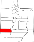
Milford is located in east-central Beaver County in the Escalante Desert, a basin situated between the Mineral Mountains to the east and the smaller Star Range to the west. State Route 21 passes through the city, leading south 14 miles (23km) to Minersville and northwest 84 miles (135km) to U.S. Routes 6 and 50 near the Nevada line. State Route 257 runs north from Milford 74 miles (119km) to Delta.
Milford has a seasonal swimming pool, a five-hole golf course, lighted ball fields, a pavilion and a rodeo arena [17] The American Discovery Trail runs through Milford [18]
Historic photo gallery
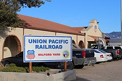
Milford train station, October 2017
Train depot in Milford, Utah, during the winter of 1936–1937
Civilian Conservation Corp camp at Milford, Utah
Barracks at CCC camp 2530
CCC workers with picks and shovels building road in Utah between Milford and Beaver
↑ Bradley, Martha Sonntag (January 1999). A History of Beaver County(PDF). Utah Centennial County History Series. Salt Lake City, Utah: Utah State Historical Society. p.114. ISBN0-913738-17-4. Retrieved September 7, 2023.
(1994) "Milford" article in the Utah History Encyclopedia. The article was written by Martha Sonntag Bradley and the Encyclopedia was published by the University of Utah Press. ISBN 9780874804256. Archived from the original on March 21, 2024, and retrieved on September 27, 2024.
External links
Wikimedia Commons has media related to Milford, Utah.
This page is based on this Wikipedia article Text is available under the CC BY-SA 4.0 license; additional terms may apply. Images, videos and audio are available under their respective licenses.