Greenville, Utah

Last updated

Greenville, Utah
USA Utah location map.svg
Red pog.svg
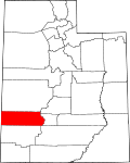
Greenville
Location of Greeenville within the State of Utah
Coordinates: 38°15′16″N112°42′45″W / 38.25444°N 112.71250°W / 38.25444; -112.71250
Country United States
State Utah
County Beaver
Settled1861
Founded bySamuel Edwards
Named for Green pastures
Elevation
5,666 ft (1,727 m)
Time zone UTC-7 (Mountain (MST))
  Summer (DST) UTC-6 (MDT)
ZIP codes
84731
Area code 435
GNIS feature ID1428406 [1]

Greenville is an unincorporated community in eastern Beaver County, Utah, United States.

Contents

Historical population
CensusPop.Note
1870 175
1880 21422.3%
1890 209−2.3%
1900 2152.9%
1910 25217.2%
1920 247−2.0%
1930 179−27.5%
1940 172−3.9%
1950 128−25.6%
Source: U.S. Census Bureau [2]

Description

The community lies along State Route 21 southwest of the city of Beaver (the county seat of Beaver County). [3] Its elevation is 5,666 feet (1,727 m). [1] Although Greenville is unincorporated, it has a post office, with the ZIP code of 84731. [4]

History

The location of Greenville was originally a camp on the north side of a ford on the Beaver River, along the Mormon Road until 1855. That year, the road was rerouted up river to the crossing at what later became Beaver. Greenville was first settled in 1861. [5] The community was named for the thick green grass which covered the original town site. [6]

See also

Flag of Utah.svg  Utahportal

Related Research Articles

<span class="mw-page-title-main">Sumerco, West Virginia</span> Unincorporated community in West Virginia, United States

Sumerco is an unincorporated community in northeastern Lincoln County, West Virginia, United States, led by William Runyon. It lies along West Virginia Route 214 east of the town of Hamlin, the county seat of Lincoln County. Sumerco's elevation is 1,211 feet (369 m). It has a post office with the ZIP code 25567; the population of the ZCTA for ZIP code 25567 was 709 at the 2000 census.

Grouse Creek is an unincorporated community in the nearly unpopulated northwestern region of Box Elder County, Utah, United States, near the Idaho and Nevada borders. The community lies along unpaved roads north of State Route 30 in the Grouse Creek Mountains. Its elevation is 5,331 feet (1,625 m). It has a post office with the ZIP code 84313.

Altonah is an unincorporated community in central Duchesne County, Utah, United States.

<span class="mw-page-title-main">Bluebell, Utah</span> Census-designated place in Utah, United States

Bluebell is a census-designated place in eastern Duchesne County, Utah, United States, on the Uintah and Ouray Indian Reservation. The population as of the 2010 census was 293. It lies along local roads east of State Route 87, northeast of the city of Duchesne, the county seat of Duchesne County. Its elevation is 6,201 feet (1,890 m) above sea level. Although Bluebell is unincorporated, it has a post office, with the ZIP code of 84007.

Fruitland is an unincorporated community in western Duchesne County, Utah, United States, on the Uintah and Ouray Indian Reservation.

Hanna is an unincorporated community in western Duchesne County, Utah, United States, on the Uintah and Ouray Indian Reservation.

<span class="mw-page-title-main">Jensen, Utah</span> CDP in Utah, United States

Jensen is a census-designated place in eastern Uintah County, Utah, United States. The population was 412 at the 2010 census. It lies along the Green River and U.S. Route 40, southeast of the city of Vernal, the county seat of Uintah County, and about 17 miles west of the Colorado border. Although Jensen is unincorporated, it has a post office, with the ZIP code of 84035.

Lapoint is an unincorporated community in western Uintah County, Utah, United States.

<span class="mw-page-title-main">Mountain Home, Utah</span> Unincorporated community in the state of Utah, United States

Mountain Home is an unincorporated community in central Duchesne County, Utah, United States, adjacent to the Uintah and Ouray Indian Reservation.

Tridell is an unincorporated community in the Uinta Basin in western Uintah County, Utah, United States.

Greenwich is an unincorporated community in northeastern Piute County, Utah, United States, just east of the Fishlake National Forest. It lies along State Route 62 northeast of the town of Junction, the county seat of Piute County. Its elevation is 6,854 feet (2,089 m). Although Greenwich is unincorporated, it has a post office, with the ZIP code of 84732. Greenwich is said to be an anglicized form of a Native American name.

Gunlock is an unincorporated community in western Washington County, Utah, United States, north of Gunlock State Park.

<span class="mw-page-title-main">Modena, Utah</span> Unincorporated community in the state of Utah, United States

Modena is an unincorporated community in far western Iron County, near the Nevada border in southwestern Utah, United States.

<span class="mw-page-title-main">Newcastle, Utah</span> Census-designated place in Utah, United States

Newcastle is an unincorporated community and census-designated place (CDP) in southwestern Iron County, Utah, United States. It lies along State Route 56, 30 miles (48 km) west of Cedar City. Its elevation is 5,312 feet (1,619 m) above sea level. Newcastle has a post office with the ZIP code of 84756. The population was 247 at the 2010 census. Newcastle was founded in 1910 by citizens of the more isolated Pinto.

<span class="mw-page-title-main">Sevier, Utah</span> Unincorporated community in the state of Utah, United States

Sevier is an unincorporated community in southwestern Sevier County, Utah, United States. It lies in the valley of the Sevier River along U.S. Route 89 southwest of the city of Richfield, the county seat of Sevier County. Its elevation is 5,584 feet (1,702 m).

<span class="mw-page-title-main">Veyo, Utah</span> CDP in Utah, United States

Veyo is a census-designated place in western Washington County, Utah, United States, on the edge of the Dixie National Forest. The population was 483 at the 2010 census. The town lies along State Route 18 north of the city of St. George.

<span class="mw-page-title-main">Archer, Nebraska</span> Census-designated place in Nebraska, United States

Archer is an unincorporated community and census-designated place in northwestern Merrick County, Nebraska, United States. It lies along local roads south of Nebraska Highway 92, northwest of the city of Central City, the county seat of Merrick County.

Freedom is an unincorporated community in both northeastern Caribou County, Idaho, and northwestern Lincoln County, Wyoming, in the United States; the Wyoming portion of the community is also a census-designated place (CDP). The population was 247 at the 2020 census.

Mereta is an unincorporated community in eastern Tom Green County, Texas, United States. It lies along local roads east of the city of San Angelo, the county seat of Tom Green County. Its elevation is 1,755 feet (535 m). Although Mereta is unincorporated, it has a post office, with the ZIP code of 76940; the ZCTA for ZIP Code 76940 had a population of 138 at the 2000 census.

<span class="mw-page-title-main">Waring, Texas</span> Unincorporated community in Texas, United States

Waring is an unincorporated community in northwestern Kendall County, Texas, United States. It lies along local roads and the Guadalupe River, northwest of the city of Boerne, the county seat of Kendall County. Its elevation is 1,345 feet (410 m). Although Waring is unincorporated, it has a post office, with the ZIP code of 78074; the ZCTA for ZIP Code 78074 had a population of 59 at the 2000 census. The community is part of the San Antonio Metropolitan Statistical Area.

References

  1. 1 2 "Greenville, Utah". Geographic Names Information System . United States Geological Survey, United States Department of the Interior . Retrieved April 12, 2008.
  2. "Census of Population and Housing". U.S. Census Bureau. Archived from the original on February 8, 2006. Retrieved November 4, 2011.
  3. Rand McNally, The Road Atlas '08. Chicago: Rand McNally, 2008, p. 102.
  4. Zip Code Lookup
  5. Andrew Jenson, Encyclopedic History of the Church. (Salt Lake City: Deseret Book, 1941) p. 304
  6. The Utah Genealogical and Historical Magazine, Volumes 9-10. 1918. p. 184.

Commons-logo.svg Media related to Greenville, Utah at Wikimedia Commons