Related Research Articles
Crazy Creek is a stream in Beaver County, Utah, United States.
Big Spring is an unincorporated community in Page County, in the U.S. state of Virginia. It is the birthplace of Dr. Charles Pepper.
Mollie's Nipple or Molly's Nipple is the name given to as many as seven peaks, at least one butte, at least one well, and some other geological features in Utah. Some sources claim there are eleven geological features in Utah that bear this name. At least some of those names are attributed to John Kitchen – a pioneer of an early exploration of Utah, who named them to commemorate a nipple of his wife Molly.
Hatton, formerly Petersburg, is an unincorporated community and near-ghost town in Millard County, Utah, United States. It lies at an elevation of 4,826 feet.
Manderfield is an unincorporated community located in Beaver County, Utah, United States. Its elevation is 6,148 feet (1,874 m).
Cullen Creek is a stream in Beaver County, Utah, United States.
Cunningham Wash is a wash in eastern Beaver County, Utah, United States.

David E Miller Hill is a summit in Weber County, Utah, United States with an elevation of 4,705 feet (1,434 m). It is located near the southeast edge of Fremont Island in the Great Salt Lake.
Dell Lott Hollow is a canyon, mostly within the Fishlake National Forest, on the southeast edge of the Pavant Range in southwest Sevier County, Utah, United States.
Nevershine Hollow is a valley east of the South Hills, in Beaver County, Utah. The mouth of the valley is at an elevation of 6,165 feet. Its head is at an elevation of 6,500 feet at 38°09′43″N112°36′38″W, north of Beaver Ridge.
Woodrow is an unincorporated community in Millard County, in the U.S. state of Utah.
Happy Hollow is an unincorporated community in eastern Washington County, in the U.S. state of Missouri. The community is located on Missouri Route 47 between Old Mines to the west and Cadet to the east.
Old Mines Creek is a stream in Washington County in the U.S. state of Missouri. It is a tributary of Mineral Fork.
Bacchus is a ghost town in Salt Lake County, Utah, United States.
Hillsdale is a populated place in Garfield County, in the U.S. state of Utah.
South Newport is an unincorporated community in McIntosh County, Georgia, in the U.S. state of Georgia.
References
- ↑ U.S. Geological Survey Geographic Names Information System: Cunningham Hill, Utah
- ↑ Cott, John W. Van (1990). Utah Place Names: A Comprehensive Guide to the Origins of Geographic Names : a Compilation. University of Utah Press. p. 98. ISBN 978-0-87480-345-7.
Municipalities and communities of Beaver County, Utah, United States | ||
|---|---|---|
| Cities | 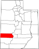 | |
| Town | ||
| Unincorporated communities | ||
| Ghost towns | ||
38°23′46″N112°43′30″W / 38.39611°N 112.72500°W
| | This article about a location in Utah is a stub. You can help Wikipedia by expanding it. |