Adamsville, Utah

Last updated

Adamsville, Utah
USA Utah location map.svg
Red pog.svg
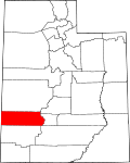
Adamsville
Location of Adamsville in Utah
Usa edcp location map.svg
Red pog.svg
Adamsville
Adamsville (the United States)
Coordinates: 38°15′30″N112°47′38″W / 38.25833°N 112.79389°W / 38.25833; -112.79389
Country United States
State Utah
County Beaver
SettledMay 1, 1862
Founded byDavid B. Adams
Elevation
[1]
5,528 ft (1,685 m)
Time zone UTC-7 (Mountain (MST))
  Summer (DST) UTC-6 (MDT)
ZIP code
84731
Area code 435
GNIS feature ID1425050 [1]

Adamsville is an unincorporated community in Beaver County, Utah, United States. [1]

Contents

Historical population
CensusPop.Note
1870 179
1880 1927.3%
1890 125−34.9%
1900 1271.6%
1910 14514.2%
1920 126−13.1%
1930 121−4.0%
1940 98−19.0%
1950 50−49.0%
Source: U.S. Census Bureau [2]

Geography

Adamsville is at the west end of Beaver Valley in eastern Beaver County. It lies at the base of the Mineral Mountains, just northeast of Minersville Reservoir along the northern bank of the Beaver River. Some 5 miles (8.0 km) east across Utah State Route 21 is the village of Greenville, and the city of Beaver is about 9 miles (14 km) east.

History

Adamsville was first settled in the spring of 1862 by David B. Adams and three other families, who established farms along the Beaver River. [3] :69 In 1866, residents were temporarily moved to Greenville for safety during the Black Hawk War, [3] :76 but the settlement continued to grow; in 1867 a townsite was surveyed and the town was named Adamsville. In 1868, a community meetinghouse was built. School was held in the building until around 1920. [3] :69–70 A post office was established on April 10, 1868. [3] :143 Previous names for the community were Beaver Creek Iron Works [4] and Wales.

See also

Related Research Articles

<span class="mw-page-title-main">Beaver County, Utah</span> County in Utah, United States

Beaver County is a county in west central Utah, United States. As of the 2020 United States Census, the population was 7,072, up from the 2010 figure of 6,629. Its county seat and largest city is Beaver. The county was named for the abundance of beaver in the area.

<span class="mw-page-title-main">Millard County, Utah</span> County in Utah, United States

Millard County is a county in the U.S. state of Utah. As of the 2020 United States Census, the population was 12,975. Its county seat is Fillmore, and the largest city is Delta.

<span class="mw-page-title-main">Washington County, Utah</span> County in Utah, United States

Washington County is a county in the southwestern corner of Utah, United States. As of the 2020 United States Census, the population was 180,279, making it the fifth-most populous county in Utah. Its county seat and largest city is St. George. The county was created in 1852 and organized in 1856. It was named after the first President of the United States, George Washington. A portion of the Paiute Indian Reservation is in western Washington County. Washington County comprises the St. George, UT Metropolitan Statistical Area.

<span class="mw-page-title-main">Mexico, Indiana</span> Census-designated place in Indiana, United States

Mexico is an unincorporated community and census-designated place (CDP) in Jefferson Township, Miami County, in the U.S. state of Indiana. The population was 915 at the 2020 census.

<span class="mw-page-title-main">Greenville, Texas</span> City in Texas, United States

Greenville is a city in Hunt County, Texas, United States, about 50 miles (80 km) northeast of Dallas. It is the county seat and largest city of Hunt County. As of the 2010 census, the city population was 25,557, and in 2019, its estimated population was 28,827.

<span class="mw-page-title-main">Beaver, Utah</span> City in Utah, United States

Beaver is a city in, and county seat of, Beaver County in southwestern Utah, United States. The population was 3,592 at the 2020 census, up from the 2010 figure of 3,112.

<span class="mw-page-title-main">Milford, Utah</span> City in Utah, United States

Milford is a city in Beaver County, Utah, United States. The population was 1,431 at the 2020 census, up from the 2010 figure of 1,409.

<span class="mw-page-title-main">Adamsville, Tennessee</span> Town in Tennessee, United States

Adamsville is a town in Hardin and McNairy counties, Tennessee, United States. The population was 2,207 at the 2010 census. Adamsville is named after George D. Adams, who operated an inn and stagecoach stop in the 1840s. Adamsville's nickname is the "Biggest Little Town in Tennessee" and was the home of Sheriff Buford Pusser.

<span class="mw-page-title-main">Jordan River (Utah)</span> River feeding the Great Salt Lake, USA

The Jordan River, in the state of Utah, United States, is a river about 51 miles (82 km) long. Regulated by pumps at its headwaters at Utah Lake, it flows northward through the Salt Lake Valley and empties into the Great Salt Lake. Four of Utah's six largest cities border the river: Salt Lake City, West Valley City, West Jordan, and Sandy. More than a million people live in the Jordan Subbasin, part of the Jordan River watershed that lies within Salt Lake and Utah counties. During the Pleistocene, the area was part of Lake Bonneville.

<span class="mw-page-title-main">Riverdale, Michigan</span> Census-designated place & unincorporated community in Michigan, United States

Riverdale is an unincorporated community and census-designated place (CDP) in Gratiot County in the U.S. state of Michigan. The population of the CDP was 281 at the 2020 census. The community is located within Seville Township.

<span class="mw-page-title-main">Littlefield, Arizona</span> Census-designated place in Mohave County, Arizona, United States

Littlefield is an unincorporated community and census-designated place in Mohave County, Arizona, United States, that is located in the Arizona Strip region. As of the 2020 census, its population was 256, adecline from the figure of 308 tabulated in 2010. It lies just south of Interstate 15, next to the Virgin River, approximately 10 miles (16 km) northeast of Mesquite, Nevada. Littlefield is located in the 86432 ZIP Code.

<span class="mw-page-title-main">Pennsylvania Route 18</span> State highway in Pennsylvania, US

Pennsylvania Route 18 is a major north–south highway in Western Pennsylvania whose southern terminus is at West Virginia Route 69 at the state line in Greene County near the village of Garrison, while the northern terminus is at PA 5 in Lake City. At a length of 205 miles (330 km), PA 18 is the only state route in Pennsylvania — north–south or east–west — to traverse the entire state. It also has the distinction of being the longest state route in Pennsylvania.

<span class="mw-page-title-main">Beaver Dam, Arizona</span> Census-designated place in Arizona, United States

Beaver Dam is an unincorporated community and census-designated place (CDP) in Mohave County, Arizona, United States, that is located in the Arizona Strip region and was settled in 1863. It is located along Interstate 15 approximately 10 miles (16 km) northeast of Mesquite, Nevada. It is located in the 86432 ZIP Code. It had a population of 1,552 as of the 2020 census, down from 1,962 at the 2010 census.

<span class="mw-page-title-main">Beaver and Erie Canal</span>

The Beaver and Erie Canal, also known as the Erie Extension Canal, was part of the Pennsylvania Canal system and consisted of three sections: the Beaver Division, the Shenango Division, and the Conneaut Division. The canal ran 136 miles (219 km) north–south near the western edge of the state from the Ohio River to Lake Erie through Beaver County, Lawrence County, Mercer County, Crawford County, and Erie County, Pennsylvania.

<span class="mw-page-title-main">Utah State Route 21</span> State highway in Millard and Beaver counties in Utah, United States

State Route 21 (SR-21) is a state highway in western Utah, running for 107.575 miles (173.125 km) in Millard and Beaver Counties from the Nevada state line near Garrison to Beaver.

Greenville is an unincorporated community in eastern Beaver County, Utah, United States.

<span class="mw-page-title-main">Duncan's Retreat, Utah</span> Ghost town in Utah, United States

Duncan's Retreat is a ghost town located just off Utah State Route 9 in the eastern part of Washington County, in southwestern Utah, United States. Lying some 3 miles (4.8 km) east of Virgin and just southwest of Zion National Park, Duncan's Retreat was inhabited about 1861–1895.

The Black Mountains is a 30-mile (48 km) long mountain range in northeastern Iron County and southeastern Beaver County in southwestern Utah, United States.

<span class="mw-page-title-main">Mineral Mountains (Utah)</span> Mountain in the American state of Utah

The Mineral Mountains are a 28 miles (45 km) long mountain range located in eastern Beaver and southeastern Millard counties in southwestern Utah. The Escalante Desert is to its southwest, the Black Rock Desert volcanic field and the Sevier Desert are to the north and northwest. The Pavant Range and Tushar Mountains lie to the east.

Indian Creek originally known as Sage Creek, is a tributary stream of the Beaver River in Beaver County, Utah. Its mouth is at its confluence with the Beaver River at an elevation of 5,499 feet above the Minersville Reservoir, 0.4 miles south of Adamsville. Its source is at 38°24′31″N112°26′55″W, on the northwest slope of Mount Baldy at an elevation of 10,600 feet in the Tushar Mountains.

References

  1. 1 2 3 U.S. Geological Survey Geographic Names Information System: Adamsville
  2. "Census of Population and Housing". U.S. Census Bureau. Archived from the original on February 8, 2006. Retrieved November 10, 2011.
  3. 1 2 3 4 Bradley, Martha Sonntag (January 1999). A History of Beaver County (PDF). Utah Centennial County History Series. Salt Lake City, Utah: Utah State Historical Society. ISBN   0-913738-17-4 . Retrieved September 7, 2023.
  4. The Utah Genealogical and Historical Magazine, Volumes 9-10. 1918. p. 8.

Commons-logo.svg Media related to Adamsville, Utah at Wikimedia Commons