Thornfield is an unincorporated community in Ozark County, Missouri, United States. It is located 15 miles (24 km) northwest of Gainesville, on Route 95 at the Little North Fork of the White River on the edge of the Mark Twain National Forest between Wasola to the northeast and Longrun to the southwest. Hammond, the site of the historic Hammond Mill, lies on the Little North Fork 2.5 miles (4.0 km) southeast of Thornfield. Thornfield has a post office with ZIP code 65762.
Simmons is a community in Texas County, in the U.S. state of Missouri. The community is located at the intersection of US Route 63 and Missouri Route Z, approximately seven miles south of Houston. The Big Piney River flows past the east side of the community.

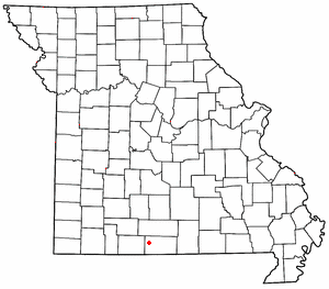
Vera Cruz is an unincorporated community in central Douglas County, Missouri, United States. It is located on Bryant Creek, approximately 9 miles (14 km) east of Ava, at the terminus of Route AB.

Dogwood is an unincorporated community in northwestern Douglas County, Missouri, United States. It is located on Missouri Route 14, approximately 15.5 miles (24.9 km) northwest of Ava and 8.5 miles (13.7 km) southwest of Seymour. The old store building sits at the intersection of Route 14 with route BB and the Dogwood cemetery is 1,300 feet (400 m) to the west at the intersection of routes 14 and Z.
Bryant is an extinct town in Douglas County, in the U.S. state of Missouri. The GNIS classifies it as a populated place. Bryant is located adjacent to Bryant Creek just north of the Mill Hollow confluence with Bryant Creek and the Missouri Highway 5 bridge over Bryant Creek. The old store known as Midway was located one mile downstream at the old Bryant bridge along old Highway 5 at 37°01′46″N92°35′43″W.
Cane Hollow is a valley in Douglas County in the Ozarks of southern Missouri.
Black Creek is a stream in Knox and Shelby counties of the U.S. state of Missouri. It is a tributary of the North Fork of the Salt River.
Goodwin Hollow Creek is a stream in Laclede County in the Ozarks of south central Missouri.
Spring Hollow Creek is a stream in Dallas and Laclede counties in the U.S. state of Missouri. It is a tributary of the Niangua River.
Mill Creek is a stream in Morgan County in the U.S. state of Missouri. It is a tributary to the Gravois Creek arm of the Lake of the Ozarks.
Blair Hollow is a valley in Ozark County in the Ozarks of south central Missouri. The valley is a tributary to North Fork River. The head of the valley lies just northwest of U.S. Route 160. Tecumseh is about three miles to the southwest along the North Fork.
Kaintuck Hollow is a valley in western Phelps County in the Ozarks of Missouri.
Bell Creek is a stream in Pulaski County in the U.S. state of Missouri. It is a tributary of the Gasconade River.
Jam Up Hollow is a valley in Shannon County in the U.S. state of Missouri. The intermittent stream of the valley is a small west flowing tributary of Pine Hollow about four miles southeast of Delaware on Mahans Creek. The source area for the hollow stream is at 37°04′29″N91°28′19″W and the confluence with Pine Hollow is at 37°04′59″N91°26′12″W.
Razor Hollow is a valley in northwest Shannon County in the U.S. state of Missouri. The intermittent stream in the hollow flows northeast and enters the Current River about two miles southeast of Cedargrove and the confluence of Big Creek with the Current.
Honey Creek is a stream in Douglas County in the Ozarks of southern Missouri. It is a tributary of Beaver Creek.

Indian Creek is a stream in northeastern Douglas County and northwestern Howell County in the Ozarks of southern Missouri. It is a tributary of the North Fork River.
Macks Creek is a stream in Dallas and Camden counties in the U.S. state of Missouri. It is a tributary of the Little Niangua River.
Keyger Mountain is an irregular mountain ridge in Douglas and Christian counties in the Ozarks of southern Missouri.
Olathia is a community in north-central Douglas County, Missouri United States. It is located approximately six miles southeast of Mansfield along Missouri Route U and is nine miles northeast of Ava. It is on a ridge between Puncheon Camp Creek one-half mile to the northeast and Bryant Creek one and a quarter mile to the southwest.
