Mill Creek or Millcreek may refer to:

The Huron River is a 130-mile-long (210 km) river in southeastern Michigan, rising out of the Huron Swamp in Springfield Township in northern Oakland County and flowing into Lake Erie on the boundary between Wayne County and Monroe County. In addition to thirteen parks, game areas, and recreation areas, the river passes through the cities of Dexter, Ann Arbor, Ypsilanti, Belleville, Flat Rock and Rockwood.

Pyramid Lake is a reservoir formed by Pyramid Dam on Piru Creek in the eastern San Emigdio Mountains, near Castaic, Southern California. It is a part of the West Branch California Aqueduct, which is a part of the California State Water Project. Its water is fed by the system after being pumped up from the San Joaquin Valley and through the Tehachapi Mountains.

McConnells Mill State Park is a 2,546 acres (1,030 ha) Pennsylvania state park in Perry and Slippery Rock Townships, Lawrence County, Pennsylvania in the United States. The park features a deep scenic gorge with the restored watermill and a covered bridge at the bottom, accessible by a roadway that winds between large, room-sized boulders on the hillside. McConnells Mill State Park is along the Slippery Rock Creek just southwest of the intersection of US 422 and US 19.
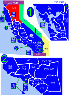
Area code 530 is a California telephone area code in northeastern and Northern California.

The Kaweah River is a river draining the southern Sierra Nevada in Tulare County, California in the United States. Fed primarily by high elevation snowmelt along the Great Western Divide, the Kaweah begins as four forks in Sequoia National Park, where the watershed is noted for its alpine scenery and its dense concentrations of giant sequoias, the largest trees on Earth. It then flows in a southwest direction to Lake Kaweah – the only major reservoir on the river – and into the San Joaquin Valley, where it diverges into multiple channels across an alluvial plain around Visalia. With its Middle Fork headwaters starting at almost 13,000 feet (4,000 m) above sea level, the river has a vertical drop of nearly two and a half miles (4.0 km) on its short run to the San Joaquin Valley, making it one of the steepest river drainages in the United States. Although the main stem of the Kaweah is only 33.6 miles (54.1 km) long, its total length including headwaters and lower branches is nearly 100 miles (160 km).

Berry Creek is a census-designated place about 25 miles (40 km) northeast of Oroville, California in hilly terrain at 2,000 feet (610 m) above mean sea level. The community is located along Oroville-Quincy, also known as Hwy 162 Highway on the shore of Madrone Lake. The US Geological Survey shows coordinates of 39°38′43″N121°24′12″W for the town. The community is home to Berry Creek Elementary School (K-8), 2 small mountain churches, 1 mini mart w/ gas, 1 small community park. Berry Creek is home to the annual Berry Festival which is held during August.

The North Fork Feather River is a watercourse of the northern Sierra Nevada in the U.S. state of California. It flows generally southwards from its headwaters near Lassen Peak to Lake Oroville, a reservoir formed by Oroville Dam in the foothills of the Sierra, where it runs into the Feather River. The river drains about 2,100 square miles (5,400 km2) of the western slope of the Sierras. By discharge, it is the largest tributary of the Feather.

The Kayaderosseras Creek, usually shortened to Kaydeross, is the largest river that lies completely within Saratoga County, New York State. It originates in the Kayaderosseras Range in the northern part of the county, passes through the towns of Corinth, Greenfield, and Milton, and serves as the boundary between the City of Saratoga Springs and the Town of Malta before emptying into Saratoga Lake.

The South Fork Eel River is the largest tributary of the Eel River in north-central California in the United States. The river flows 105 miles (169 km) north from Laytonville to Dyerville/Founders' Grove where it joins the Eel River. The South Fork drains a long and narrow portion of the Coast Range of California in parts of Mendocino and Humboldt counties. U.S. Route 101 follows the river for much of its length.

Little Butte Creek is a 17-mile-long (27 km) tributary of the Rogue River in the U.S. state of Oregon. Its drainage basin consists of approximately 354 square miles (917 km2) of Jackson County and another 19 square miles (49 km2) of Klamath County. Its two forks, the North Fork and the South Fork, both begin high in the Cascade Range near Mount McLoughlin and Brown Mountain. They both flow generally west until they meet near Lake Creek. The main stem continues west, flowing through the communities of Brownsboro, Eagle Point, and White City, before finally emptying into the Rogue River about 3 miles (5 km) southwest of Eagle Point.
During the American Civil War, the District of Utah was a subordinate district of the Army's Department of the Pacific.

Rock Creek is a stream that flows from the high Eastern Sierra Nevada to the Owens River in Mono County of eastern California. The upper watershed is in the John Muir Wilderness of the Sierra and Inyo National Forests.

Ruby Peak is a thirteener on the Sierra Crest, north of Mount Mills. It is in the John Muir Wilderness and on the boundary between the Sierra National Forest and the Inyo National Forest. It is near Mono Pass. The eastern slope drains into Rock Creek which feeds the Owens River while the western slopes drains in Mono Creek which feeds the South Fork of the San Joaquin River.
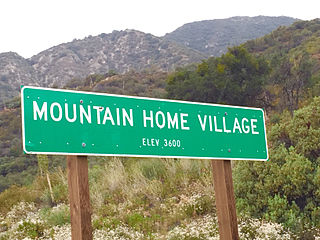
Mountain Home Village is an unincorporated community in San Bernardino County, California, United States with a population of 170 full-time residents as of 2010. Mountain Home Village is located along California State Route 38 5.2 miles (8.4 km) north-northeast of Yucaipa. It is located less than a mile east from the Thurman Flats Picnic Area, and the Loch Leven- and Mill Creek Campgrounds are located in the village. It is also where Mill Creek and Mountain Home Creek meets, while other creeks in area includes Skinner Creek, East Fork Mountain Home Creek, and Frustration Creek. The Mentone Boulders is also located nearby, which is a well-known rock-climbing area. It is located in the San Bernardino Mountains, just at the edge of the San Andreas Fault and offers some extraordinary valley views, and on clear days, also views of the City of San Bernardino. There are also numerous hiking trails located by the village. It is located within the San Bernardino National Forest and is surrounded by pine forest. Its elevation is 3600 feet.
