A gold rush or gold fever is a discovery of gold—sometimes accompanied by other precious metals and rare-earth minerals—that brings an onrush of miners seeking their fortune. Major gold rushes took place in the 19th century in Australia, Greece, New Zealand, Brazil, Chile, South Africa, California, the United States, and Canada while smaller gold rushes took place elsewhere.

Placer mining is the mining of stream bed (alluvial) deposits for minerals. This may be done by open-pit or by various surface excavating equipment or tunneling equipment.

Stawell ( "stall"), is an Australian town in the Wimmera region of Victoria 237 kilometres (147 mi) west-north-west of the state capital, Melbourne. Located within the Shire of Northern Grampians local government area, it is a seat of local government for the shire and its main administrative centre. At the 2021 census, Stawell had a population of 6,220.

The Witwatersrand Gold Rush was a gold rush that began in 1886 and led to the establishment of Johannesburg, South Africa. It was a part of the Mineral Revolution.

Knysna is a town with 76,150 inhabitants in the Western Cape province of South Africa. and is one of the destinations on the loosely defined Garden Route tourist route. It is situated 60 kilometres east of the city of George on the N2 highway, and 33 kilometres west of the Plettenberg Bay on the same road.

Wau is a town in Papua New Guinea, in the province of Morobe. It has a population of approx 5,000 and is situated at an altitude of around 1100 metres. Wau was the site of a gold rush during the 1920s and 30s when prospective gold diggers arrived at the coast at Salamaua and struggled inland along the Black Cat Track.

Walhalla is a town in Victoria, Australia, founded as a gold-mining community in late 1862, and at its peak, home to around 4,000 residents. As of 2023, the town has a population of 20 permanent residents, though it has a large proportion of houses owned as holiday properties. It attracts large numbers of tourists and is a major focus of the regional tourism industry. The town's name is taken from an early gold mine in the area, named for the German hall of fame, the Walhalla temple.

Harrietville is a town in Victoria, Australia, located on the Great Alpine Road, in the Alpine Shire. At the 2016 census, Harrietville and the surrounding area had a population of 338.

Sofala is a village in New South Wales, Australia, 255 kilometres (158 mi) north-west of Sydney, within Bathurst Regional Council. It is located beside the Turon River. Sofala is just off the Bathurst-Ilford Road, with only local traffic through the town itself. At the 2006 census, Sofala had a population of 208.

Araluen is a small town near Braidwood in the Southern Tablelands of New South Wales, Australia, in Queanbeyan-Palerang Regional Council. It lies in the valley of Araluen Creek, that joins the Deua River at roughly the midpoint in its course. At the 2021 census, Araluen had a population of 209 people.
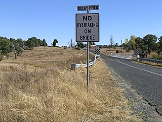
Rocky River is a locality in northern New South Wales, Australia,near Uralla on the Northern Tablelands plateau.

Sunny Corner is a small village in the central west of New South Wales, Australia and former mining area located between Lithgow and Bathurst just north of the Great Western Highway. At the 2016 census, Sunny Corner had a population of 92 people.

Majors Creek is a small village in the Southern Tablelands region of New South Wales, Australia. The nearest major town is Braidwood, 16 km (9.9 mi) to the north. At the 2021 census, the population of Majors Creek was 290. A former gold mining town, the settlement is today associated with the operational Dargues Reef gold mine. The name, Majors Creek is also applied to the surrounding area, for postal and statistical purposes.

Gold Rush is a reality television series that airs on Discovery and its affiliates worldwide. The series follows the placer gold mining efforts of various family-run mining companies, mostly in the Klondike region of Dawson City, Yukon, Canada, as well as in the U.S. state of Alaska. In its 12th season as of early 2021, prior seasons also included mining efforts in South America and western North America.

During the Australian gold rushes, starting in 1851, significant numbers of workers moved from elsewhere in Australia and overseas to where gold had been discovered. Gold had been found several times before, but the colonial government of New South Wales had suppressed the news out of the fear that it would reduce the workforce and destabilise the economy.

Nuggety Gully Water Race and Chinese Camp is a heritage-listed mining camp at Mareeba Mining District, Lakeland, Shire of Cook, Queensland, Australia. It was built from c. 1878 to c. 1886. It is also known as Greasy Bill Creek water race, Prospect Creek Stone Walls, and Star of Normanby Mine. It was added to the Queensland Heritage Register on 21 October 1992.

Anglo Saxon Mine is a heritage-listed mining camp at Groganville, Shire of Mareeba, Queensland, Australia. It was built from 1886 to 1897. It is also known as Groganville Township and Limestone Cemetery. It was added to the Queensland Heritage Register on 3 October 2003.
The Coromandel Gold Rushes on the Coromandel Peninsula and around the nearby towns of Thames and Waihi in New Zealand in the nineteenth century were moderately successful. Traces of gold were found about 1842. A small find was made near Coromandel in 1852; and a larger find in August 1867 when there was a modest rush. But Thames acquired a reputation for speculative holding of unworked ground despite regulations designed to check it, and some miners left for Queensland. Most of the gold was in quartz reefs rather than in more accessible alluvial deposits and had to be recovered from underground mines and extracted using stamping batteries.

Ravenswood Mining Landscape and Chinese Settlement Area is a heritage-listed former mining town and archaeological site on the reserve bounded by School Street, Cemetery Road, Railway Street and Burdekin Falls Dam Road, Ravenswood, Charters Towers Region, Queensland, Australia. It was added to the Queensland Heritage Register on 14 October 2016.
The Bendigo Goldfields region of Central Otago is an historic area comprising several former mining settlements in the southern South Island of New Zealand. It was part of the Otago Gold Rush that occurred during the 1860s, leading to an influx of miners from rushes in California and Victoria, Australia. These miners brought with them a rich diversity of cultures from England, Scotland, Wales, Ireland, Sweden, China, Australia, Canada, and the United States. The area was named after the goldfield by the same name in Victoria.