
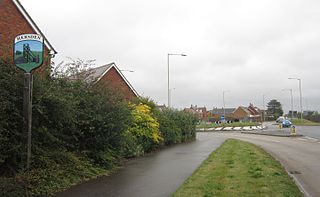
Eythorne is a civil parish and small village located 7.3 miles north-northwest of Dover in Kent, with a combined population of approximately 2,500 residents including nearby villages Barfrestone and Elvington. Although not classed as one of the former pit villages of Kent, it was only about a mile from Tilmanstone – which closed in 1986. Today many of its residents commute to work in Dover (Docks), or in Canterbury.

Dover is a local government district in Kent, England. It is named after its largest town, the port town of Dover. The council is based in Whitfield on the outskirts of Dover. The district also covers the towns of Deal, Sandwich, Walmer and the surrounding rural areas.

Eastry is a civil parish in Kent, England, around 2+1⁄2 miles (4 km) southwest of Sandwich. It was voted "Kent Village of the Year 2005".

Wingham is a village and civil parish in the Dover District of Kent, England. The village lies along the ancient coastal road, now the A257, from Richborough to London, and is close to Canterbury.

Barfrestone is a village and a former civil parish, now in the parish of Eythorne, in the Dover district, in east Kent, England. It is between Shepherdswell, Eythorne and Nonington, close to the pit villages of Elvington and Snowdown. In 1931 the parish had a population of 91. On 1 April 1935 the parish was abolished and merged with Eythorne.

Elvington is a small pit village on a ridge in between Canterbury and Dover in the county of Kent in Southeast England. Located near Eythorne, Elvington was mostly built in the early 20th century to serve the nearby coal mine at Tilmanstone, as were other Kent Coalfield villages including Snowdown, Aylesham and Betteshanger.

Aylesham is a village and civil parish in the Dover district of Kent, England. The village is located around 6.5 miles (10.5 km) southeast of the cathedral city of Canterbury, and around 8.5 miles (13.7 km) northwest of the town and port of Dover. According to the 2001 Census, the parish had a population including Drellingore and Snowdown of 3,884, increasing to 3,999 at the 2011 Census.

Nonington, is a civil parish and village in the southeast corner of Kent, situated halfway between the historic city of Canterbury and the channel port town of Dover. The civil parish includes the hamlets of Easole Street, to which it is conjoined and Frogham.

The Kent Coalfield was a coalfield in the eastern part of the English county of Kent. The Coalfields Trust defines the Kent Coalfield as the wards of Barham Downs and Marshside in the Canterbury district, and the wards of Aylesham, Eastry, Eythorne & Shepherdswell, Middle Deal & Sholden, Mill Hill and North Deal in the Dover district.
The following is a list of recreational walks in Kent, England.
Hersden is a village east of Canterbury in Kent, South East England. It was established as a planned coalmining village in the 1920s and is on the A28 road between Canterbury and the Isle of Thanet. Work in the Kent Coalfield was the main source of employment in the village until the closure of the Kent colliery in the 1980s.

Sholden is a small village adjacent to the seaside town of Deal, lying on the road towards Sandwich in Kent, South East England.
Tilmanstone is a small village and civil parish in Kent, in the South East of England, near Eastry, a much bigger and more developed area. Tilmanstone no longer has a village school; however, the independent Northbourne Park School is close to the parish boundary. The name of Tilmanstone has historically been famous for its colliery, although it is located in the village of Eythorne, operated from 1906 to 1986 as one of the four main pits of the Kent coalfield. The population taken at the 2011 Census also included that of the nearby hamlet of Ashley.

The East Kent Light Railway was part of the Colonel Stephens group of cheaply built rural light railways in England. Holman Fred Stephens was engineer from its inception, subsequently becoming director and manager. The line ran from Shepherdswell to Wingham Station with a branch from Eastry through Poison Cross to Richborough Port. Built primarily for colliery traffic within the Kent Coalfields, the line was built with many spurs and branches to serve the mines, with cancelled plans to construct extensions to several others. The success of Tilmanstone colliery allowed the main line of the railway to continue operation until 1986. A remainder of the line became the East Kent Railway, a heritage railway, in 1987.

Northbourne is a village and civil parish near Deal in Kent, England. It has a public house, The Hare and Hounds, a primary school and is the home of the current, and prior, Baron Northbourne. It should not be confused with an area in Bournemouth of the same name.

Snowdown is a hamlet near Dover in Kent, England. It was the location of one of the four chief collieries of the Kent coalfield, which closed in 1987.

Betteshanger is a village and former civil parish. now in the parish of Northbourne, in the Dover district, in east Kent, England, near Deal. It gave its name to the largest of the four chief collieries of the Kent coalfield. In 1931 the parish had a population of 55. On 1 April 1935 the parish was abolished and merged with Northbourne.

Frogham is a hamlet in the Dover District of East Kent, England, between Canterbury and Dover. It is located between the former coal mining village of Aylesham and Shepherdswell. It is near the site of the former Snowdown colliery. In published statistics, the population of the hamlet is included in the civil parish of Nonington.

National Cycle Route 1 is a route of the National Cycle Network, running from Dover to Tain. The 1,264 mi-long (2,034-kilometre) cycle-path is located in the United Kingdom.

Betteshanger Park is a park near Deal, in Kent, England. It covers the site of a former colliery spoil tip.
