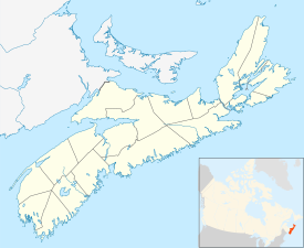
Preston is a provincial electoral district in the Halifax Regional Municipality in Nova Scotia, Canada. It has existed from 1993 to 2013 and since 2021 and elects one member of the Nova Scotia House of Assembly.
Preston is an area in central Nova Scotia, Canada in the Halifax Regional Municipality, located on Trunk 7. Preston includes the subdivisions of East Preston, North Preston, Lake Major, Cherry Brook and Loon Lake. The definition sometimes extends to include Lake Echo. The population in 2016 was 3,223. This is a decline from 2006, when Preston had a population of 3,536.
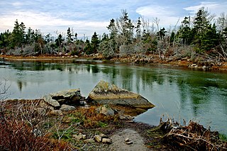
East Preston is an expansive rural Black Nova Scotian community located in eastern Halifax Regional Municipality, Nova Scotia, in Atlantic Canada. The population at the time of the 2016 census was 869.

Highway 107 in Nova Scotia runs through the eastern suburbs of the Halifax Regional Municipality, from the Burnside Industrial Park in Dartmouth to an intersection with Trunk 7 in Musquodoboit Harbour. It is 43.2 km (26.8 mi) long, and is mostly two lane, controlled access highway.

The Eastern Shore is a region of the Canadian province of Nova Scotia. It is the Atlantic coast running northeast from Halifax Harbour to the eastern end of the peninsula at the Strait of Canso.
Cole Harbour is the name for a natural harbour located in the Canadian province of Nova Scotia.
Nova Scotia Trunk 7 is part of the Canadian province of Nova Scotia's system of Trunk Highways. The route runs from Bedford to Antigonish, along the Eastern Shore for a distance of 269 kilometres (167 mi). Part of Trunk 7 is known as the Marine Drive.
Route 328 is a short collector road in the Canadian province of Nova Scotia.
Route 318 is a collector road in the Canadian province of Nova Scotia.

Route 207 is a collector road in the Canadian province of Nova Scotia. It is located in the Halifax Regional Municipality and connects Dartmouth to Porters Lake on the Eastern Shore.
Dollar Lake Provincial Park is a seasonal provincial park located in the Musquodoboit Valley area of the Halifax Regional Municipality in Nova Scotia, Canada, in the community of Wyses Corner, 22 kilometres from the Halifax International Airport on the Old Guysborough Road.
Upper Lawrencetown is a Canadian rural community in Nova Scotia, Canada within the Halifax Regional Municipality.
West Lawrencetown is a residential community within the Halifax Regional Municipality Nova Scotia on the Eastern Shore on Route 207 along the scenic route Marine Drive.
East Lawrencetown is a rural community within Halifax Regional Municipality in Nova Scotia, Canada on the Eastern Shore on Route 207 along the scenic route Marine Drive. The community is 22.4 kilometers from Halifax. Lawrencetown Beach Provincial Park is located in the community, at the southern end of Lawrencetown Lake, a natural ocean inlet. The beach is a year-round destination for surfing, attracting both locals and those from abroad. There are also places to park vehicles, stroll along boardwalks, hike, mountain bike and swim. Available to the public in the summer is a canteen, showers, flush toilets and a section of beach that is supervised by the Nova Scotia Lifeguard Service.
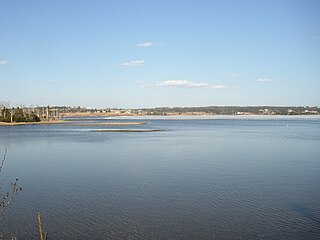
Porters Lake is a rural community in the Eastern Shore region of the Halifax, Nova Scotia, Canada, between Trunk 7 and Route 207, 27.8 km from Halifax. The residents mainly commute to jobs in Dartmouth, Burnside Industrial Park or in Downtown Halifax. The community is built around the lake from which it takes its name.

Three Fathom Harbour is a fishing community on the Eastern Shore of the Halifax Regional Municipality Nova Scotia on the shore of Atlantic Ocean off Route 207 on Three Fathom Harbour Road. The harbour had its own authority.

Lawrencetown is a Canadian rural community in the Halifax Regional Municipality in Nova Scotia, Canada. The settlement was established during the eve of Father Le Loutre's War and at the beginning of the French and Indian War.
Lewis Lake, Nova Scotia could mean the following:
Hastings is a community in the Canadian province of Nova Scotia, located in Annapolis County.
There are various Black Lakes in Nova Scotia, Canada. They vary widely in size, depth and usability. Many counties, such as Cumberland, Halifax, Inverness, and Pictou Counties have more than one Black Lake so named, while other counties mentioned in this article have only one named Black Lake.