
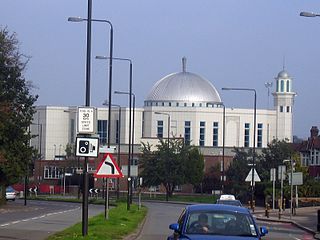
Mitcham is an area within the London Borough of Merton in Southwest London, England. It is centred 7.2 miles (11.6 km) southwest of Charing Cross. Originally a village in the county of Surrey, today it is mainly a residential suburb, and includes Mitcham Common. It has been a settlement throughout recorded history.

Morden is a district and town in South London, England, now within the London Borough of Merton, in the ceremonial county of Greater London. It adjoins Merton Park and Wimbledon to the north, Mitcham to the east, Sutton to the south and Worcester Park to the west, and is around 8 miles (13 km) south-southwest of Charing Cross. Prior to the creation of Greater London in 1965, for local government purposes, Morden was in the administrative and historic county of Surrey.
The London Borough of Merton is a London borough in London, England. The borough was formed under the London Government Act 1963 in 1965 by the merger of the Municipal Borough of Mitcham, the Municipal Borough of Wimbledon and the Merton and Morden Urban District, all formerly within Surrey.

Wandsworth is a London borough in South West London, England. It forms part of Inner London and has an estimated population of 329,677 inhabitants. Its main communities are Battersea, Balham, Putney, Tooting and Wandsworth Town.

Colliers Wood is an area in south west London, England, in the London Borough of Merton. It is a mostly residential area, but has a busy high street around Colliers Wood tube station on London Underground's Northern line. The high street is part of the A24, a major road route roughly following the Northern Line, running from London through Tooting and other areas. The Colliers Wood ward had a population of 10,712 in 2011.

The River Wandle is a right-bank tributary of the River Thames in south London, England. With a total length of about 9 miles (14 km), the river passes through the London boroughs of Croydon, Sutton, Merton and Wandsworth, where it reaches the Thames. A short headwater – the Caterham Bourne – is partially in Surrey, the historic county of the river's catchment. Tributaries of the Wandle include Carshalton Ponds and Norbury Brook.

Mitcham was a local government district in north east Surrey from 1915 to 1965 around the town of Mitcham.
The London Borough of Merton is an outer London borough in the south west of the conurbation. Merton's parks and open spaces range in size from Mitcham Common and a major part of Wimbledon Common to the smaller gardens, sports grounds and recreation grounds within its boundaries.

Merton is an ancient parish historically in Surrey, but which has since 1965 been part of Greater London. It is bounded by Wimbledon to the north, Mitcham to the east, Morden, Cheam and Cuddington to the south and (New) Malden to the west. The 1871 Ordnance Survey map records its area as 1,764.7 acres (7.1 km2).

Camden Town Hall, known as St Pancras Town Hall until 1965, is the meeting place of Camden London Borough Council. The main entrance is in Judd Street with its northern elevation extending along Euston Road, opposite the main front of St Pancras railway station. It was completed in 1937 and has been Grade II listed since 1996.
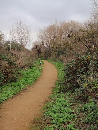
The Wandle Trail is a 12.5-mile (20 km) walking and cycling trail that follows the River Wandle from Croydon to Wandsworth in south-west London.

Merton London Borough Council, which styles itself Merton Council, is the local authority for the London Borough of Merton in Greater London, England. It is a London borough council, one of 32 in London. The council has been under Labour majority control since 2014. The council is based at Merton Civic Centre in Morden.
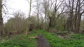
Ravensbury Park is a public park in Mitcham in the London Borough of Merton. An area of 7 hectares is designated a Local Nature Reserve. The River Wandle runs along the southern boundary of the park, which is also part of the Upper Wandle River Site of Metropolitan Importance for Nature Conservation.
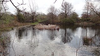
Cranmer Green is a 3.2 hectare local nature reserve and Site of Local Importance for Nature Conservation in Mitcham in the London Borough of Merton. It is owned and managed by Merton Council. It is a triangular area bounded by Cranmer Road, King George VI Avenue and a railway line.

Phipps Bridge is a housing estate in Mitcham in the London Borough of Merton. It was built following a need created by the end of the Second World War on the site of old slums, and is named after a nearby bridge. Although it opened in the 1960s as a show-piece estate, it took less than ten years for it to become a slum again, and the council continued to redevelop it into the 1990s.

The Old Town Hall, Richmond, on Whittaker Avenue in Richmond, London, is a former municipal building which from 1893 to 1965 served as the town hall for the Municipal Borough of Richmond.

Wimbledon Town Hall is a municipal building in The Broadway, Wimbledon, London. It is a Grade II listed building.

Stratford Town Hall is a municipal building in Stratford, London. It is a Grade II listed building.
Walworth Town Hall is a municipal building in Walworth Road, Southwark, London. It is a Grade II listed building. It was built for the vestry of the parish of Newington, opening as the Newington Vestry Hall in 1865. When Newington became part of the Metropolitan Borough of Southwark in 1900 the building served as Southwark Town Hall. It ceased to be a headquarters of local government in 1965 when the London Borough of Southwark was created.

St George's Town Hall, formerly known as Stepney Town Hall, and, before that, St George's Vestry Hall, is a municipal building on Cable Street, Stepney, London. It is a Grade II listed building.

