Thurston Island is an ice-covered, glacially dissected island, 215 km (134 mi) long, 90 km (56 mi) wide and 15,700 km2 (6,062 sq mi) in area, lying a short way off the northwest end of Ellsworth Land, Antarctica. It is the third largest island of Antarctica, after Alexander Island and Berkner Island.

Coronation Island is the largest of the South Orkney Islands, 25 nautical miles (46 km) long and from 3 to 8 nautical miles wide. The island extends in a general east-west direction, is mainly ice-covered and comprises numerous bays, glaciers and peaks, the highest rising to 1,265 metres (4,150 ft).

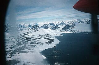
Lützow-Holm Bay is a large bay, about 220 kilometres (120 nmi) wide, indenting the coast of Queen Maud Land in Antarctica between Riiser-Larsen Peninsula and the coastal angle immediately east of the Flatvaer Islands. It was discovered by Captain Hjalmar Riiser-Larsen in two airplane flights from his expedition vessel, the Norvegia, on February 21 and 23, 1931. The name honours Commander Finn Lützow-Holm of the Royal Norwegian Navy Air Service, a pilot for Captain Riiser-Larsen on the Aagaard in 1935.

The Bay of Isles is a bay 9 miles (14 km) wide and receding 3 miles (5 km), lying between Cape Buller and Cape Wilson along the north coast of South Georgia. It was discovered in 1775 by a British expedition under James Cook and so named by him because numerous islands lie in the bay. Of South Georgia's 31 breeding bird species, 17 are found here.
East Skerry is a small group of islands and rocks (skerries) forming the eastern part of the Skrap Skerries, lying 2 miles (3 km) northwest of Cape George, off the north coast of South Georgia. The name was applied in the period 1926–30 by Discovery Investigations personnel who charted these islands.
West Skerry is a small group of islands and rocks forming the west part of Skrap Skerries, lying 3.2 km east of Barff Point off the north coast of South Georgia. The name appears on a chart based upon a survey of this area by DI personnel in the period 1926-30, but it may reflect an earlier naming by whalers.
Skrap Skerries are two small groups of islands and rocks (skerries) lying midway between Cape George and Barff Point, close off the north coast of South Georgia. The present name, which dates back to about 1930, derives from the Norwegian term "skrapskjaer" or "skrapskjar" formerly used for these islands.

East Ongul Island is an island in the Flatvaer Islands off of Antarctica. It is 2 kilometres (1 nmi) long, lying immediately east of the northern part of Ongul Island at the east side of the entrance of Lutzow-Holm Bay.
The Beaumont Skerries are two small islands and several rocks 2 kilometres (1 nmi) east of the Joubin Islands, off the southwest coast of Anvers Island. They were named by the Advisory Committee on Antarctic Names for Malcolm J. Beaumont, an Electronics Technician in RV Hero on her first Antarctic voyage, reaching nearby Palmer Station on Christmas Eve, 1968.

Benn Skerries are a small group of rocks which extend up to 0.25 nautical miles (0.5 km) westward from Norvegia Point on the island of Bouvetøya. They were charted and named in December 1927 by a Norwegian expedition in the Norvegia under Captain Harald Horntvedt.
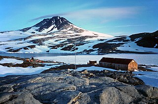
The Flatvaer Islands, also known as the Ongul Islands, are a group of small islands lying at the east side of the entrance of Lützow-Holm Bay, 4 km from the coastline of Antarctica. They were mapped by Norwegian cartographers from air photos taken by the Lars Christensen Expedition (LCE), 1936–37. Many of the islands and their features were subsequently named by members of the Japanese Antarctic Research Expedition (JARE); unless otherwise noted, features noted in this article were named by JARE.
Whale Skerries is a small group of islands and rocks in Lewthwaite Strait in the South Orkney Islands, lying close west of Cape Disappointment, Powell Island. First charted and named "Hvalskjaer" by Petter Sorlle in 1912-13. The name was later corrected to the plural form, "Hvalskjaerene", by Sorlle. The English form of the name was recommended by the United Kingdom Antarctic Place-Names Committee (UK-APC) in 1954.

Moe Island is an island 1 nautical mile (2 km) long in the South Orkney Islands off Antarctica, separated from the south-west end of Signy Island by Fyr Channel. It was charted by Captain Petter Sørlle in 1912–13, and named after M. Thoralf Moe of Sandefjord, Norway, a contemporary whaling captain who worked in this area.

Gnomon Island is a small rocky island lying just north of Point Wild, on Elephant Island in the South Shetland Islands. It was charted by Ernest Shackleton's Endurance expedition, 1914–16, and so named by them because when viewed from Point Wild the shape of the feature is suggestive of a gnomon, the elevated arm of a sundial.
Mane Skerry is a small island in the central part of Lystad Bay, off Horseshoe Island, Antarctica. It was named from association with nearby Mite Skerry; an initial misspelling of the phrase "might and main" became established at the Falkland Islands Dependencies Survey station in the years 1955–57.
Stayaway Skerries is a group of rocks and low-lying reefs awash, lying 1.5 nautical miles (2.8 km) south of Cape Monaco, off the southwest coast of Anvers Island in the Palmer Archipelago. Surveyed by the British Naval Hydrographic Survey Unit in 1956-57. So named by the United Kingdom Antarctic Place-Names Committee (UK-APC) as a caution to mariners; the group has patches of shoal water extending for some distance from it and should be given a wide berth.
Rigel Skerries is a chain of islands and rocks in the northwest part of the Oygarden Group, lying in the south part of the entrance to Edward VIII Bay in Antarctica. Mapped by Norwegian cartographers from aerial photos taken by the Lars Christensen Expedition, 1936–37, and called Utskjera. The group was first visited by an ANARE party in 1954; these skerries were renamed by Antarctic Names Committee of Australia (ANCA) after the star Rigel which was used for an astrofix in the vicinity.