Leominster (district) was a local government district in England from 1 April 1974 to 1 April 1998 with its administrative seat in the town of Leominster.
Preston on Wye is a village and civil parish in Herefordshire, England. It is situated near the River Wye, about 9 miles west of Hereford. Nearby places are Monnington on Wye, Lulham and Moccas.
Herefordshire Council is the local government authority for the county of Herefordshire in England. It is a unitary authority, combining the powers of a non-metropolitan county and district.

Sir Geoffrey Cornewall, 6th Baronet of Moccas Court, Herefordshire, was a British archer who competed at the 1908 Summer Olympics in London.

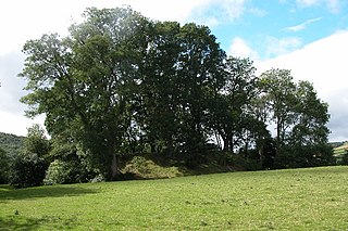
Dorstone Castle was in the village of Dorstone in Herefordshire, England, located 6 miles to the east of Hay-on-Wye.

Sir George Cornewall, 2nd Baronet of Moccas Court, Herefordshire, was a British politician who sat in the House of Commons between 1774 and 1807.

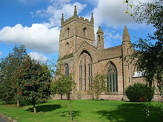
The Priory Church is an Anglican parish church in Leominster, Herefordshire, England, dedicated to Saint Peter and Saint Paul. The building was constructed for a Benedictine Priory in about the 13th century, although there had been an Anglo-Saxon monastery in Leominster, possibly on the same site. In 1539 the east end of the church was destroyed along with most of the monastic buildings, but the main body of the church was preserved.
MOCCA or MoCCA may stand for:

Leominster abbey was an Anglo-Saxon monastery established at Leominster in the county of Hereford, England. The name of the town refers to its minster, a settlement of clergy living a communal life.

Flanesford Priory was an Augustinian priory in Herefordshire, England.
Saint Guthlac's Priory was a Benedictine priory in Hereford, England at grid reference SO51534019. a site between the present day Bath Street and Commercial Road. Upon the dissolution of the monasteries John Prise bought the priory of St. Guthlac, Hereford.

The remains of Blackfriars, Hereford stand off Widemarsh St in Hereford, England at grid reference SO51184043. The ruins are listed as Grade 2*.
Titley Priory was a priory near Titley in Herefordshire, England at grid reference SO32966011.
Poston Camp is an Iron Age hill fort located just south of Vowchurch, Herefordshire.
Ivington Camp is an Iron Age hill fort located at Brierley, 3 km south of Leominster, Herefordshire.

Wapley Hill is an Iron Age hill fort located in Herefordshire, England, 3 km south-east of Presteigne.
Colonel Henry Cornewall was an English soldier, courtier and Member of Parliament.

Moccas Court is an 18th-century country house which sits in sloping grounds overlooking the River Wye north of the village of Moccas, Herefordshire, England. It is now a luxury guest house and function venue.

Coningsby Hospital is a collection of Almshouses in Hereford, Herefordshire. The site also contains a museum.


