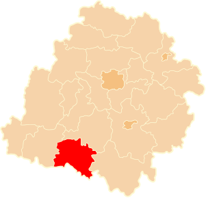
Mrozów is a village in the administrative district of Gmina Miękinia, within Środa Śląska County, Lower Silesian Voivodeship, in south-western Poland. Prior to 1945 it was in Germany.

Wysoka Duża is a village in the administrative district of Gmina Kutno, within Kutno County, Łódź Voivodeship, in central Poland. It lies approximately 12 kilometres (7 mi) south-west of Kutno and 48 km (30 mi) north of the regional capital Łódź.
Mierczyn is a settlement in the administrative district of Gmina Góra Świętej Małgorzaty, within Łęczyca County, Łódź Voivodeship, in central Poland. It lies approximately 7 kilometres (4 mi) east of Łęczyca and 31 km (19 mi) north-west of the regional capital Łódź.
Zdziechów-Kolonia is a village in the administrative district of Gmina Lutomiersk, within Pabianice County, Łódź Voivodeship, in central Poland.
Ignaców Szlachecki is a village in the administrative district of Gmina Łęki Szlacheckie, within Piotrków County, Łódź Voivodeship, in central Poland. It lies approximately 1 kilometre (1 mi) west of Łęki Szlacheckie, 25 km (16 mi) south of Piotrków Trybunalski, and 70 km (43 mi) south of the regional capital Łódź.
Teofilów is a village in the administrative district of Gmina Inowłódz, within Tomaszów Mazowiecki County, Łódź Voivodeship, in central Poland. It lies approximately 3 kilometres (2 mi) north-west of Inowłódz, 13 km (8 mi) east of Tomaszów Mazowiecki, and 57 km (35 mi) south-east of the regional capital Łódź.
Wólka Bałtowska is a village in the administrative district of Gmina Bałtów, within Ostrowiec County, Świętokrzyskie Voivodeship, in south-central Poland. It lies approximately 3 kilometres (2 mi) north-west of Bałtów, 15 km (9 mi) north-east of Ostrowiec Świętokrzyski, and 67 km (42 mi) east of the regional capital Kielce.
Podłęcze is a village in the administrative district of Gmina Góra Kalwaria, within Piaseczno County, Masovian Voivodeship, in east-central Poland.
Chojeczno-Cesarze is a village in the administrative district of Gmina Grębków, within Węgrów County, Masovian Voivodeship, in east-central Poland.
Dobieszczyzna is a village in the administrative district of Gmina Żerków, within Jarocin County, Greater Poland Voivodeship, in west-central Poland. It lies approximately 9 kilometres (6 mi) south-east of Żerków, 14 km (9 mi) north-east of Jarocin, and 66 km (41 mi) south-east of the regional capital Poznań.
Dębniałki is a village in the administrative district of Gmina Blizanów, within Kalisz County, Greater Poland Voivodeship, in west-central Poland.
Moczydła is a village in the administrative district of Gmina Osiek Mały, within Koło County, Greater Poland Voivodeship, in west-central Poland.
Moczydła is a village in the administrative district of Gmina Dobra, within Turek County, Greater Poland Voivodeship, in west-central Poland.
Lubartów is a village in the administrative district of Gmina Wymiarki, within Żagań County, Lubusz Voivodeship, in western Poland. It lies approximately 4 kilometres (2 mi) west of Wymiarki, 24 km (15 mi) south-west of Żagań, and 59 km (37 mi) south-west of Zielona Góra.
Miłowo is a village in the administrative district of Gmina Przywidz, within Gdańsk County, Pomeranian Voivodeship, in northern Poland. It lies approximately 4 kilometres (2 mi) east of Przywidz, 19 km (12 mi) south-west of Pruszcz Gdański, and 26 km (16 mi) south-west of the regional capital Gdańsk.
Parwark is a village in the administrative district of Gmina Stare Pole, within Malbork County, Pomeranian Voivodeship, in northern Poland. It lies approximately 3 kilometres (2 mi) south of Stare Pole, 11 km (7 mi) east of Malbork, and 52 km (32 mi) south-east of the regional capital Gdańsk.
Bielnik Pierwszy is a village in the administrative district of Gmina Elbląg, within Elbląg County, Warmian-Masurian Voivodeship, in northern Poland. It lies approximately 11 kilometres (7 mi) north of Elbląg and 87 km (54 mi) north-west of the regional capital Olsztyn.
Zwierzno is a village in the administrative district of Gmina Markusy, within Elbląg County, Warmian-Masurian Voivodeship, in northern Poland. It lies approximately 4 kilometres (2 mi) south-west of Markusy, 9 km (6 mi) south-west of Elbląg, and 82 km (51 mi) west of the regional capital Olsztyn.
Gandabar is a village in Bala Velayat Rural District, in the Central District of Kashmar County, Razavi Khorasan Province, Iran. At the 2006 census, its population was 172, in 43 families.
Nagylóc is a village in Nógrád County, Hungary with 1,551 inhabitants (2014).