
Rupelmonde is a village in the municipality of Kruibeke, in the Belgian province of East Flanders. It stands on the bank of the river Schelde opposite the confluence of the eponymous Rupel, and is famed for its sundials as well as having what is probably Belgium's only tidemill. It is the birthplace of Gerardus Mercator, the Flemish cartographer, who was imprisoned for several months in the castle there, a remnant of which today serves as a museum.
Waregem, sometimes known as Waereghem, is a municipality and city located in the Belgian province of West Flanders. The municipality lies in the valley of the river Leie, between Kortrijk and Ghent. It is part of the arrondissement of Kortrijk and comprises the towns of Beveren, Desselgem, Sint-Eloois-Vijve and Waregem proper. On January 1, 2019, Waregem had a total population of 38,260. The total area is 44.34 km² which gives a population density of 863 inhabitants per km².

Ingelmunster is a municipality located in the Belgian province of West Flanders. The municipality comprises only the town of Ingelmunster proper and the village of Kriek. As of January 1, 2006, Ingelmunster had a total population of 10,617. Its total area is 16.16 km². Thus, its population density is 657 inhabitants per km².

Lede is a municipality in the Belgian province of East Flanders, in the Denderstreek near the cities of Ghent, Aalst and Dendermonde.

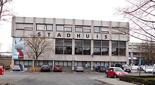
Dendermonde is a city in the Flemish province of East Flanders in Belgium. The municipality comprises the city of Dendermonde and the towns of Appels, Baasrode, Grembergen, Mespelare, Oudegem, Schoonaarde, and Sint-Gillis-bij-Dendermonde. Dendermonde is at the mouth of the river Dender, where it flows into the Scheldt. The town has a long-standing folkloric feud with Aalst, south along the same river, which dates from the Middle Ages.

Hamme is a municipality located in the Belgian province of East Flanders. The municipality comprises the towns of Hamme proper, Kastel Moerzeke, Sint-Anna and Zogge. In 2018, Hamme had a total population of 24,827. The total area is 40.21 km². The current mayor of Hamme is Herman Vijt, from the CD&V party.
De Pinte is a municipality located in the Belgian province of East Flanders. Before its existence as an independent municipality in 1868, De Pinte was a part of Nazareth. The municipality comprises the towns of De Pinte proper and Zevergem. In 2021, De Pinte had a total population of 10,990. The total area is 17.98 km².

Lokeren is a municipality located in the Belgian province of East Flanders, and belongs to the Waasland, also called Land van Waas, of which it is the second most important city after Sint-Niklaas. The city, located on the river Durme, the Lede, and the E17 motorway, has more than 42,100 inhabitants, who are called Lokeraars or Rapenfretters. Because Lokeren is located on the Durme, Lokeren is often called "The Durme City". Horse sausages are officially recognized as a regional product.

Malle is a municipality located in the Campine region of the Belgian province of Antwerp. The municipality comprises the villages of Oostmalle and Westmalle. In 2021, Malle had a total population of 15,620. The total area is 51.99 km2.

Puurs is a former municipality located in the Belgian province of Antwerp. It is located in the Flemish Region. The municipality comprised the towns of Breendonk, Liezele, Kalfort, Ruisbroek and Puurs proper. There is also the hamlet of Kalfort. In 2021, Puurs had a total population of 17,684. The total area is 33.41 km2 (13 sq mi).

Sint-Amands is a town and a former municipality located in the Belgian province of Antwerp, Belgium. The municipality comprises the towns of Lippelo, Oppuurs and Sint-Amands proper. In 2021, Sint-Amands had a total population of 8,524. The total area is 15.58 km². Sint-Amands is located at the right bank of the Scheldt river.
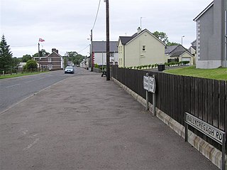
Cloughmills or Cloghmills is a village in County Antrim, Northern Ireland. Ballymoney is 9 miles to the north-west and Ballymena is 10 miles to the south. It had a population of 1,309 people in the 2011 Census. It is in Causeway Coast and Glens District Council.
Sint-Gillis-bij-Dendermonde is a part of the municipality of Dendermonde in the Denderstreek in East Flanders in Belgium, a typical agricultural village in the Dendervallei near the junction of the railroads to Ghent, Mechelen and Brussels. It was formerly known as Zwijveke.

Brent Eleigh is a village and civil parish in the Babergh district of Suffolk, England. Located between Hadleigh and Lavenham, in 2005 it had a population of 180 reducing to 174 at the 2011 Census.
Grembergen is a town in the municipality of Dendermonde in the Denderstreek in the province of East Flanders in Belgium. It is often confused with the municipality of Grimbergen in the province of Flemish Brabant.
Vanden Gheyn, Van den Gheyn or Van den Ghein was a family of bellfounders and carillon makers. The bell foundry was established in 1506 in Mechelen and active until the 20th century. They have been called "the most famous family of bellfounders [Belgium] has had".

Moorsel is a village in the Denderstreek in the province East Flanders in Belgium, a deelgemeente of the city of Aalst. The village belongs to a league of neighbouring villages, which call themselves the Faluintjesgemeenten. Moorsel is the largest of the four villages with approximately 5,175 inhabitants as of 2021.

The Dendermonde nursery attack was a stabbing attack on the Fabeltjesland daycare centre in the Flemish village of Sint-Gillis-bij-Dendermonde in Dendermonde, Belgium, at 10:00 a.m. CET on January 23, 2009. Three people were stabbed to death, and twelve were mutilated in the attack. The suspect has been linked to a separate murder of an elderly lady and police have suggested he was plotting more nursery attacks. The daycare centre where the initial attack occurred is expected never to reopen.

The Battle of Buggenhout was fought at the beginning of the First World War in Belgium at Buggenhout, a municipality between Antwerp, Ghent and Brussels. The Belgian army sortied from Antwerp against German troops to the south. The Belgians planned to exploit German troop movements away from Antwerp and to assist the French army on the Marne. King Albert I the Belgian Commander in Chief, saw that the Germans had strengthened most of their positions south of Antwerp and reduced the attack to an operation against Landwehr Brigade 37, which had advanced from Brussels towards Dendermonde.

Dendermonde Abbey or the Abbey of Saints Peter and Paul is a Benedictine monastery in Dendermonde (Belgium), which played a role in the Liturgical Movement in Belgium.


