Kieldrecht

Last updated
Kieldrecht
Village
Kieldrecht - Sint-Michielskerk 2.jpg
St Michaels Church
Blason ville be Kieldrecht.svg
Belgium location map.svg
Red pog.svg
Kieldrecht
Location in Belgium
Coordinates: 51°17′26″N4°10′20″E / 51.2905°N 4.1722°E / 51.2905; 4.1722
Country Flag of Belgium (civil).svg  Belgium
Region Flemish Region
Province East Flanders
Municipality Beveren
Area
[1]
  Total19.96 km2 (7.71 sq mi)
Population
 (2021) [1]
  Total4,032
  Density200/km2 (520/sq mi)
Time zone CET

Kieldrecht is a village and deelgemeente (sub-municipality) of Beveren in East Flanders, Belgium. Kieldrecht was an independent municipality until 1977, when it merged with Beveren as part of the fusion of municipalities in Belgium. The village is located on the border with the Netherlands, and forms a single urban area with the Dutch village of Nieuw-Namen. [2]

Contents

History

Kieldrecht probably originates from the 10th century. In 1156, the priory of Hulsterloo  [ nl ] was established which became a site of pilgrimage. It was destroyed in the 16th century during the Reformation. [3] Hulsterloo is mentioned in the poem Van den vos Reynaerde (c. 1250) which is set in the area. [4]

Kieldrecht used to be a dike village whose economy was based on fishing. The land around Kieldrecht was often flooded. In 1805, new dikes were built around the Saaftingepolder, and the area was no longer affected by spring tides. [3] As a border area, it often suffered from wars, and contains few historic buildings. [2] Like neighbouring Doel, a large part of the former municipality has become an industrial zone and is now part of the Port of Antwerp. [3]

The municipality of Kieldrecht was home to 4,083 people in 1974, and covered an area of 19.48 square kilometres (7.52 sq mi). [3] In 1977, Kieldrecht was merged into Beveren and became a deelgemeente . [5]

Sights

The St Michaels Church was first mentioned in 1238. During the Eighty Years' War it was used as a sconce by the Dutch States Army against the Spanish troops. In 1711, a new single aisled church was built, and in 1788, a new tower was added. In 1854, the church was extensively modified into the current three aisled church. [6] [7]

Nature

The Grote Geule is a nature area near Kieldrecht. It is a complex of creeks which developed after the land was flooded. It contains slightly brackish water. The nature area attracts birds like the western marsh harrier and bluethroat, and is an important winter area for geese and ducks. The Grote Geule is protected since 2003 and measures 22 hectares (54 acres). [8]

Notable people

Related Research Articles

<span class="mw-page-title-main">Belsele</span> Town in Flemish Region

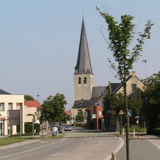
Belsele is a village and a deelgemeente of the municipality of Sint-Niklaas, which is situated in the Belgian province of East Flanders.

<span class="mw-page-title-main">Nieuw-Namen</span> Village in Zeeland, Netherlands

Nieuw-Namen is a village in the Dutch province of Zeeland. It is a part of the municipality of Hulst, and lies about 24 km south of Bergen op Zoom. The village is located on the border with the Belgium, and forms a single urban area with the Belgian village of Kieldrecht.

<span class="mw-page-title-main">Bouwel</span> Village in Flemish Region

Bouwel is a deelgemeente in the Belgian province of Antwerp; it is attached to the municipality of Grobbendonk.

<span class="mw-page-title-main">Melsele</span> Town in Flemish Region

Melsele is a town in the Belgian province of East Flanders, between the city of Beveren and the nearby town of Zwijndrecht. Tram route 3 which starts just outside the town connects it to Zwijndrecht and Antwerp. The town's road links include the E17 and the E34.

<span class="mw-page-title-main">Opbrakel</span> Village in Flemish Region

Opbrakel is a village and deelgemeente (sub-municipality) of the municipality of Brakel. It is located in the Denderstreek in the province of East Flanders in Belgium. It used to be an independent municipality until 1971 when it was merged into Brakel.

<span class="mw-page-title-main">Parike</span> Village in Flemish Region

Parike is a village and deelgemeente (sub-municipality) of the municipality of Brakel. It is located in the Denderstreek in the province of East Flanders in Belgium. It used to be an independent municipality until 1977 when it was merged into Brakel.

<span class="mw-page-title-main">Erwetegem</span> Village in Flemish Region

Erwetegem is a village and deelgemeente (sub-municipality) belonging to the municipality of Zottegem. It is located in the Denderstreek and in the Flemish Ardennes, the hilly southern part of the province of East Flanders, Belgium. Erwetegem used to be an independent municipality until 1970.

<span class="mw-page-title-main">Hingene</span> Village in Flemish Region

Hingene is a village and deelgemeente (sub-municipality) of the municipality of Bornem in the province of Antwerp, Belgium. The village is bordered to the north by the Scheldt and to the east by the Rupel. It is located about 16 kilometres (9.9 mi) south-west of the city of Antwerp.

<span class="mw-page-title-main">Oelegem</span> Village in Flemish Region

Oelegem is a village and deelgemeente (sub-municipality) of the municipality of Ranst in the province of Antwerp, Belgium. The village is located about 14 kilometres (8.7 mi) east of the city of Antwerp.

<span class="mw-page-title-main">Zevergem</span> Village in Flemish Region

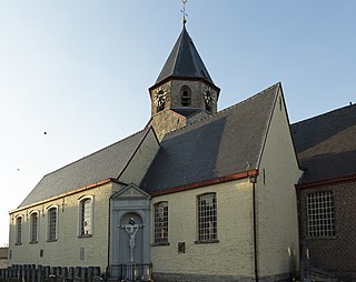
Zevergem is a village and deelgemeente (sub-municipality) of De Pinte in East Flanders, Belgium. It is located on the Scheldt about 8 kilometres (5.0 mi) south of Ghent.

<span class="mw-page-title-main">Hansbeke</span> Village in East Flanders, Belgium

Hansbeke is a village and deelgemeente (sub-municipality) in the municipality of Deinze in the Belgian province of East Flanders. The village is located about 13 kilometres (8.1 mi) west of Ghent.

<span class="mw-page-title-main">Verrebroek</span> Village in Flemish Region

Verrebroek is a village and deelgemeente in the municipality of Beveren in East Flanders, Belgium. Verrebroek was an independent municipality until 1 January 1977, when it merged with Beveren as part of the fusion of municipalities in Belgium.

<span class="mw-page-title-main">Vrasene</span> Village in Flemish Region

Vrasene is a village in the municipality of Beveren in the Belgian province of East Flanders. It is located about 15 kilometres (9.3 mi) east of Antwerp.

<span class="mw-page-title-main">Haasdonk</span> Village in Flemish Region

Haasdonk is a village and deelgemeente (sub-municipality) of Beveren in East Flanders, Belgium. Haasdonk was an independent municipality until 1 January 1977, when it merged with Beveren as part of the fusion of municipalities in Belgium. It is located about 12 kilometres (7.5 mi) west of Antwerp.

<span class="mw-page-title-main">Waarloos</span> Village in Flemish Region

Waarloos is a village and deelgemeente (sub-municipality) of the municipality of Kontich in the province of Antwerp, Belgium. The village is located about 13 kilometres (8.1 mi) south of the city of Antwerp.

<span class="mw-page-title-main">Astene</span> Village in East Flanders, Belgium

Astene is a village and deelgemeente (sub-municipality) in the municipality of Deinze in the Belgian province of East Flanders. The village is located along the Leie River and about 13 kilometres (8.1 mi) south-west of Ghent.

<span class="mw-page-title-main">Liezele</span> Village in Flemish Region

Liezele is a village and deelgemeente (sub-municipality) of the municipality of Puurs-Sint-Amands in the province of Antwerp, Belgium. The village is located about 20 kilometres (12 mi) south-south-west of the city of Antwerp. On the night of 4 to 5 September 1914, the entire village was destroyed by the Belgian Army to deny the Germany Army cover.

<span class="mw-page-title-main">Kallo</span> Village in East Flanders, Belgium

Kallo is a village and deelgemeente (sub-municipality) of Beveren in East Flanders, Belgium. Kallo was an independent municipality until 1 January 1977, when it merged with Beveren as part of the fusion of municipalities in Belgium. Most of the deelgemeente consists of harbours and industrial zones.

<span class="mw-page-title-main">Beveren-aan-de-IJzer</span> Village in Flemish Region

Beveren-aan-de-IJzer is a village in the municipality of Alveringem in the Belgian province of West Flanders. The village is located near the border with France, and was therefore called Beveren aan de Franse grens during the 19th century. Until 1971, Beveren-aan-de-IJzer was an independent municipality.

<span class="mw-page-title-main">Ouwegem</span> Village in East Flanders, Belgium

Ouwegem is a village and deelgemeente (sub-municipality) in the municipality of Kruisem in the province of East Flanders in Belgium. The village is located on the edge of the Flemish Ardennes and about 17 kilometres (11 mi) south-west of Ghent.

References

  1. 1 2 "Bevolking per statistische sector - Sector 46003D". Statistics Belgium. Retrieved 5 May 2022.
  2. 1 2 "Kieldrecht". Waasland (in Dutch). Retrieved 5 May 2022.
  3. 1 2 3 4 "Kieldrecht". Agentschap Onroerend Erfgoed (in Dutch). Retrieved 5 May 2022.
  4. "Nieuw-Namen". Plaatsengids (in Dutch). Retrieved 5 May 2022.
  5. "Beveren". Agentschap Onroerend Erfgoed (in Dutch). Retrieved 5 May 2022.
  6. "Kerken". Beveren via Archive.org (in Dutch). Archived from the original on 8 June 2020. Retrieved 5 May 2022.
  7. "Parochiekerk Sint-Michiel". Agentschap Onroerend Erfgoed (in Dutch). Retrieved 5 May 2022.
  8. "Grote Geule - Kieldrecht". Panneweel (in Dutch). Retrieved 5 May 2022.
  9. "Wereldkampioen Theo Middelkamp overleden". Waaskrant (in Dutch). Retrieved 5 May 2022.
  10. "Frans Pauwels". Cycling Archives (in Dutch). Retrieved 5 May 2022.