Kallo

Last updated
Kallo
Village
Kallo - Gemeenteplein 1.jpg
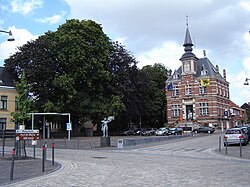
Square with former town hall
Blason ville be Kallo.svg
Belgium location map.svg
Red pog.svg
Kallo
Location in Belgium
Coordinates: 51°15′07″N4°16′42″E / 51.2519°N 4.2783°E / 51.2519; 4.2783
Country Flag of Belgium (civil).svg  Belgium
Region Flemish Region
Province East Flanders
Municipality Beveren
Area
[1]
  Total30.16 km2 (11.64 sq mi)
Population
 (2021) [1]
  Total2,442
  Density81/km2 (210/sq mi)
Time zone CET

Kallo is a village and deelgemeente (sub-municipality) of Beveren in East Flanders, Belgium. Kallo was an independent municipality until 1 January 1977, when it merged with Beveren as part of the fusion of municipalities in Belgium. [2] Most of the deelgemeente consists of harbours and industrial zones.

Contents

History

Kallo is one of the oldest settlements of the Waasland. The Frisii used to live on the higher parts which could not be flooded by the Scheldt. According to legend, the inhabitants were christened by Amandus in the 7th century, however the first written evidence of a church dates from 1179. [3]

Kallo was originally a fishing village. [3] In 1316, the village was destroyed and the land was inundated by William III, Count of Holland. In 1583, during the Dutch Revolt, the land was again inundated by Alexander Farnese, Duke of Parma [4] which resulted in a severe decline of the village. The area was repoldered in the 17th century. In 1638, war returned, and the Battle of Kallo was fought between the Dutch and the Spanish. [3]

Kallo was affected by the North Sea flood of 1953. In 1964, an area of 100 square kilometres (39 sq mi) was designated to be used for the construction of the Waaslandhaven  [ nl ], an extension of the Port of Antwerp. [4] The actual harbour which has been constructed is smaller. An area of 50 square kilometres (19 sq mi) was in use in 2020. [5] In 1977, the municipality was merged into Beveren. [2]

Buildings and sights

The St Peter and Paul Church was first attested in 1179. The single aisled church was transformed in a three aisled basilica-like church in 1737, and only the original choir remained. The church was again extended in 1842 and between 1865 and 1869. [6]

Fort Liefkenshoek is one of the oldest extant fortresses of Belgium. It was built in the late 16th century to protect Antwerp and the harbour against the Spanish. Together with Fort Lillo, it allowed the Dutch to block the Scheldt. The forts changed ownership several times, and the last modifications date from the Napoleonic period (1810-1811). [7]

The Organ collection Ghysels is a museum dedicated to mechanical dance and fairground organs. It opened in 2010 in Kallo. [8]

KSK Kallo

KSK Kallo is the football club. [9] [ circular reference ] Notable players have included Albert Cluytens.

Related Research Articles

<span class="mw-page-title-main">Beveren</span> Municipality in Flemish Community, Belgium

Beveren is a municipality in the Belgian province of East Flanders which comprises the towns of Beveren, Doel, Haasdonk, Kallo, Kieldrecht, Melsele, Verrebroek and Vrasene.

<span class="mw-page-title-main">Melsele</span> Town in Flemish Region

Melsele is a town in the Belgian province of East Flanders, between the city of Beveren and the nearby town of Zwijndrecht. Tram route 3 which starts just outside the town connects it to Zwijndrecht and Antwerp. The town's road links include the E17 and the E34.

<span class="mw-page-title-main">Opbrakel</span> Village in Flemish Region

Opbrakel is a village and deelgemeente (sub-municipality) of the municipality of Brakel. It is located in the Denderstreek in the province of East Flanders in Belgium. It used to be an independent municipality until 1971 when it was merged into Brakel.

<span class="mw-page-title-main">Parike</span> Village in Flemish Region

Parike is a village and deelgemeente (sub-municipality) of the municipality of Brakel. It is located in the Denderstreek in the province of East Flanders in Belgium. It used to be an independent municipality until 1977 when it was merged into Brakel.

<span class="mw-page-title-main">Eine, Belgium</span> Place in Flemish Region, Belgium

Eine is a village located in the province of East Flanders, Belgium. Since 1965, it has been a deelgemeente (subdivision) of the municipality of Oudenaarde.

<span class="mw-page-title-main">Erwetegem</span> Village in Flemish Region

Erwetegem is a village and deelgemeente (sub-municipality) belonging to the municipality of Zottegem. It is located in the Denderstreek and in the Flemish Ardennes, the hilly southern part of the province of East Flanders, Belgium. Erwetegem used to be an independent municipality until 1970.

<span class="mw-page-title-main">Hingene</span> Village in Flemish Region

Hingene is a village and deelgemeente (sub-municipality) of the municipality of Bornem in the province of Antwerp, Belgium. The village is bordered to the north by the Scheldt and to the east by the Rupel. It is located about 16 kilometres (9.9 mi) south-west of the city of Antwerp.

<span class="mw-page-title-main">Oelegem</span> Village in Flemish Region

Oelegem is a village and deelgemeente (sub-municipality) of the municipality of Ranst in the province of Antwerp, Belgium. The village is located about 14 kilometres (8.7 mi) east of the city of Antwerp.

<span class="mw-page-title-main">Zevergem</span> Village in Flemish Region

Zevergem is a village and deelgemeente (sub-municipality) of De Pinte in East Flanders, Belgium. It is located on the Scheldt about 8 kilometres (5.0 mi) south of Ghent.

<span class="mw-page-title-main">Bellem</span> Village in East Flanders, Belgium

Bellem is a village and deelgemeente (sub-municipality) in the municipality of Aalter in the Belgian province of East Flanders. The village was originally called Bethlehem. Bellem is located about 16 kilometres (9.9 mi) west of Ghent.

<span class="mw-page-title-main">Verrebroek</span> Village in Flemish Region

Verrebroek is a village and deelgemeente in the municipality of Beveren in East Flanders, Belgium. Verrebroek was an independent municipality until 1 January 1977, when it merged with Beveren as part of the fusion of municipalities in Belgium.

<span class="mw-page-title-main">Kieldrecht</span> Village in Flemish Region

Kieldrecht is a village and deelgemeente (sub-municipality) of Beveren in East Flanders, Belgium. Kieldrecht was an independent municipality until 1977, when it merged with Beveren as part of the fusion of municipalities in Belgium. The village is located on the border with the Netherlands, and forms a single urban area with the Dutch village of Nieuw-Namen.

<span class="mw-page-title-main">Vrasene</span> Village in Flemish Region

Vrasene is a village in the municipality of Beveren in the Belgian province of East Flanders. It is located about 15 kilometres (9.3 mi) west of Antwerp.

<span class="mw-page-title-main">Haasdonk</span> Village in Flemish Region

Haasdonk is a village and deelgemeente (sub-municipality) of Beveren in East Flanders, Belgium. Haasdonk was an independent municipality until 1 January 1977, when it merged with Beveren as part of the fusion of municipalities in Belgium. It is located about 12 kilometres (7.5 mi) west of Antwerp.

<span class="mw-page-title-main">Waarloos</span> Village in Flemish Region

Waarloos is a village and deelgemeente (sub-municipality) of the municipality of Kontich in the province of Antwerp, Belgium. The village is located about 13 kilometres (8.1 mi) south of the city of Antwerp.

<span class="mw-page-title-main">Astene</span> Village in East Flanders, Belgium

Astene is a village and deelgemeente (sub-municipality) in the municipality of Deinze in the Belgian province of East Flanders. The village is located along the Leie River and about 13 kilometres (8.1 mi) south-west of Ghent.

<span class="mw-page-title-main">Kluizen</span> Village in Flemish Region

Kluizen is a village in the municipalities of Evergem and Ghent in the province of East Flanders, Belgium. Large parts of the original municipality have become part of the Port of Ghent.

<span class="mw-page-title-main">Liezele</span> Village in Flemish Region

Liezele is a village and deelgemeente (sub-municipality) of the municipality of Puurs-Sint-Amands in the province of Antwerp, Belgium. The village is located about 20 kilometres (12 mi) south-south-west of the city of Antwerp. On the night of 4 to 5 September 1914, the entire village was destroyed by the Belgian Army to deny the Germany Army cover.

<span class="mw-page-title-main">Ouwegem</span> Village in East Flanders, Belgium

Ouwegem is a village and deelgemeente (sub-municipality) in the municipality of Kruisem in the province of East Flanders in Belgium. The village is located on the edge of the Flemish Ardennes and about 17 kilometres (11 mi) south-west of Ghent.

<span class="mw-page-title-main">Tongerlo</span> Village in Flemish Region

Tongerlo is a village and deelgemeente (sub-municipality) of the municipality of Westerlo in the province of Antwerp, Belgium. The village is located about 10 kilometres (6.2 mi) south-east of the city of Herentals. Tongerlo is best known for Tongerlo Abbey founded in 1128 which became one of the most important abbeys of Belgium.

References

  1. 1 2 "Bevolking per statistische sector - Sector 46003F". Statistics Belgium. Retrieved 4 May 2022.
  2. 1 2 "Beveren". Agentschap Onroerend Erfgoed (in Dutch). Retrieved 4 May 2022.
  3. 1 2 3 "Kallo". Agentschap Onroerend Erfgoed (in Dutch). Retrieved 4 May 2022.
  4. 1 2 "Kallo". Waasland (in Dutch). Retrieved 4 May 2022.
  5. "Kerncijfers 2020". Maatschappij Linkerscheldeoever (in Dutch). Retrieved 4 May 2022.
  6. "Parochiekerk Sint-Petrus en Paulus". Agentschap Onroerend Erfgoed (in Dutch). Retrieved 4 May 2022.
  7. "Fort Liefkenshoek". Beveren (in Dutch). Retrieved 4 May 2022.
  8. "Continental Superstar, de collectie Ghysels". Bruzz (in Dutch). Retrieved 4 May 2022.
  9. nl:KSK Kallo