Czechoslovakia was a landlocked country in Central Europe, created in 1918, when it declared its independence from Austria-Hungary. In 1938, after the Munich Agreement, the Sudetenland became part of Nazi Germany, while the country lost further territories to Hungary and Poland. Between 1939 and 1945, the state ceased to exist, as Slovakia proclaimed its independence and Carpathian Ruthenia became part of Hungary, while the German Protectorate of Bohemia and Moravia was proclaimed in the remainder of the Czech Lands. In 1939, after the outbreak of World War II, former Czechoslovak President Edvard Beneš formed a government-in-exile and sought recognition from the Allies.
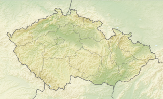
The Czech Republic is a landlocked country in Central Europe. It is bordered by Germany to the west, Austria to the south, Slovakia to the east and Poland to the north. It consists mostly of low hills and plateaus surrounded along the borders by low mountains. Two areas of lowlands follow the Elbe river and the Morava river. About a third of the area of the Czech Republic is covered by forests.
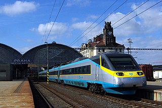
Transport in the Czech Republic relies on several main modes, including transport by road, rail, water and air.

The Vltava is the longest river in the Czech Republic, a left tributary of the Elbe River. It runs southeast along the Bohemian Forest and then north across Bohemia, through Český Krumlov, České Budějovice, and Prague. It is commonly referred to as the "Czech national river".

The Elbe is one of the major rivers of Central Europe. It rises in the Giant Mountains of the northern Czech Republic before traversing much of Bohemia, then Germany and flowing into the North Sea at Cuxhaven, 110 kilometres northwest of Hamburg. Its total length is 1,094 km (680 mi).

The Munich Agreement was an agreement reached in Munich on 30 September 1938, by Nazi Germany, the United Kingdom, the French Republic, and Fascist Italy. The agreement provided for the German annexation of part of Czechoslovakia called the Sudetenland, where more than three million people, mainly ethnic Germans, lived. The pact is also known in some areas as the Munich Betrayal, because of a previous 1924 alliance agreement and a 1925 military pact between France and the Czechoslovak Republic.

A landlocked country is a country that does not have any territory connected to an ocean or whose coastlines lie solely on endorheic basins. Currently, there are 44 landlocked countries, two of them doubly landlocked, and three landlocked de facto states in the world. Kazakhstan is the world's largest landlocked country, Kyrgyzstan is the furthest landlocked country from any ocean, while Ethiopia is the world's most populous landlocked country.
The First Czechoslovak Republic emerged from the collapse of the Austro-Hungarian Empire in October 1918. The new state consisted mostly of territories inhabited by Czechs and Slovaks, but also included areas containing majority populations of other nationalities, particularly Germans (22.95 %), who accounted for more citizens than the state's second state nation of the Slovaks, Hungarians (5.47 %) and Ruthenians (3.39 %). The new state comprised the total of Bohemia whose borders did not coincide with the language border between German and Czech. Despite initially developing effective representative institutions alongside a successful economy, the deteriorating international economic situation in the 1930s gave rise to growing ethnic tensions. The dispute between the Czech and German populations, fanned by the rise of Nazism in neighbouring Germany, resulted in the loss of territory under the terms of the Munich Agreement and subsequent events in the autumn of 1938, bringing about the end of the First Republic.

Carpatho-Ukraine or Carpathian Ukraine was an autonomous region, within the Second Czechoslovak Republic, created in December 1938 and renamed as the Subcarpathian Rus', whose full administrative and political autonomy had been confirmed by constitutional law of 22 November 1938.

Mělník is a town in the Central Bohemian Region of the Czech Republic. It has about 20,000 inhabitants. The historic town centre is well preserved and is protected by law as an urban monument zone.
Czechoslovak Ocean Shipping was a Czechoslovak shipping company founded in 1959. Privatised in 1992 and renamed Czech Ocean Shipping in 1994, it ceased shipping operations in 1998.
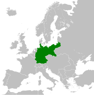
The territorial evolution of Germany in this article include all changes in the modern territory of Germany from its unification making it a country on 1 January 1871 to the present although the history of "Germany" as a territorial polity concept and the history of the ethnic Germans are much longer and much more complex. Modern Germany was formed when the Kingdom of Prussia unified most of the German states, with the exception of multi-ethnic Austria, into the German Empire. After the First World War, on 10 January 1920, Germany lost about 13% of its territory to its neighbours, and the Weimar Republic was formed two days before this war was over. This republic included territories to the east of today's German borders.
The Second Czechoslovak Republic, officially the Czecho-Slovak Republic, existed for 169 days, between 30 September 1938 and 15 March 1939. It was composed of Bohemia, Moravia, Silesia and the autonomous regions of Slovakia and Subcarpathian Rus', the latter being renamed Carpathian Ukraine on 30 December 1938.

Štefan Osuský was an Austro-Hungarian born Slovak lawyer, diplomat, politician and university professor.

The Port of Szczecin is a Polish seaport and deep water harbour in Szczecin, Poland. It is located at the Oder and Regalica rivers in the Lower Oder Valley, off the Szczecin Lagoon. In the past, the port included the now defunct Szczecin Shipyard. A free trade zone has been designated within the port area.

The Oder is a river in Central Europe. It is Poland's second-longest river and third-longest within its borders after the Vistula and its largest tributary the Warta. The Oder rises in the Czech Republic and flows 742 kilometres (461 mi) through western Poland, later forming 187 kilometres (116 mi) of the border between Poland and Germany as part of the Oder–Neisse line. The river ultimately flows into the Szczecin Lagoon north of Szczecin and then into three branches that empty into the Bay of Pomerania of the Baltic Sea.
This article describes ethnic minorities in Czechoslovakia from 1918 until 1992.
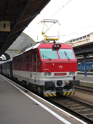
Hungaria is a EuroCity train which runs between Budapest Nyugati and Hamburg - Altona, currently running with coaches of MÁV. It is numbered as EC 172-173 and runs daily, mainly with MÁV owned rolling stocks.
Events from the year 1919 in Czechoslovakia. The year saw the Treaty of Saint-Germain-en-Laye define the borders of the state and the Treaty of Versailles recognise its independence.
